
GIS-based real-time data archiving system
A technology for data and detection systems, applied in database management systems, special data processing applications, structured data retrieval, etc., can solve problems such as inability to aggregate data information, fragmented data, and inconvenient porting of exchange database information.
Patent Information
- Authority / Receiving Office
- CN · China
- Patent Type
- Applications(China)
- Current Assignee / Owner
- Publication Date
- 2020-05-01
Smart Images
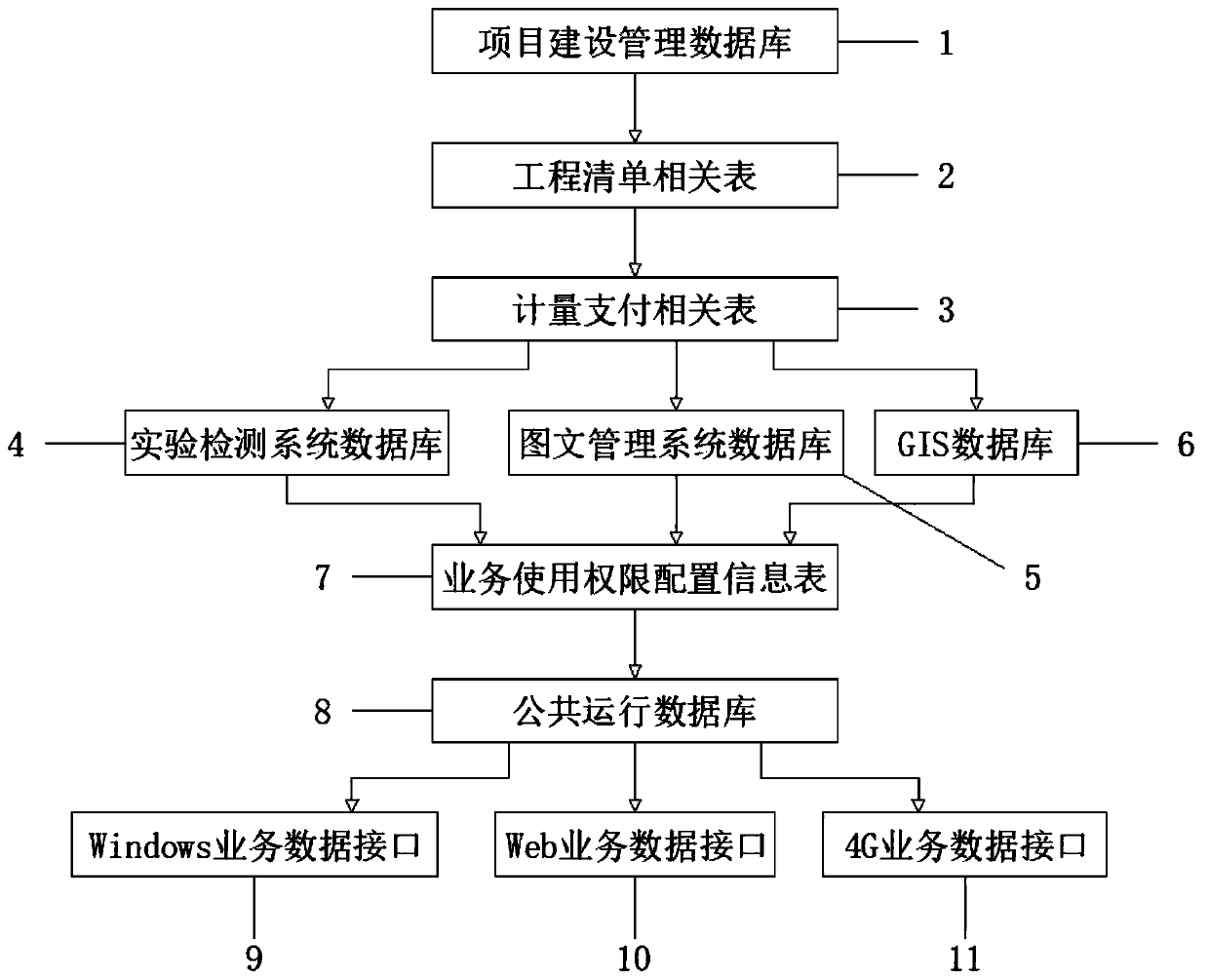
Figure 1 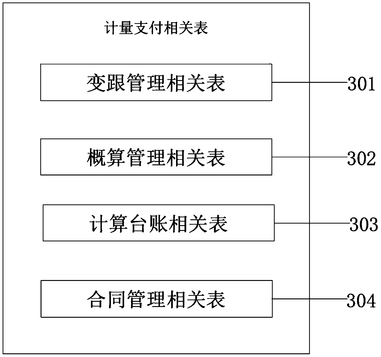
Figure 2 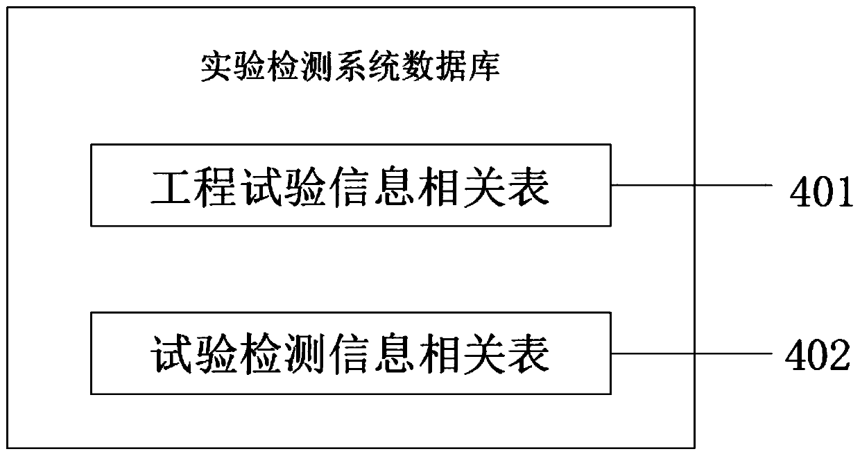
Figure 3
Abstract
Description
technical field
[0001] The invention relates to the technical field of highway management, in particular to a GIS-based real-time data filing system. Background technique
[0002] Since the beginning of this century, expressways, as an important transportation infrastructure for stimulating domestic demand and promoting economic and social development in my country, have achieved rapid development. By the end of 2017, the total mileage of expressways in my country exceeded 135,000 kilometers.
[0003] At present, the data of expressway visualization management is relatively scattered, and the data information among various businesses cannot be summarized, which is not conducive to data management and information extraction, and causes inconvenience to the communication between project progress and the transplantation of database information. Contents of the invention
[0004] (1) Solved technical problems
[0005] Aiming at the deficiencies of the prior art, the present...
Examples
Embodiment 1
[0034] A design method of a GIS-based real-time data filing system, which consists of the following steps:
[0035] Step 1. In the requirements analysis stage, according to the system information, the existing applications and future applications are screened to realize data analysis;
[0036] Step 2: In the conceptual design stage, on the basis of demand analysis, the conceptual data model is used to represent the data and their interrelationships, so as to realize the design of the conceptual model;
[0037] Step 3: In the logical design stage, the conceptual data model obtained in the conceptual design stage is converted into a logical model represented by the DBMS logical data model, and the logical model design is realized for the conceptual model;
[0038] Step 4. In the physical design stage, design the internal schema of the database, and the data type, size, length, file structure, access path, and storage space of the database fields according to the conceptual model...
Embodiment 2
[0040] A design method of a GIS-based real-time data filing system, which consists of the following steps:
[0041] Step 1. In the requirements analysis stage, according to the system information, the existing applications and future applications are screened to realize data analysis;
[0042] Step 2: In the conceptual design stage, on the basis of demand analysis, the conceptual data model is used to represent the data and their interrelationships, so as to realize the design of the conceptual model;
[0043] Step 3: In the logical design stage, the conceptual data model obtained in the conceptual design stage is converted into a logical model represented by the DBMS logical data model, and the logical model design is realized for the conceptual model;
[0044] Step 4. In the physical design stage, design the internal schema of the database, and the data type, size, length, file structure, access path, and storage space of the database fields according to the conceptual model...
Embodiment 3
[0047] A design method of a GIS-based real-time data filing system, which consists of the following steps:
[0048] Step 1. In the requirements analysis stage, according to the system information, the existing applications and future applications are screened to realize data analysis;
[0049] Step 2: In the conceptual design stage, on the basis of demand analysis, the conceptual data model is used to represent the data and their interrelationships, so as to realize the design of the conceptual model;
[0050]Step 3: In the logical design stage, the conceptual data model obtained in the conceptual design stage is converted into a logical model represented by the DBMS logical data model, and the logical model design is realized for the conceptual model;
[0051] Step 4. In the physical design stage, design the internal schema of the database, and the data type, size, length, file structure, access path, and storage space of the database fields according to the conceptual model,...