

Method for automatic modeling and dynamic updating of geological three-dimensional model
A three-dimensional model, geological model technology, applied in the field of geological information processing, to achieve the effect of improving efficiency
- Summary
- Abstract
- Description
- Claims
- Application Information
AI Technical Summary
Problems solved by technology
Method used
Image

Examples
Embodiment Construction
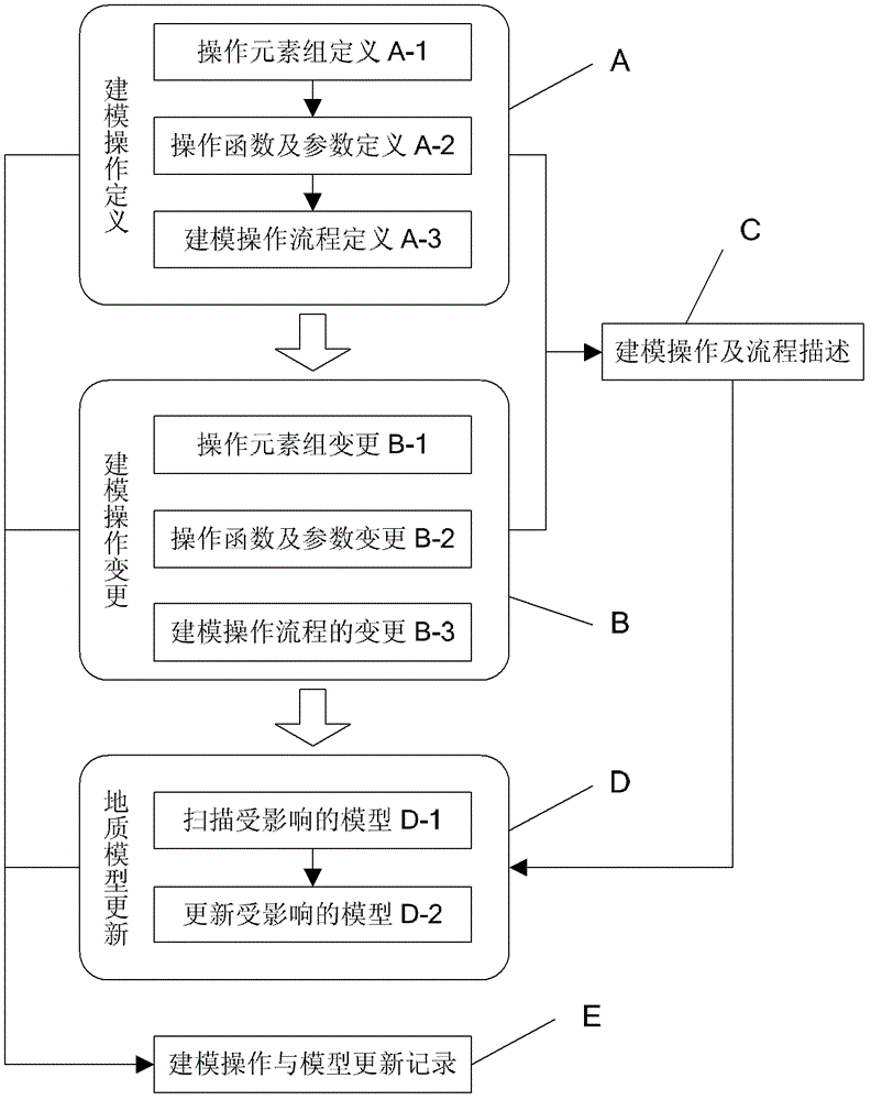
[0027] The following is attached figure 1 The technical solution of the present invention is described in detail.
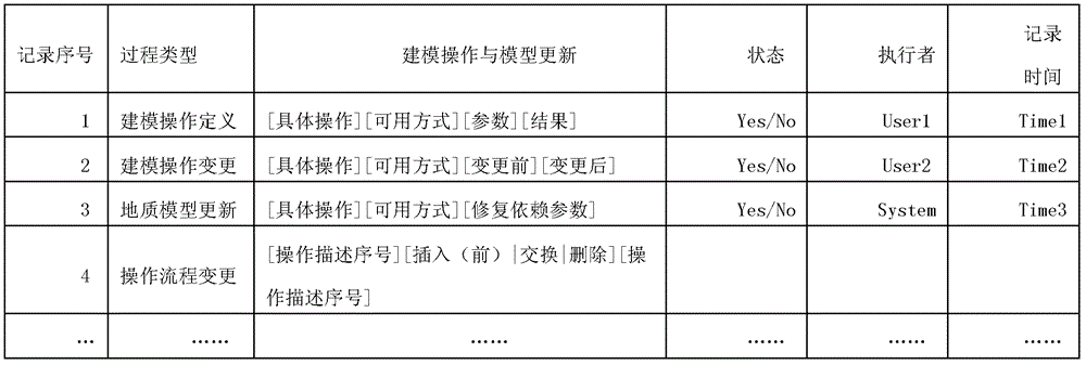
[0028] This embodiment includes three main processes of modeling operation definition A, modeling operation change B and geological model update D, and two auxiliary processes of modeling operation and process description C and modeling operation and model update record E, the specific process and The implementation is as follows:
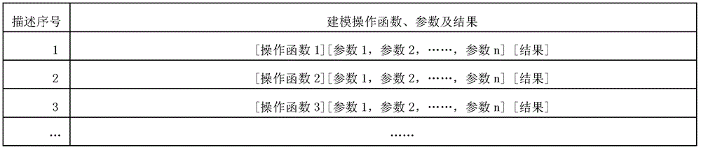
[0029] 1. Modeling operation definition A process: the user defines the modeling operation in the geological 3D modeling program, and this process includes the definition of operation element group A-1, the definition of operation function and parameter A-2, and the definition of modeling operation process A -3 three sub-processes, and then this process triggers the modeling operation and process description C process, and obtains the modeling operation and process description records to be executed by the computer (such as figure ...
PUM
 Abstract
Description
Claims
Application Information