

Obtaining method of optical remote sensing satellite image in-scene relative distortion indexes
A satellite image and optical remote sensing technology, applied in photogrammetry/video metrology, instruments, surveying and mapping, and navigation, etc., can solve problems affecting image use, image quality and use efficiency in satellite scenes, and optimize the development process , Improving the image quality and the effect of using efficiency
- Summary
- Abstract
- Description
- Claims
- Application Information
AI Technical Summary
Problems solved by technology
Method used
Image

Examples
Embodiment Construction
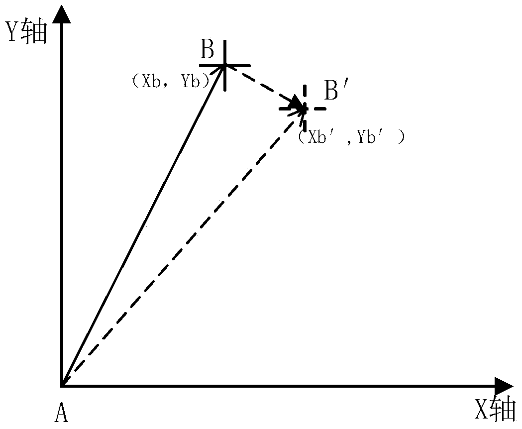
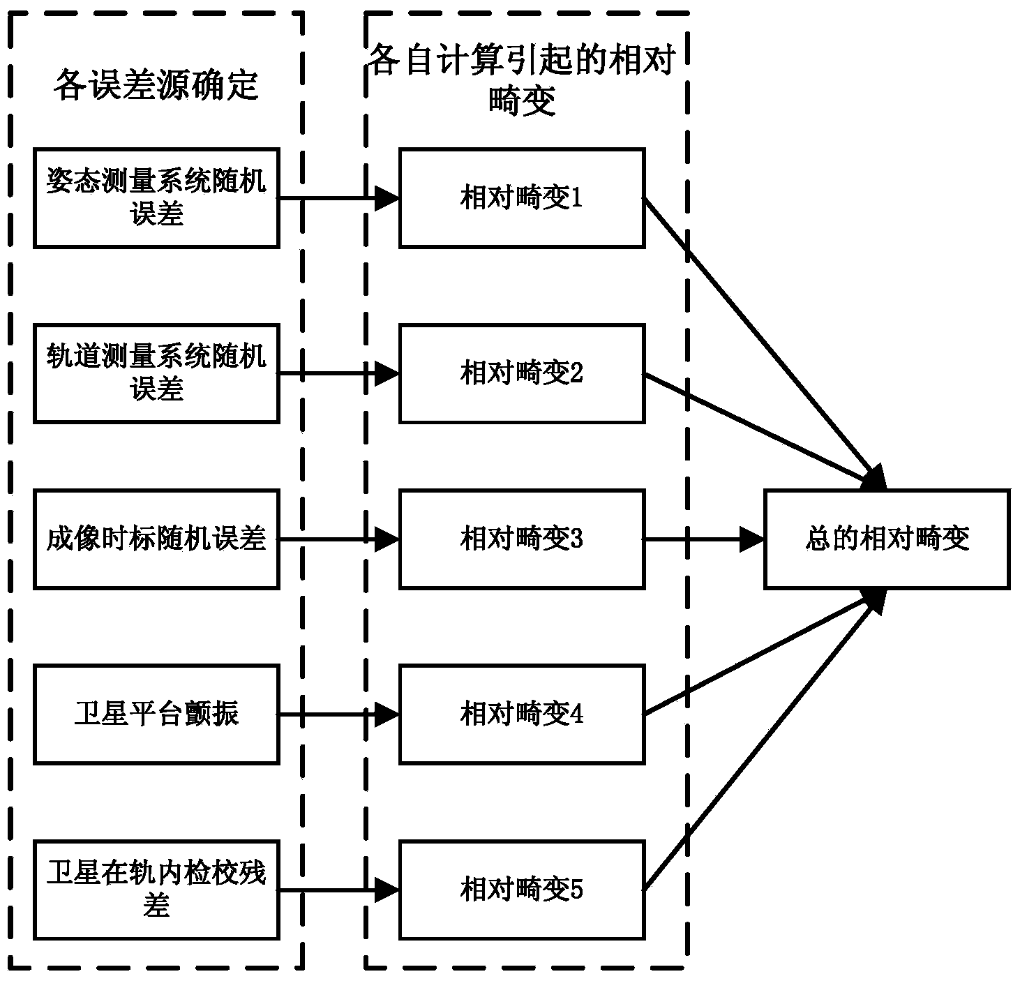
[0025] The invention discloses an analysis method for relative distortion index in an optical remote sensing satellite image scene, points out each element that affects the relative distortion in the image scene, and provides a method for calculating and predicting the relative distortion in the image scene through each independent influencing factor.
[0026] Under the condition of no control point, the relative distortion in the image scene is mainly affected by the random error of the satellite measurement system, the random error of the satellite imaging time scale, the flutter of the satellite platform, and the accuracy of the satellite in-orbit calibration. Combined with the above errors for analysis.
[0027] Satellite measurement system is mainly divided into: attitude measurement system and orbit measurement system. For high-resolution optical remote sensing satellites, their attitude measurement systems are mostly star sensors, so the source of random errors in attit...
PUM
 Abstract
Description
Claims
Application Information