Anti-jamming GIS mobile terminal data processing method

A mobile terminal and data processing technology, applied in the field of geographic information, can solve problems such as crash, slow display of GIS platform, and low efficiency.

Active Publication Date: 2019-12-24
XIAN REMOTE SENSING SCI & TECH OF INFORMATION CO LTD
View PDF4 Cites 0 Cited by
  • Summary
  • Abstract
  • Description
  • Claims
  • Application Information

AI Technical Summary

Problems solved by technology

[0003] The present invention provides an anti-stuck GIS mobile terminal data processing method, which is used to solve the problems of slow display, easy freeze, crash, difficult data collection, low efficiency, difficult data editing, and single interaction mode of the GIS platform during rendering.

Method used


Image

  • Anti-jamming GIS mobile terminal data processing method
  • Anti-jamming GIS mobile terminal data processing method
  • Anti-jamming GIS mobile terminal data processing method

Examples


Embodiment Construction

[0120]The application will be further described in detail below in conjunction with the accompanying drawings and embodiments. It should be understood that the specific embodiments described here are only used to explain related inventions, rather than to limit the invention. It should also be noted that, for ease of description, only parts related to the invention are shown in the drawings.

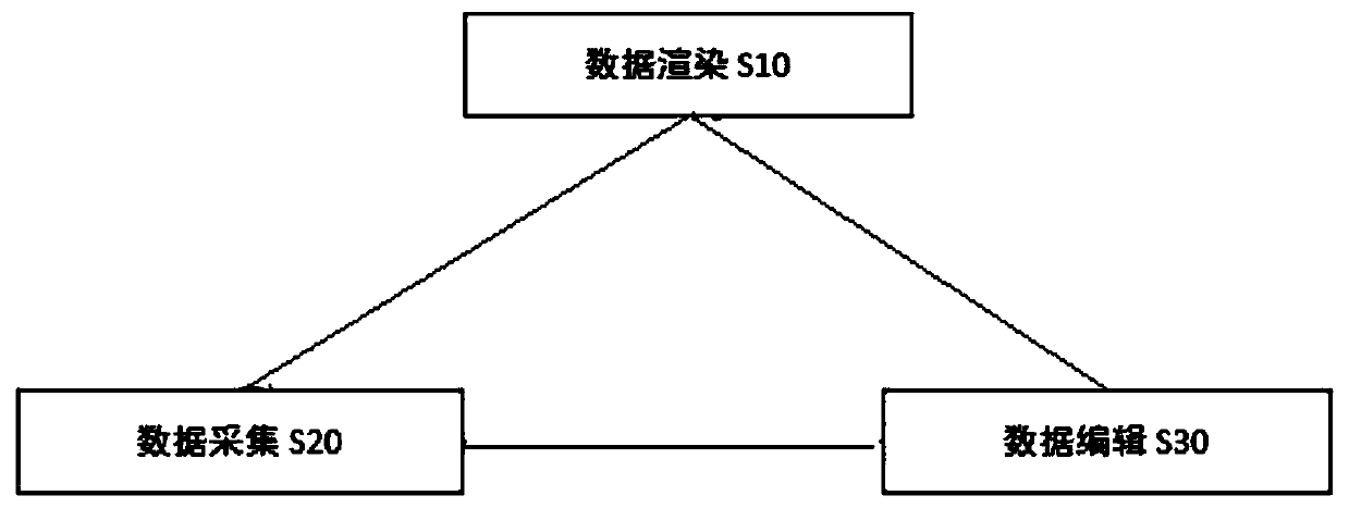
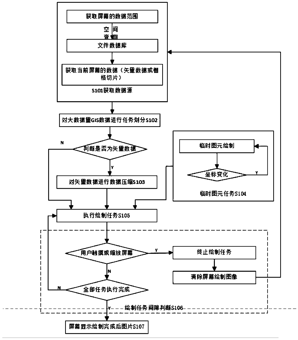
[0121] refer to Figure 1-4 , an anti-jamming GIS mobile terminal data processing method, comprising the following operations:

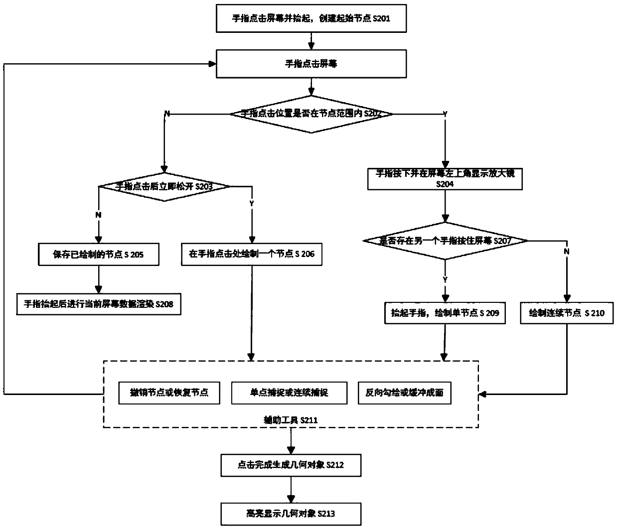
[0122] The GIS mobile terminal obtains information from the database for rendering, then collects the information and renders the collected information at the same time, and performs editing operations after the collection of information is completed;

[0123] The information obtained from the database is rendered as:

[0124] The GIS mobile terminal acquires data from the database according to the current screen range, and divides the acquired data into tas...


PUM


Abstract

The invention belongs to the technical field of geographic information methods, and discloses an anti-jamming GIS mobile terminal data processing method. The method comprises the steps of rendering the information obtained in a database according to a screen range, creating an initial node after rendering, starting to collect the information, editing the collected information after collection, andrendering the collected information while editing the collected information. The method has the quick and efficient display performance, particularly for the display of GIS data with a large data volume, can load and display quickly, does not generate the phenomenon of jamming or crash and is more flexible and efficient in data acquisition process. The various drawing modes included in an acquisition module can be randomly switched during the data acquisition process, and moreover, the investigators can conveniently edit and correct the drawn geometric figures on a field site, so that the field data editing efficiency is improved.

Description

technical field [0001] The present invention generally relates to the technical field of geographic information methods, and in particular to a data processing method for a GIS mobile terminal that prevents freezing. Background technique [0002] With the continuous development of mobile GIS, that is, geographic information methods, the GIS data rendering, collection and editing platform based on the large amount of mobile terminal data is often used in field data investigation and collection. For field data survey and collection, staff often need to carry remote sensing images and corresponding office data to the field for data display, collection, and editing; among them, in terms of data display, for large-scale geographic information data, existing mobile It is difficult for the GIS platform to quickly load and display, and sometimes there are even situations such as freezes and crashes. This often brings a lot of inconvenience to field investigators, affects the data b...

Claims


Application Information

Patent Timeline
Patent Type & Authority Applications(China)
IPC IPC(8): G06F16/29G06F3/0481G06F3/0484G06F3/0488G06T11/00
CPCG06F16/29G06F3/0481G06F3/04847G06F3/0488G06T11/001G06F2203/04806
Inventor 李崇贵
Owner XIAN REMOTE SENSING SCI & TECH OF INFORMATION CO LTD
Why Eureka
Try Eureka