
Route cognizing method of interstellar links of multi-level satellite communication system
A satellite communication system and interstellar link technology, which is applied in the field of satellite communication, can solve problems such as link congestion and failure to reflect the superiority of multi-level space communication systems, and achieve improved link utilization, reduced network delay, and improved The effect of signal quality
Patent Information
- Authority / Receiving Office
- CN · China
- Patent Type
- Applications(China)
- Current Assignee / Owner
- Publication Date
- 2012-04-11
- Estimated Expiration
- Not applicable · inactive patent
Smart Images
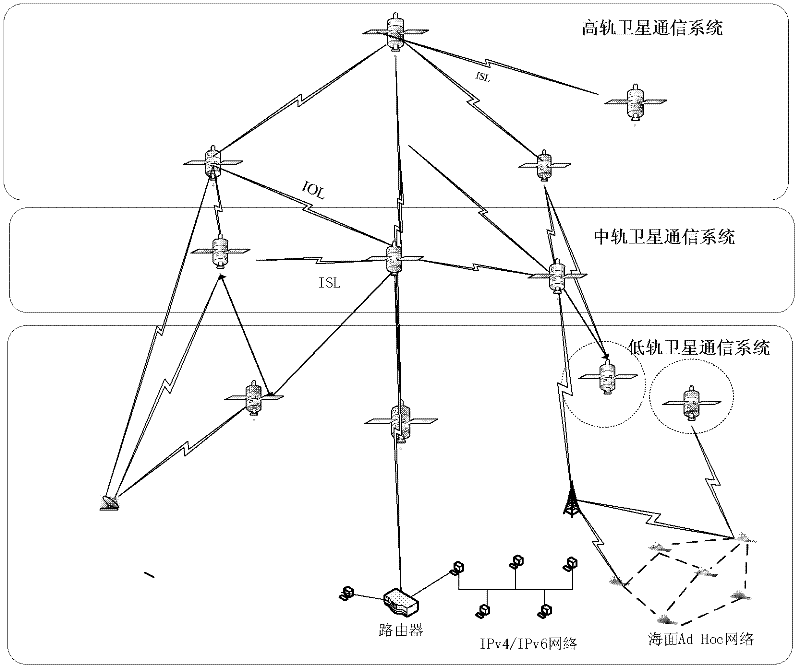
Figure 1 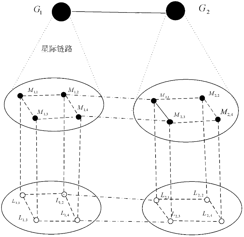
Figure 2 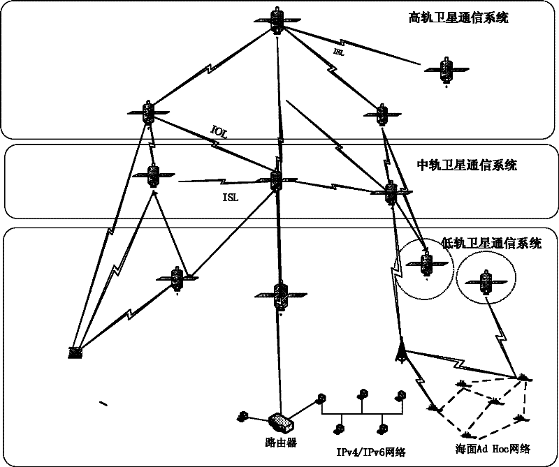
Figure 3
Abstract
Description
technical field
[0001] The invention relates to a cognitive routing algorithm applied to an interstellar link of a multi-level satellite communication system, belonging to the technical field of satellite communication. Background technique
[0002] Satellite communication is the radio communication carried out by multiple earth stations (including land, water surface and atmosphere) on the earth using artificial communication satellites in the air as relay stations. The communication satellite consists of several transponders, several antennas, position and attitude control, telemetry and command, and power supply subsystems. Its main function is to transmit signals from various earth stations.
[0003] According to the working orbit, satellite communication systems are generally divided into the following three categories:
[0004] Low-orbit satellite communication system (LEO): 500-2000Km from the ground, the transmission delay and power consumption are relatively small,...
Examples
Embodiment Construction
[0039] For the convenience of description, we assume the following application examples, such as figure 2 Shown: The system includes two high-orbit satellites, multiple medium-orbit satellites and low-orbit satellites, several ground terminals and a ground control center. The earth station acts as a source to continuously send messages to regions of different geographical lengths.
[0040] Step 1: The ground network source continuously sends messages of different geographical lengths, and marks the different messages separately.
[0041] Step 2: During the sending process, the path of the data can be known according to the tag information of the data, because the length of each data terminal is different, and the data will pass through satellites in different orbits.
[0042] Step 3: Detect and analyze the data utilization rate and time delay of links on different tracks within the time of data transmission and communication.
[0043] Step 4: Continue to send data, select a...