
Geographic information system of drainage pipe network
A geographic information system and drainage pipe network technology, applied in geographic information databases, data processing applications, special data processing applications, etc., can solve problems such as information inconsistency with the status quo, incomplete data, slow update speed, etc., to achieve convenient management, The effect of improving management efficiency
Patent Information
- Authority / Receiving Office
- CN · China
- Patent Type
- Applications(China)
- Current Assignee / Owner
- Publication Date
- 2022-03-25
Smart Images
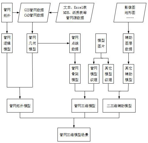
Figure 1 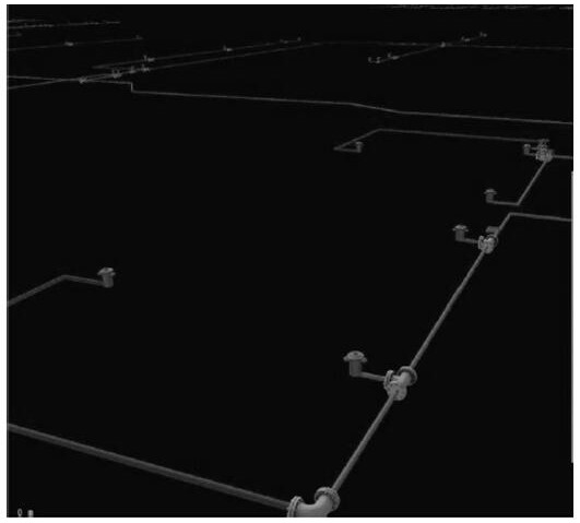
Figure 2 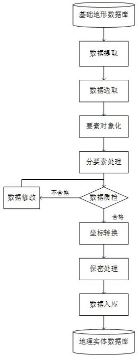
Figure 3
Abstract
Description
technical field
[0001] This application relates to the field of computer technology, in particular to a drainage network geographic information system. Background technique
[0002] With the rapid development of my country's infrastructure construction, the expansion and transformation of urban underground pipelines have increased dramatically, and its comprehensive management problems have become increasingly prominent. First of all, underground pipelines are a huge and complex system composed of many different pipelines and facilities. , charts and other paper media record keeping and management, incomplete data, inconvenient query, slow update speed, resulting in information inconsistent with the status quo.
[0003] However, the pipeline information of the current underground pipeline system is stored in the database in two-dimensional form. The pipeline planning for real-time terrain is inefficient, and the operation status of the pipeline network cannot be well analyzed...
Examples
Embodiment Construction
[0046] In order to make the purpose, technical solution and advantages of the present application clearer, the present application will be further described in detail below in conjunction with the accompanying drawings and embodiments. It should be understood that the specific embodiments described here are only used to explain the present application, and are not intended to limit the present application.
[0047] In one embodiment, such as figure 1 As shown, a drainage pipe network geographic information system is provided, and the system includes a user layer, an application layer, a support layer, a data layer and an infrastructure layer; the user layer, the application layer, the support layer, the data layer and the infrastructure layer are connected through an interface .
[0048] The application layer is used to provide comprehensive pipe network information services from two-dimensional to three-dimensional for drainage pipe network geographic information system user...