

Flood disaster warning water area remote sensing survey method
A technology for flood disasters and water areas, which is applied in the field of disaster monitoring and remote sensing monitoring of flood disasters, and achieves the effect of strong reliability and good promotion and application prospects
- Summary
- Abstract
- Description
- Claims
- Application Information
AI Technical Summary
Problems solved by technology
Method used
Image

Examples
Embodiment Construction
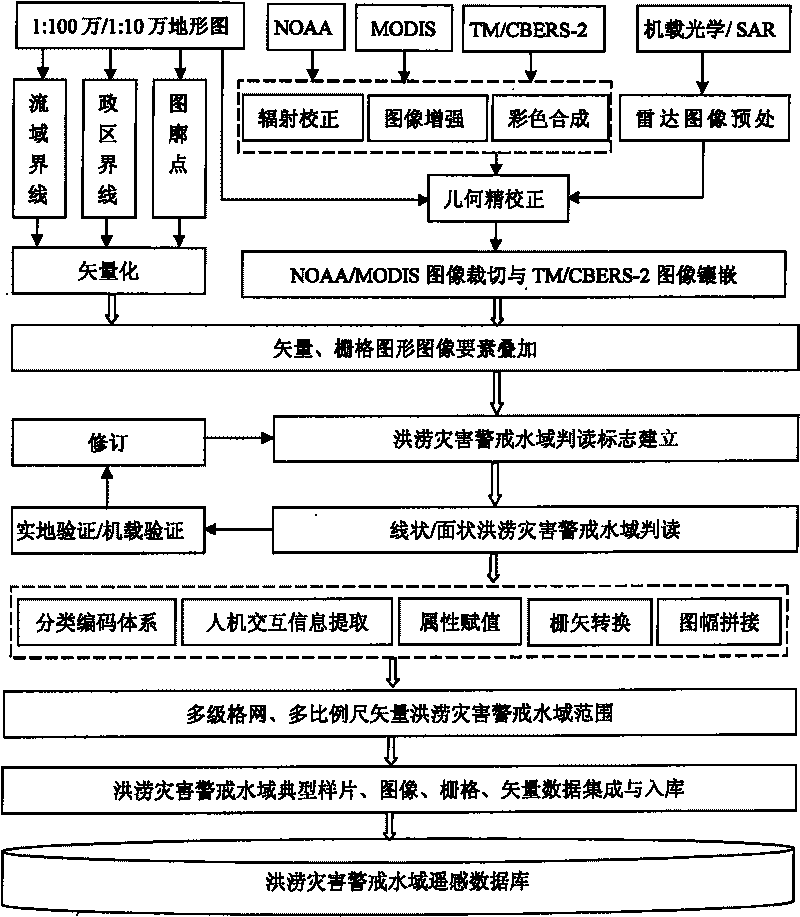
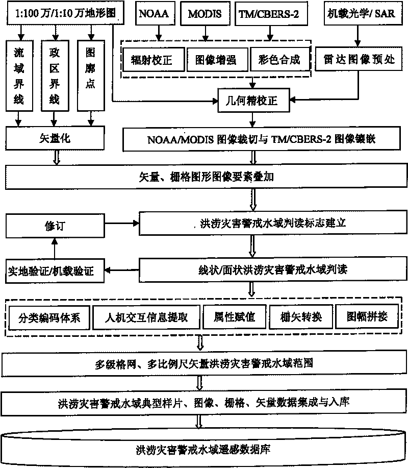
[0019] The present invention utilizes satellite remote sensing data to carry out the technical process of remote sensing survey of warning waters as follows figure 1 shown. Using this method, the technical process of remote sensing investigation of multi-level flood warning waters is as follows:
[0020] ①Establishment of warning waters cognition and interpretation sign sample map
[0021] Propose the warning water area for flood disasters, carry out cognition of the warning water area according to different remote sensing images, establish interpretation signs, and establish a sample map of the warning water area.
[0022] ②Standardized processing of remote sensing surveys in warning waters
[0023] Vectorize topographic maps of different scales, carry out image radiation correction, enhancement, and color synthesis according to the information characteristics of warning waters, use topographic maps for geometric fine correction, and crop watersheds for NOAA / AVHRR and MODIS...
PUM
 Abstract
Description
Claims
Application Information