Data hierarchy and organization method and device capable of fast displaying road conditions

A technology for displaying data and road conditions, applied in the field of traffic navigation, can solve problems such as increasing the load of navigation software, achieve the effect of reducing memory overhead, reducing the time to search for data, and reducing display points

Inactive Publication Date: 2012-12-12
BEIJING QIANTU FANGYUAN SOFTWARE TECH
View PDF5 Cites 23 Cited by
  • Summary
  • Abstract
  • Description
  • Claims
  • Application Information

AI Technical Summary

Problems solved by technology

[0004] Since there is no independent road condition display data, there is no direct index for easy search and positioning between the display data and the road condition information, which

Method used


Image

  • Data hierarchy and organization method and device capable of fast displaying road conditions
  • Data hierarchy and organization method and device capable of fast displaying road conditions
  • Data hierarchy and organization method and device capable of fast displaying road conditions

Examples


Embodiment Construction

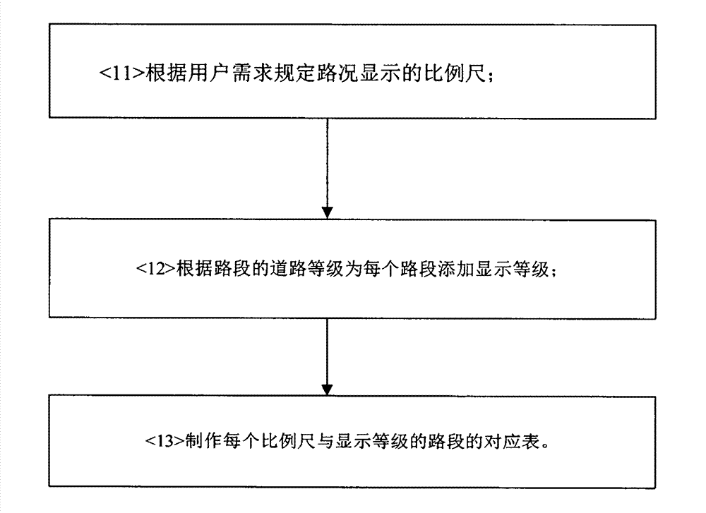
[0028] figure 1 It is a flow chart of the data layering and organizing method for quickly performing road condition display in the present invention. It includes the following steps:

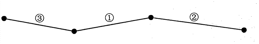
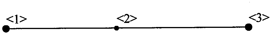
[0029] Step 1: Define the display levels of different road sections in the map data according to the road grade information. Through layering, road sections of different levels can be drawn for different scales when drawing, and the line widths of different levels of road sections can be drawn to make the display effect clear and clear. It should be noted that there are no breaks in the road sections of each level, and the overall feeling of the drawing is full. The specific layering method includes the following steps, see figure 2 :

[0030] Specify the scales for displaying road conditions according to user needs, for example, the specified scales are 9 scales of 20m, 50m, 100m, 200m, 400m, 800m, 1km, 2km, and 4km.

[0031] Add display grades for each road segment according to the roa...


PUM


Abstract

A data hierarchy and organization method capable of fast displaying road conditions includes defining display levels of different road sections in map data according to road hierarchy information; then, combining the road sections with same index identifications into a road section according to index identifications of a road section coding schedule in the map data and performing thinning; establishing code corresponding indexes which can be rapidly and mutually searched between road condition display data and the road section coding schedule according to a unique index of road condition information; and finally, generating road condition display data according to the established code corresponding indexes and subjecting the road condition display data to partitioning organization to display the area road conditions.

Description

technical field [0001] The invention relates to the technical field of traffic navigation, in particular to a data layering and organizing method and device for quickly displaying road conditions. Background technique [0002] Due to the increasing number of vehicles, the public's desire for timely access to road condition information has also become increasingly high. Therefore, it has become more urgent than ever to add functions such as the display of road condition information in navigation services. Therefore, how to present road condition information to the public more quickly and better is a problem that must be considered in today's navigation services. As we all know, the complexity of navigation services far surpasses that of other multimedia devices. Therefore, traditional navigation software has taken up a lot of system and device resources. This trending demand of the public. [0003] Existing navigation software does not have independent road condition displ...

Claims


Application Information

Patent Timeline
IPC IPC(8): G01C21/26
Inventor 杨强
Owner BEIJING QIANTU FANGYUAN SOFTWARE TECH
Why Eureka
Try Eureka