Method for surveying and mapping map by collecting farmland key points

A key point and farmland technology, applied in the field of map surveying and mapping, can solve the problems of redundancy and unsuitability for collection, and achieve the effects of reducing labor intensity and preventing missed and wrong measurements

Active Publication Date: 2013-08-14
BEIJING RES CENT FOR INFORMATION TECH & AGRI
View PDF2 Cites 15 Cited by
  • Summary
  • Abstract
  • Description
  • Claims
  • Application Information

AI Technical Summary

Problems solved by technology

Due to the large amount of redundancy, it is generally not suitable for collec...

Method used


Image

  • Method for surveying and mapping map by collecting farmland key points
  • Method for surveying and mapping map by collecting farmland key points
  • Method for surveying and mapping map by collecting farmland key points

Examples


Embodiment Construction

[0033] The specific implementation manners of the present invention will be further described in detail below in conjunction with the accompanying drawings and embodiments. The following examples are used to illustrate the present invention, but are not intended to limit the scope of the present invention.

[0034] Such as Figure 4 Shown, the present invention a kind of method that collects farmland key point surveying and mapping, comprises:

[0035] S1: Obtain GPS signal;

[0036] S2: outline the area to be measured;

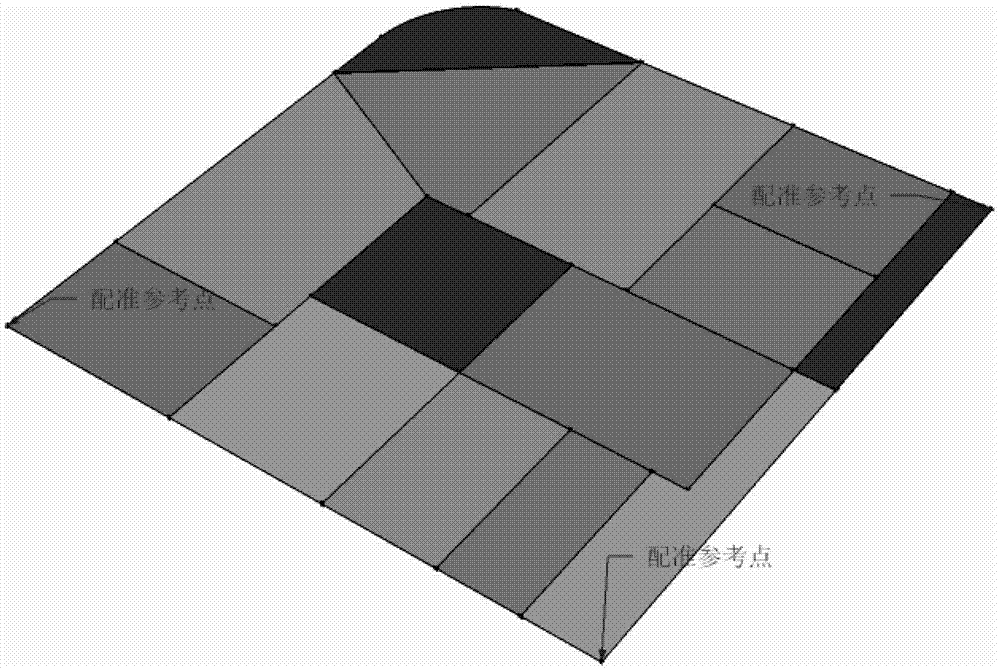
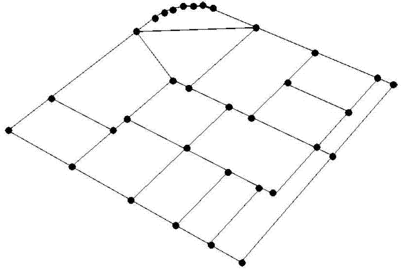
[0037] S3: Survey and map the key demarcation points of the farmland, and mark the name and notes of the plot;

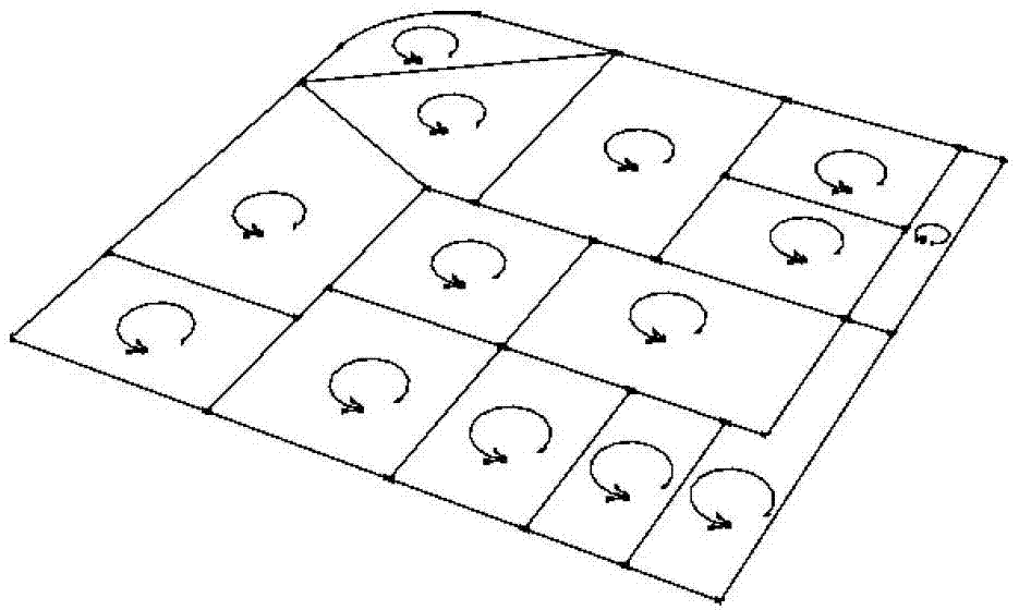
[0038] S4: Real-time verification, reminder and segmentation of farmland;

[0039] S5: Upload surveying and mapping data;

[0040] S6: Get the vector map.

[0041] In S1, ensure that the GPS signal accuracy is within the specified range, generally within 1 meter.

[0042] In S2, the outline of the area to be measured includes two calibration...


PUM


Abstract

The invention discloses a method for surveying and mapping a map by collecting farmland key points. The method comprises the following steps: 1, obtaining GPS position information; 2, drawing an outline of an area to be surveyed; 3, surveying and mapping a farmland key demarcation point, and marking a land parcel name and note; 4, performing real-time verification, prompting, and dividing the farmland; 5, uploading surveying and mapping data; and 6, obtaining a vector map. Compared with the prior art, in the technical scheme provided by the invention, the real-time mapping can be achieved merely by collecting key control points, simultaneously, initiative verification is further performed according to a logic relation between the key points, the non-collected key points are promoted, and the missed survey and the false survey are prevented; and moreover, the reliability is improved, and the labor intensity of manual operation is reduced simultaneously.

Description

technical field [0001] The invention relates to the technical field of map surveying and mapping, in particular to a method for collecting key points of farmland for surveying and mapping to form a map. Background technique [0002] With the completion of the second national land survey and the establishment of a "one map" of national land basic information, the methods, methods and monitoring content of land survey and monitoring will continue to expand. At the same time, the survey and monitoring areas will be divided into key areas, Key cities and key economic zones are developing towards full-coverage monitoring, especially the importance of high-precision monitoring of vast rural land use has become increasingly prominent. This new development trend puts forward higher requirements for the reliability of land resource survey and monitoring data sources, the scientificity of data processing technology, and the ease of operation of survey equipment. In production practic...

Claims


Application Information

Patent Timeline
IPC IPC(8): G06T11/00
Inventor 徐刚陈立平张瑞瑞
Owner BEIJING RES CENT FOR INFORMATION TECH & AGRI
Why Eureka
Try Eureka