

A method of obtaining navigation altitude by fusing relative altitude and absolute altitude
A technology of relative altitude and absolute altitude, which is applied in the direction of altitude or depth control, and can solve the problems of navigation altitude value jump, flight accidents, and different altitude values.
- Summary
- Abstract
- Description
- Claims
- Application Information
AI Technical Summary
Problems solved by technology
Method used
Image

Examples
Embodiment Construction
[0093] The present invention is described in further detail now in conjunction with accompanying drawing. These drawings are all simplified schematic diagrams, and only illustrate the design concept of the present invention in a schematic manner.
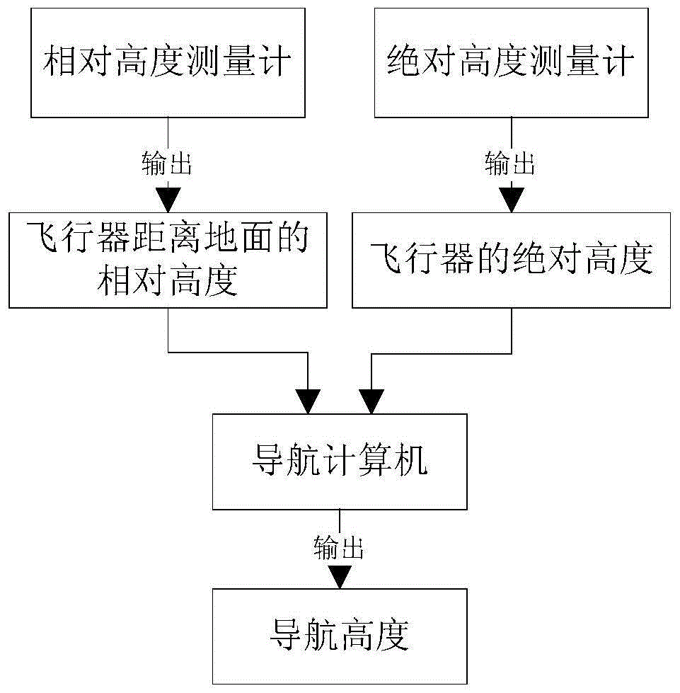
[0094] Such as figure 1 As shown, a method of fusing relative altitude and absolute altitude to obtain navigation altitude requires the following equipment conditions: relative altitude gauge, absolute altitude gauge and navigation computer;
[0095] Among them, the relative altimeter can be any sensor that can measure relative altitude, such as ultrasonic altimeter, laser altimeter, radio altimeter, etc., and the absolute altimeter can be GPS (Global Positioning System) positioning system, barometric altimeter, etc. Sensors that measure absolute altitude;
[0096] Among them, the relative height data h of the aircraft from the ground is obtained from the relative altimeter relat , obtain the absolute height data h of the aircraf...
PUM
 Abstract
Description
Claims
Application Information