Image feature decomposition-based high spatial resolution remote sensing image prospecting method

A high-spatial-resolution, remote-sensing image technology, applied in the field of high-spatial-resolution remote sensing image prospecting, can solve problems such as inability to provide remote sensing technology services

Inactive Publication Date: 2016-04-06
CHENGDU UNIVERSITY OF TECHNOLOGY +1
View PDF2 Cites 5 Cited by
  • Summary
  • Abstract
  • Description
  • Claims
  • Application Information

AI Technical Summary

Problems solved by technology

Neither of these two methods can make remote sensing tec

Method used


Image

  • Image feature decomposition-based high spatial resolution remote sensing image prospecting method
  • Image feature decomposition-based high spatial resolution remote sensing image prospecting method
  • Image feature decomposition-based high spatial resolution remote sensing image prospecting method

Examples


Embodiment

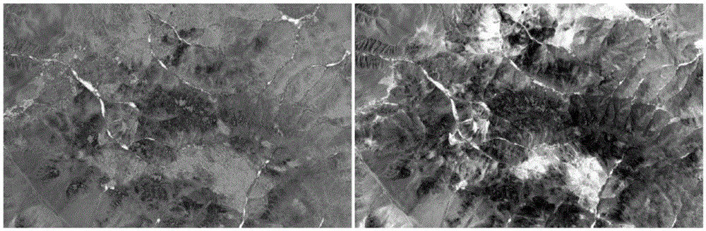
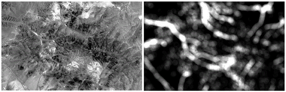
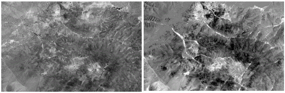
[0021] When high-spatial-resolution remote sensing images display geological information, they are mainly realized through different image characteristics, rather than its hidden spectral information. Generally speaking, the performance of remote sensing geological features in images is: color (including hue, brightness, saturation), texture (rough, medium, fine), shape (linear, circular, lumpy). Different geological bodies, altered rocks, and hidden mineral deposits are all represented by the above-mentioned basic features in high-altitude remote sensing images. These are also the most direct responses of geologists to use remote sensing images for target recognition. How to effectively use these most direct appearance features and Accurately identifying the basic features of the above-mentioned images and determining the relationship between the feature appearance and the mineral deposit are the key points of the present invention.

[0022] Suppose x represents a color, wher...


PUM


Abstract

The invention discloses an image feature decomposition-based high spatial resolution remote sensing image prospecting method. The method comprises the following steps of extracting color feature and the texture feature of an image; solving the spectrum second derivative of the image; comprehensively analyzing the three elements i.e. the extracted color feature, the texture feature and the second derivative image; and by using a logic overlay analysis method, solving the intersection by using the algorithm of multiplying the three elements through a fuzzy mathematical theory, wherein the intersection position is the remote sensing prospecting target area. According to the method, appearance shapes such as color, shape, texture and the like shown by the high spatial resolution remote sensing data are fully utilized and the data is fully mined by adopting the techniques such as mathematics, image processing, GIS (Geographic Information System) and the like to comprehensively confirm the prospecting target area; and reliable basis is provided for the periphery prospecting of mining areas and the ore deposit location in the next step.

Description

technical field [0001] The invention relates to a high spatial resolution remote sensing image prospecting method based on image feature decomposition. Background technique [0002] Remote sensing technology is an essential means of geological exploration. Traditional remote sensing ore prospecting methods are generally based on low-to-medium spatial resolution, multispectral or hyperspectral image data. The research methods can be roughly divided into four types: one is to rely on experience and purely visual interpretation to determine the target area. This method is usually suitable for remote sensing geologists with many years of experience; the second is to extract geological structure and alteration information from multispectral remote sensing images, comprehensively analyze the mineralization geological conditions in the area, and then determine the ore prospecting target area. This method is usually suitable for those who are familiar with geological and mineraliza...

Claims


Application Information

Patent Timeline
IPC IPC(8): G06K9/00G06K9/46
CPCG06V20/13G06V10/56
Inventor 郭娜唐菊兴彭书明唐楠汪重午
Owner CHENGDU UNIVERSITY OF TECHNOLOGY
Why Eureka
Try Eureka