Establishing method for training image of distributary channel-estuary dam type delta front

A technology for training images and establishing methods, which is applied in image data processing, 3D modeling, instruments, etc., can solve problems such as difficulty in obtaining training images, and achieve the effect of reducing difficulty

CN108805982AActive Publication Date: 2018-11-13YANGTZE UNIVERSITY
4 Cites 0 Cited by

Patent Information

Authority / Receiving Office
CN · China
Patent Type
Applications(China)
Current Assignee / Owner
Publication Date
2018-11-13

Smart Images

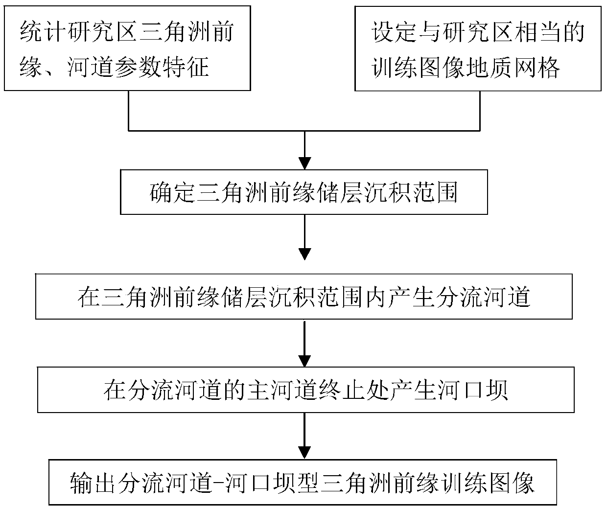
  • Figure 1
    Figure 1
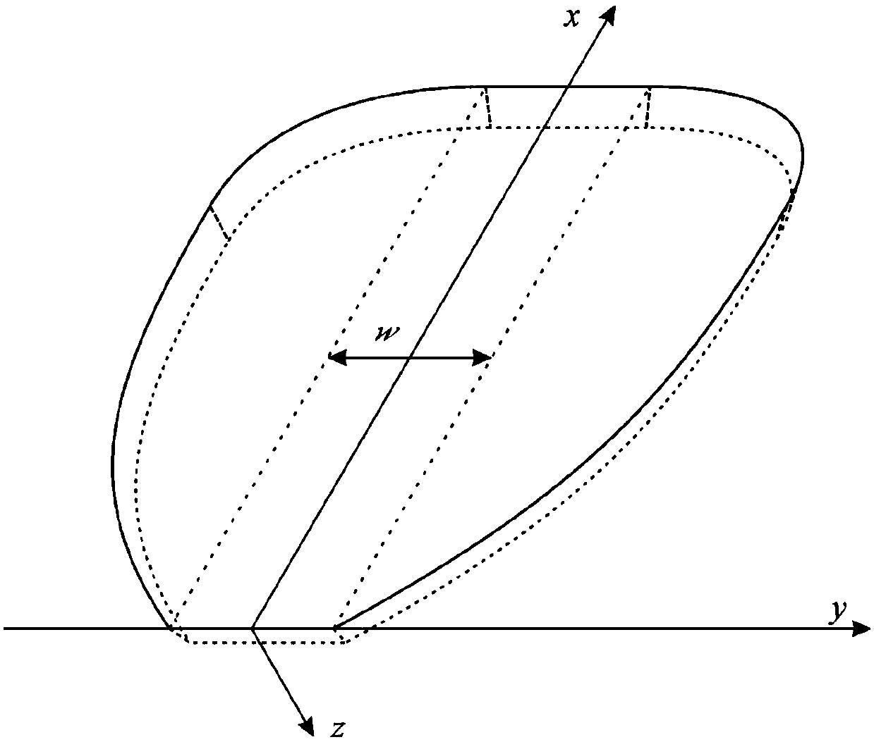
  • Figure 2
    Figure 2
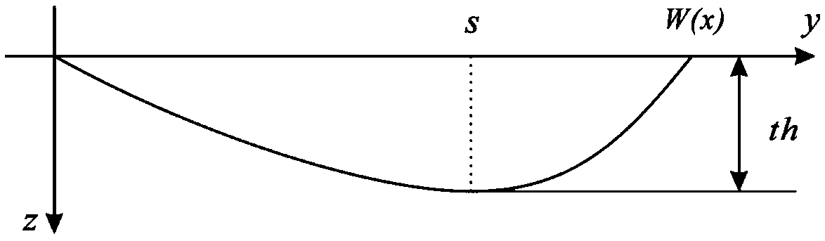
  • Figure 3
    Figure 3
Patent Text Reader

Abstract

The invention relates to an establishing method for a training image of a distributary channel-estuary dam type delta front. The establishing method comprises the steps that (1) the delta front reservoir deposition range is determined; (2) distributary channels are generated in the delta front reservoir deposition range; and (3) an estuary dam is generated at the termination position of a main channel of the distributary channels. According to the establishing method for the training image of the distributary channel-estuary dam type delta front, the training image of the distributary channel-estuary dam type delta front is automatically obtained, the research result of a research area and statistic data of a geological library can be rapidly combined to be converted into the digitized training image specific to an actual area, an accurate geological pattern library is provided for later multipoint geological statistical modeling, and multipoint modeling difficulty is greatly lowered.
Need to check novelty before this filing date? Find Prior Art

Description

technical field

[0001] The invention belongs to the technical field of oil and gas exploration and development, in particular to a method for establishing a training image of a distributary channel-mouth bar delta front. Background technique

[0002] The traditional two-point statistical modeling method based on the variogram has played an important role in the establishment of the 3D geological model of continental sedimentary reservoirs, and has strongly promoted the development of reservoir description in the direction of refinement and quantification. However, the two-point variogram is difficult to describe the complex shape of the reservoir (such as a curved channel), and it must rely on the combination of multiple spatial points to describe the relationship between the shape of the reservoir and the spatial configuration. Multi-point geostatistics has been established and developed. It uses multi-point templates (data templates) to scan training images (conceptualized...

Examples

Embodiment 1

[0154] 1. According to the actual situation of the work area, the grid division of the training image is determined to be 400×400×20, the number of original grid points is 3,200,000, and the grid size is 10(m)×10(m)×1(m). Among them, the length of the delta front reservoir deposition range is 2400 meters, the width is 300 meters to 1600 meters, the length of the channel is 400 meters to 900 meters, the width is 40 meters to 80 meters, and the thickness is 8 to 15 meters. The length of the mouth bar is 270 meters to 340 meters, the width of the mouth bar sand bar is 80 to 200 meters, the thickness of the mouth bar is 10 to 20 meters, the azimuth angle is 0 to 15 degrees, and the dip angle is 0 to 5 degrees. The mouth bar accounts for 15%.

[0155] 2. Use the existing measurement data to determine the provenance direction and determine the depositional range of the delta front reservoir. The length of the depositional area is 1900 meters, the maximum width is 1400 meters, the min...