Geological map compilation method based on geological three-dimensional modeling process

A technology of 3D modeling and geological mapping, applied in 3D modeling, image data processing, instruments, etc., can solve problems such as single data utilization, separation of drawing process, cumbersome drawing labeling and format layout, etc., to improve output Effects on Graph Quality and Efficiency

Inactive Publication Date: 2015-12-23
POWERCHINA HUADONG ENG COPORATION LTD
View PDF3 Cites 16 Cited by
  • Summary
  • Abstract
  • Description
  • Claims
  • Application Information

AI Technical Summary

Problems solved by technology

[0010] The technical problem to be solved by the present invention is to provide a method for compiling and drawing geological maps based on the geological three-dimensional modeling process to solve the problem of separation of the geological three-dimensional modeling process and the geological two-dimensional drawing process in view of the above-mentioned existing problems, As well as problems such as heavy workload of drawing geological maps, long cycle of drawing proofreading, cumbersome map labeling and format layout, single data utilization method, high human error rate, inconsistent map interpretation content, and difficulty in modifying and updating drawings, etc., it is difficult to improve geological maps. output quality and efficiency

Method used


Image

  • Geological map compilation method based on geological three-dimensional modeling process
  • Geological map compilation method based on geological three-dimensional modeling process
  • Geological map compilation method based on geological three-dimensional modeling process

Examples


Embodiment Construction

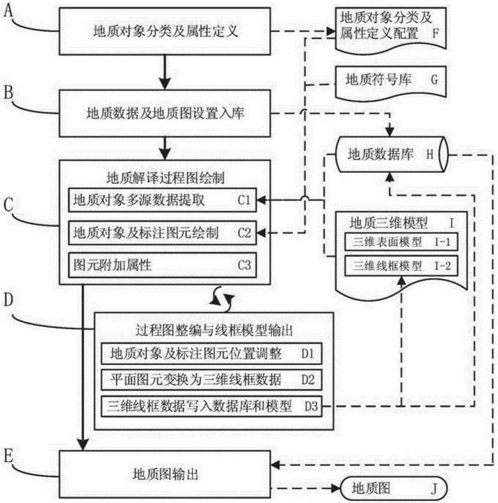
[0041] Such as figure 1 As shown, this embodiment takes the drawing of the exploration line geological profile as an example, and further introduces the present invention in detail.

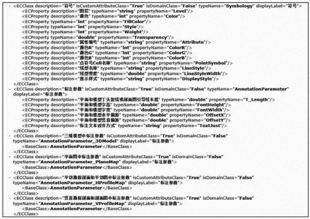
[0042] This example uses the GeoStation geological three-dimensional survey and design system developed based on the Bentley MicroStation computer-aided design (CAD) platform, which stores geological object data and various map parameter data in the SQLServer database.

[0043] In this embodiment, according to the method for compiling geological maps based on the geological three-dimensional modeling process described in the present invention, the process mainly includes the following steps: 1. Geological object classification and attribute definition A; 2. Geological data and geological Map setting storage B; 3. Geological interpretation process map drawing C; 4. Process map compilation and wireframe model output D; 5. Geological map output E.

[0044] 1. Geological object classification and at...


PUM


Abstract

The invention relates to a geological map compilation method based on a geological three-dimensional modeling process. The invention aims to provide the geological map compilation method based on the geological three-dimensional modeling process, so as to solve the problems that the geological three-dimensional modeling process and a geological two-dimensional drawing output process are separated, the geological map drawing workload is heavy, the drawing proofreading work cycle is long, the drawing marking and format composing are tedious, the data utilization method is single, the man-made error rate is high, the map interpretation content is inconsistent, the drawing revision and updating are difficult and the like, as well as improve drawing output quality and efficiency of a geological map. The invention adopts the technical scheme that the geological map compilation method is characterized by comprising the steps of: 1, classifying geological objects and defining attributes; 2, setting and storing geological data and geological maps; 3, drawing geological interpretation process maps; 4, compiling the process maps and outputting wireframe models; 5, and outputting the geological maps. The geological map compilation method based on the geological three-dimensional modeling process is applicable to the professional fields of engineering geology in the industries of hydropower, water conservancy, geotechnical, mine, traffic and the like.

Description

technical field [0001] The invention relates to a method for editing and drawing geological maps based on a geological three-dimensional modeling process. It is applicable to the professional fields of engineering geology in hydropower, water conservancy, rock and soil, mining, transportation and other industries. Background technique [0002] Traditionally, the simulation and expression of geological information mainly use plan and section diagrams, and its essence is to project strata, structures, landforms and other geological phenomena in three-dimensional space onto a certain plane for depiction. The main problems of this method are loss and distortion of spatial information, complicated drawing process, low data reusability and difficulty in updating information. [0003] With the development of computer hardware and software and the wide application of digital information technology represented by computer-aided design technology, graphics and image technology, and d...

Claims


Application Information

Patent Timeline
Patent Type & Authority Applications(China)
IPC IPC(8): G06T17/05
Inventor 王国光王金锋单治钢陈健李成翔徐霞
Owner POWERCHINA HUADONG ENG COPORATION LTD
Why Eureka
Try Eureka