

House vectorization method for multi-element remote sensing data
A remote sensing data and vectorization technology, applied in the field of image processing, can solve the problems of lack of house post-processing method, low degree of automation, unsatisfactory house extraction results, etc., to achieve fast detection results, avoid trouble and adverse effects, and calculate the amount of less effect
- Summary
- Abstract
- Description
- Claims
- Application Information
AI Technical Summary
Problems solved by technology
Method used
Image

Examples
Embodiment Construction
[0035] The content of the present invention will be described below in conjunction with specific embodiments.
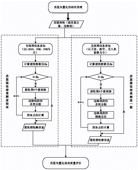
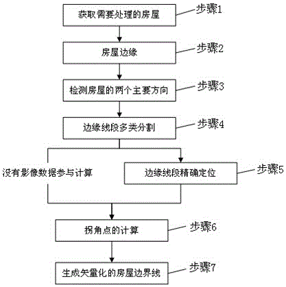
[0036] Such as figure 1 and figure 2 As shown, the specific process of a house vectorization method for multivariate remote sensing data described in this embodiment is as follows:
[0037] Step 1. Obtain the house to be processed.
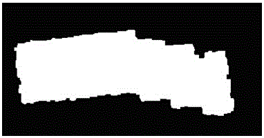
[0038] Such as image 3 As shown, the house described here can be a house candidate point obtained by various means, or it can be a house patch, a house boundary line and other information that can represent the position and shape of the house: for example, using multi-scale segmentation combined with support vector machine Segmented house patches, house point set outlines obtained by using point cloud segmentation technology and α-shapes algorithm, house edge lines obtained by using active contour method, etc.
[0039] Step 2, get the edge of the house.
[0040] Such as Figure 4 As shown, there are two main steps here: one is to...
PUM
 Abstract
Description
Claims
Application Information