Land utilization category determination method fusing in streetscape images

A determination method and street view technology, applied in the field of land use category determination, can solve problems such as kernel density regression error, and achieve the effects of high accuracy, fine classification results, and accurate classification.

Active Publication Date: 2019-09-20
INST OF GEOGRAPHICAL SCI & NATURAL RESOURCE RES CAS
View PDF2 Cites 19 Cited by
  • Summary
  • Abstract
  • Description
  • Claims
  • Application Information

AI Technical Summary

Problems solved by technology

However, these methods are limited to the block scale, and do not use single pixel information to classify land use, and for some areas with sparse street view sample points, or areas with uneven distribution of street view samples, using kernel density regression will produce big error

Method used


Image

  • Land utilization category determination method fusing in streetscape images
  • Land utilization category determination method fusing in streetscape images
  • Land utilization category determination method fusing in streetscape images

Examples


Embodiment Construction

[0040] The present invention will be described in detail below in conjunction with the accompanying drawings and embodiments.

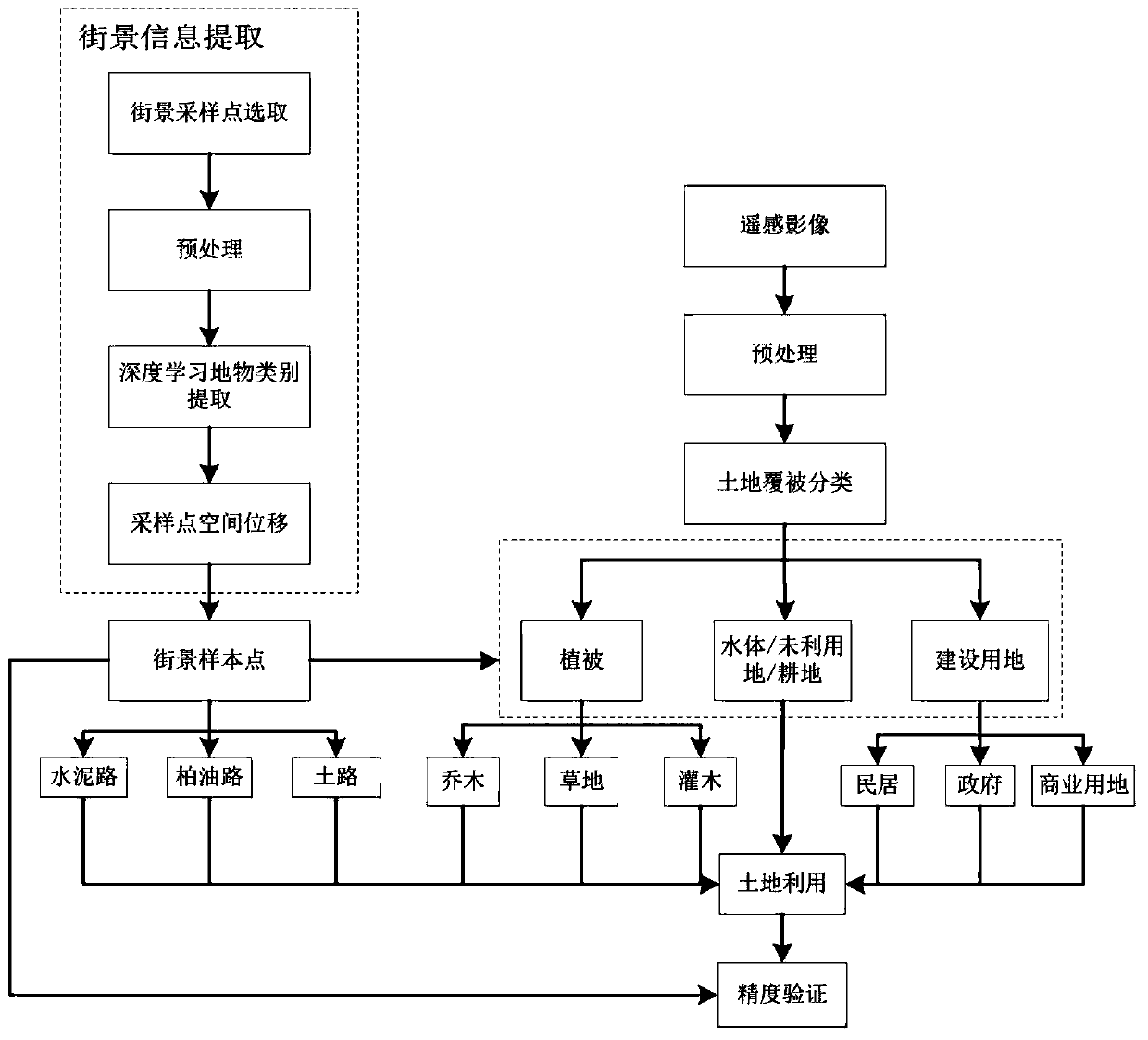
[0041] Such as figure 1 As shown, a method for determining land use category integrated into street view information of the present invention includes the following steps:

[0042] Step 1: Street View Information Extraction

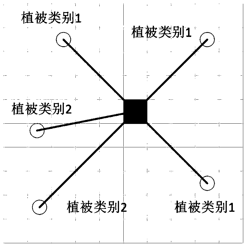
[0043] Selection of street view sampling points: edit the road vector data and extract the road vector data that exists in street view images; randomly generate sampling points on the road through GIS software, and calculate the direction of each sampling point due to the quality of the road direction image sampling point data, and obtain The four directions of each sampling point are 0°, 270°, 180° and 90° respectively. According to the location of the sampling point, one street view image on the left and right sides of the road is selected as a ground object discrimination sample and one road street view image is used as a road...


PUM


Abstract

The invention discloses a land utilization category determination method fusing in streetscape images. The method comprises the following steps of firstly, extracting the fine ground object category information in the street view image sampling points through a deep learning convolutional neural network mode; meanwhile, preprocessing the remote sensing image, and obtaining a land cover map by using a supervised classification method; secondly, through the spectrum, the texture, the shape and the geographic distribution information of the pixels where the streetscape sampling points are located, deducing the category condition of the adjacent pixels; and finally, fusing the pixel classification information and the land cover map to obtain a fine multi-class land utilization result. According to the method, by starting from the remote sensing based on the pixel classification, the fine streetscape information is combined, and the precision of the classification result is high.

Description

technical field [0001] The invention relates to a method for determining a land use category and belongs to the field of geospatial information. Background technique [0002] Land use refers to all human activities that purposefully develop and utilize land resources. Land use information plays a vital role in urban planning, urban environmental monitoring, and urban transportation (Liu X, He J, YaoY, et al. al.). How to extract more accurate land use information is an important issue and challenge. As a large-scale, non-contact data source, remote sensing image information is an important means of land use information extraction (Zhao Yingshi). Using high-resolution remote sensing images acquired by resource satellites, combined with professional remote sensing image processing software, and applying scientific information extraction methods, the corresponding resource information can be obtained quickly and accurately. [0003] However, due to the influence of the accur...

Claims


Application Information

Patent Timeline
Patent Type & Authority Applications(China)
IPC IPC(8): G06K9/00G06K9/32G06K9/34G06K9/62G06Q50/16
CPCG06Q50/16G06V20/13G06V20/62G06V10/267G06F18/241
Inventor 葛咏赵维恒贾远信
Owner INST OF GEOGRAPHICAL SCI & NATURAL RESOURCE RES CAS
Why Eureka
Try Eureka