A Method for Auxiliary Seismic Data Interpretation

A technology of seismic data and seismic profiles, applied in seismology, seismic signal processing, geophysical measurement, etc., can solve problems such as identification and judgment difficulties

Active Publication Date: 2022-06-17
SOUTHWEST PETROLEUM UNIV +1
View PDF6 Cites 0 Cited by
  • Summary
  • Abstract
  • Description
  • Claims
  • Application Information

AI Technical Summary

Problems solved by technology

[0010] The purpose of the present invention is to provide a method for assisting seismic data interpretation, which solves the relatively difficult problem of identifying and judging geological structures, geological horizons and faults in mountainous seismic data interpretation in existing methods, and projects geological sections to seismic data. The technique of assisting seismic interpretation on the profile can achieve accurate and effective interpretation of mountainous seismic data

Method used


Image

  • A Method for Auxiliary Seismic Data Interpretation
  • A Method for Auxiliary Seismic Data Interpretation
  • A Method for Auxiliary Seismic Data Interpretation

Examples


Embodiment 1

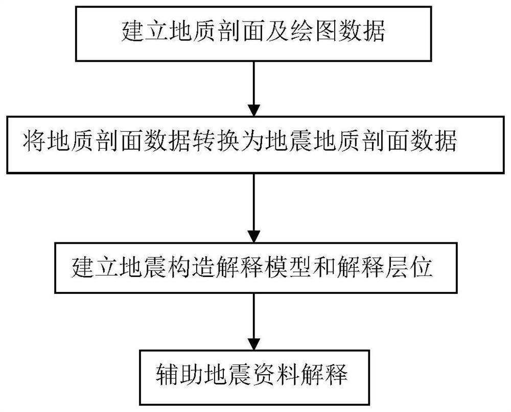
[0062] The flow of the method for assisting the interpretation of seismic data according to the present invention (see figure 1 ), formulate working steps, this embodiment is to assist the interpretation of two seismic data related to marine strata in a two-dimensional seismic work area in a mountainous area (taking a two-dimensional seismic block in the southern mountainous area as an example). The horizons are the Silurian bottom (Ts) and the Permian bottom (Tp).

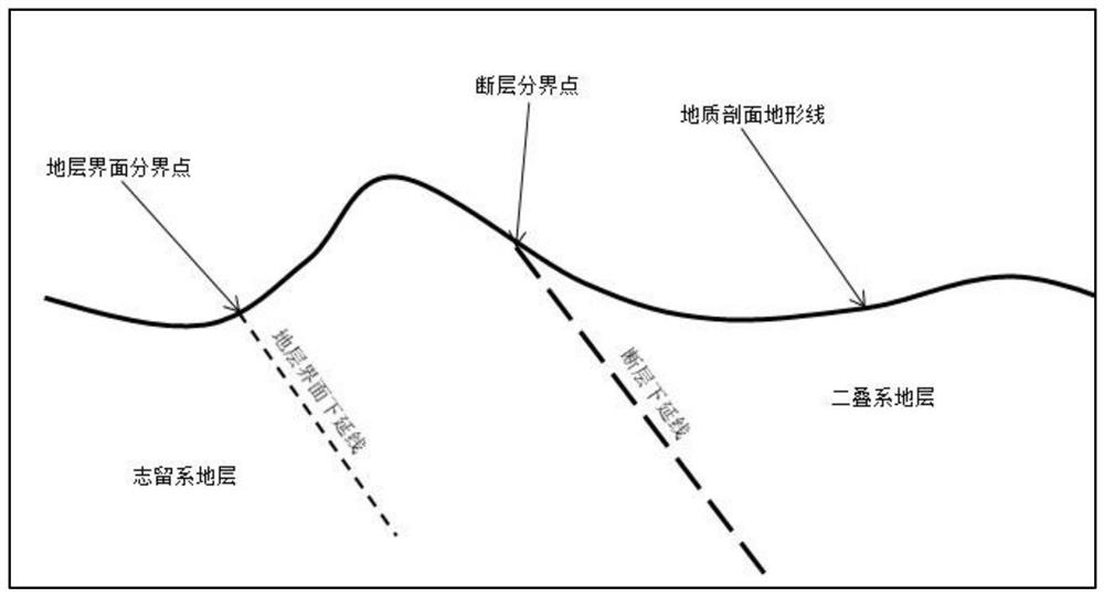
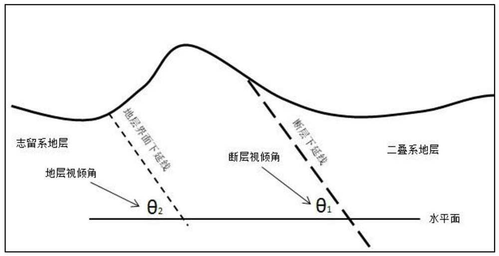
[0063] In step (1), field geological surveys are carried out on the relevant seismic survey lines to obtain mapping data such as the corresponding geological profiles and elevations, coordinates, strata and fault interface apparent dips and dips, strata and fault boundary points, etc. figure 2 As shown, it is a schematic diagram of the geological profile drawing parameters of Example 1 of the present invention Figure 1 ,like image 3 As shown, it is a schematic diagram of the geological profile drawing paramet...


PUM


Abstract

The invention discloses a method for assisting seismic data interpretation, which includes: (1) establishing a geological section on the survey line of the seismic section to be interpreted, and obtaining the drawing data of the geological section; (2) processing the geological section according to the seismic data Replace the speed, process the coordinates and elevation data of each sampling point on the datum level and the topographic line of the geological section, convert the topographic line of the geological section to the topographic line of the seismic section to form the topographic line of the seismic geological section, and convert the stratum and fault interface on the geological section The apparent dip angle is converted into the time dip angle on the seismic geological section, and the boundary point position of the stratum and fault interface on the topographic line of the seismic geological section is used to extend down a length in a straight line according to the time dip angle and dip, and then extend downward on the seismic section. The line implements manual interpretation to draw the layers and faults of the seismic geological structure model, forms a seismic geological section, and assists the interpretation of seismic data. The method of the invention can achieve accurate and effective interpretation of mountainous seismic data.

Description

technical field [0001] The invention relates to a method for interpreting seismic data, in particular to a method for assisting interpretation of seismic data. Background technique [0002] Due to the influence of geological structure, bedrock exposure and other factors in mountain seismic data, the seismic reflection waves are prone to interfere with each other, and the large number of diffracted waves make seismic imaging difficult, and there are many false events on the seismic section, which are not the same as the reflection events. Represents formation reflection. Overall, the imaging of mountain seismic data is poor, and the event axis is difficult to identify and track. [0003] In recent years, oil exploration has gradually shifted to the piedmont zone, and industrial oil and gas streams have been drilled in some piedmont zones, but some exploration wells have also failed. Drilling reveals that the horizons and structural models of seismic interpretation are often...

Claims


Application Information

Patent Timeline
Patent Type & Authority Patents(China)
IPC IPC(8): G01V1/28G01V1/30
CPCG01V1/28G01V1/301
Inventor 蒋裕强周亚东谷一凡付永红蒋增政
Owner SOUTHWEST PETROLEUM UNIV
Why Eureka
Try Eureka