

Drawing method for vector graphic map symbols
A technology for vector graphics and graphic rendering, which is applied in the field of geographic information and can solve the problems of incapable of anti-aliasing and smoothing of graphics.
- Summary
- Abstract
- Description
- Claims
- Application Information
AI Technical Summary
Problems solved by technology
Method used
Image


Examples
Embodiment Construction
[0046] In order to enable those skilled in the art to better understand the technical solution of the present invention, and to make the above-mentioned purpose, features and advantages of the present invention more comprehensible, the present invention will be further described in detail below in conjunction with the embodiments and accompanying drawings.
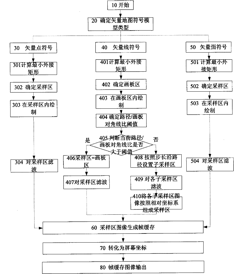
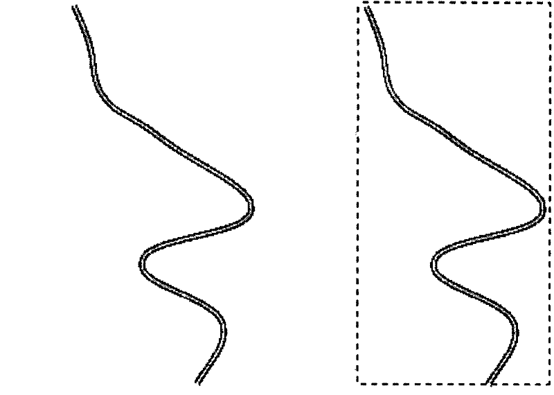
[0047] The drawing method of the present invention relates to a multi-gray-level smoothing algorithm for vector image features. The present invention does not directly output the vector map symbol graphics on the display device, but uses the vector graphics drawing sampling area to convert the vector map symbol graphics into sampling areas. For images, according to the convolution theorem, it can be known that the amount of filtering calculation is positively correlated with the area of the sampling area. Therefore, in order to improve the calculation efficiency, a single sampling area or sub-sampling area is set according...
PUM
 Abstract
Description
Claims
Application Information