

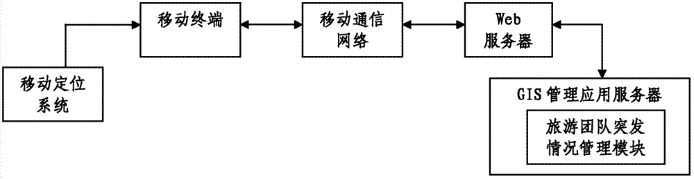
GIS (Geographic Information System)-based emergency condition management system for tour group
A technology of emergencies and management systems, applied in the field of tourism team management systems, can solve the problems of insufficient monitoring of laggard tourists and low efficiency of rescue methods, and achieve the effect of saving labor costs and efficient handling
- Summary
- Abstract
- Description
- Claims
- Application Information
AI Technical Summary
Problems solved by technology
Method used
Image

Examples
Embodiment Construction
[0045] The present invention will be described in further detail below with reference to the accompanying drawings and embodiments.
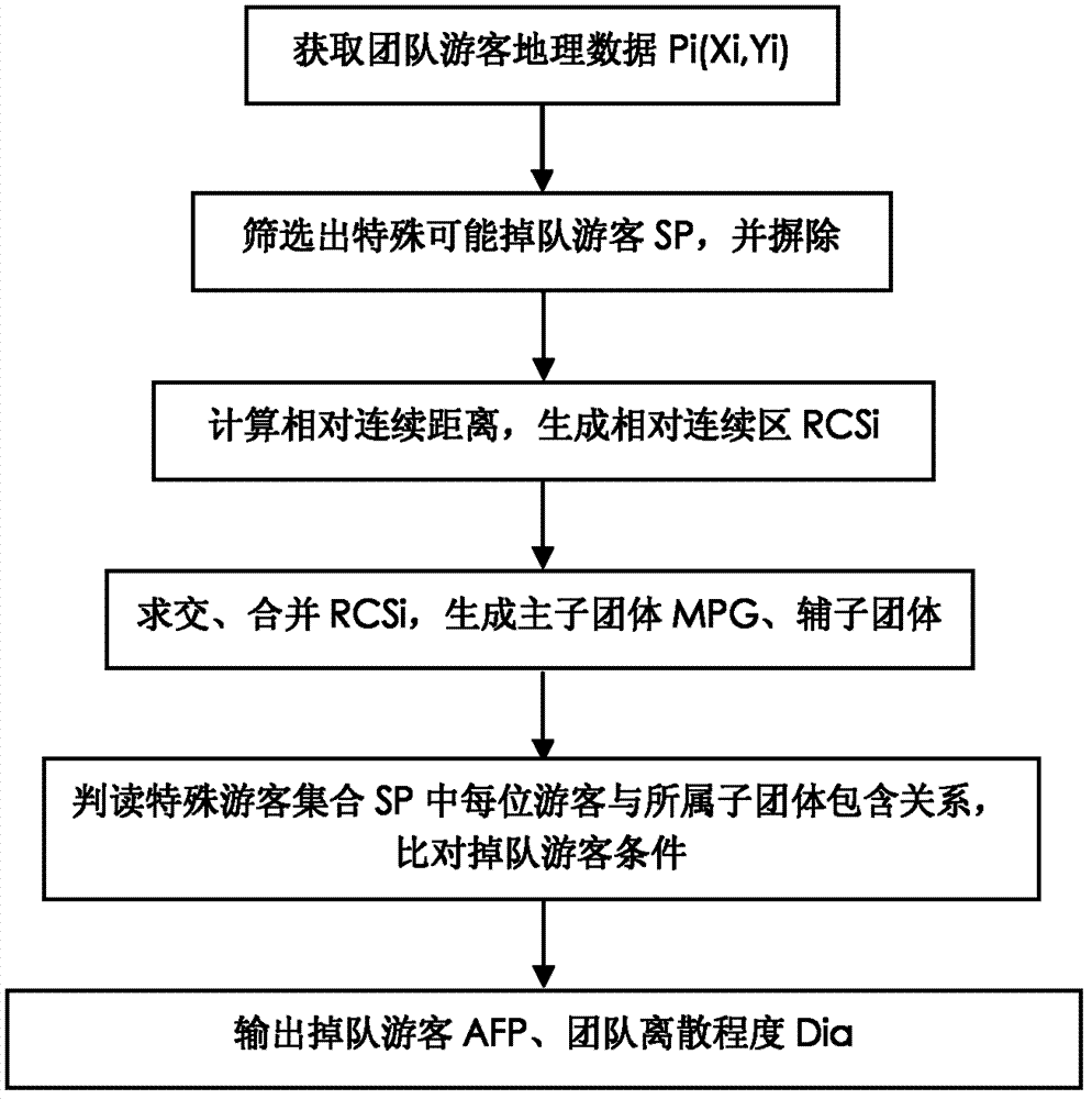
[0046] Automatically determine the components and workflow of the straggler module (such as figure 2 shown):
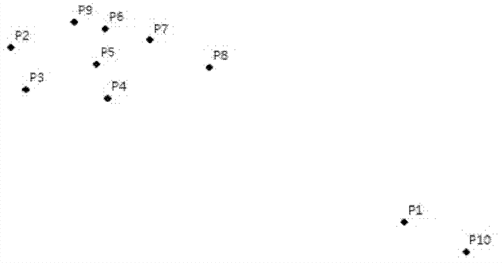
[0047] The basic idea of this module is to obtain the geographic coordinates Pi (Xi, Yi) of each tourist in the team, and calculate the Euclidean distance dij between each tourist and the other n-1 tourists (the Euclidean distance is also called the Euclidean metric, which is in the The real distance between two points in the m-dimensional space, this module adopts the two-dimensional space Euclidean distance calculation method), distance and Di; analyze and count the size distribution of Di, screen out m special points SPm, and find the remaining n-m tourist distances and the average value K of Di; calculate the relative continuous distance Dia between the two tourists in the team, Dia is to a certain extent a response to the degre...
PUM
 Abstract
Description
Claims
Application Information