

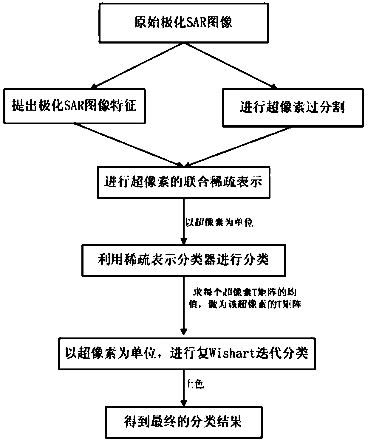
Super-pixel polarimetric SAR land feature classification method based on sparse representation
A sparse representation and object classification technology, applied in the field of image processing and remote sensing, can solve the problems of poor regional consistency and failure to utilize the spatial similarity of polarimetric SAR objects
- Summary
- Abstract
- Description
- Claims
- Application Information
AI Technical Summary
Problems solved by technology
Method used
Image

Examples
Embodiment 1
[0091] The effect of the present invention can be further illustrated by the following experiments.
[0092] 1. Experimental data
[0093] The data used in the simulation experiment of the present invention are two sets of real polarimetric SAR images.
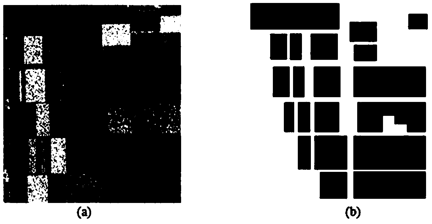
[0094]The first set of data comes from the L-band data of the Flevoland area in the Netherlands acquired by NASA / JPLARISAR. This is a four-view full-polarization data. We use a subimage of it with a size of 300×270 for experiments, such as figure 2 (a). There are six types of ground objects in this area, namely potatoes, sugar beets, bare land, barley, wheat, and peas. Marked with 6 colors respectively, such as figure 2 (b).
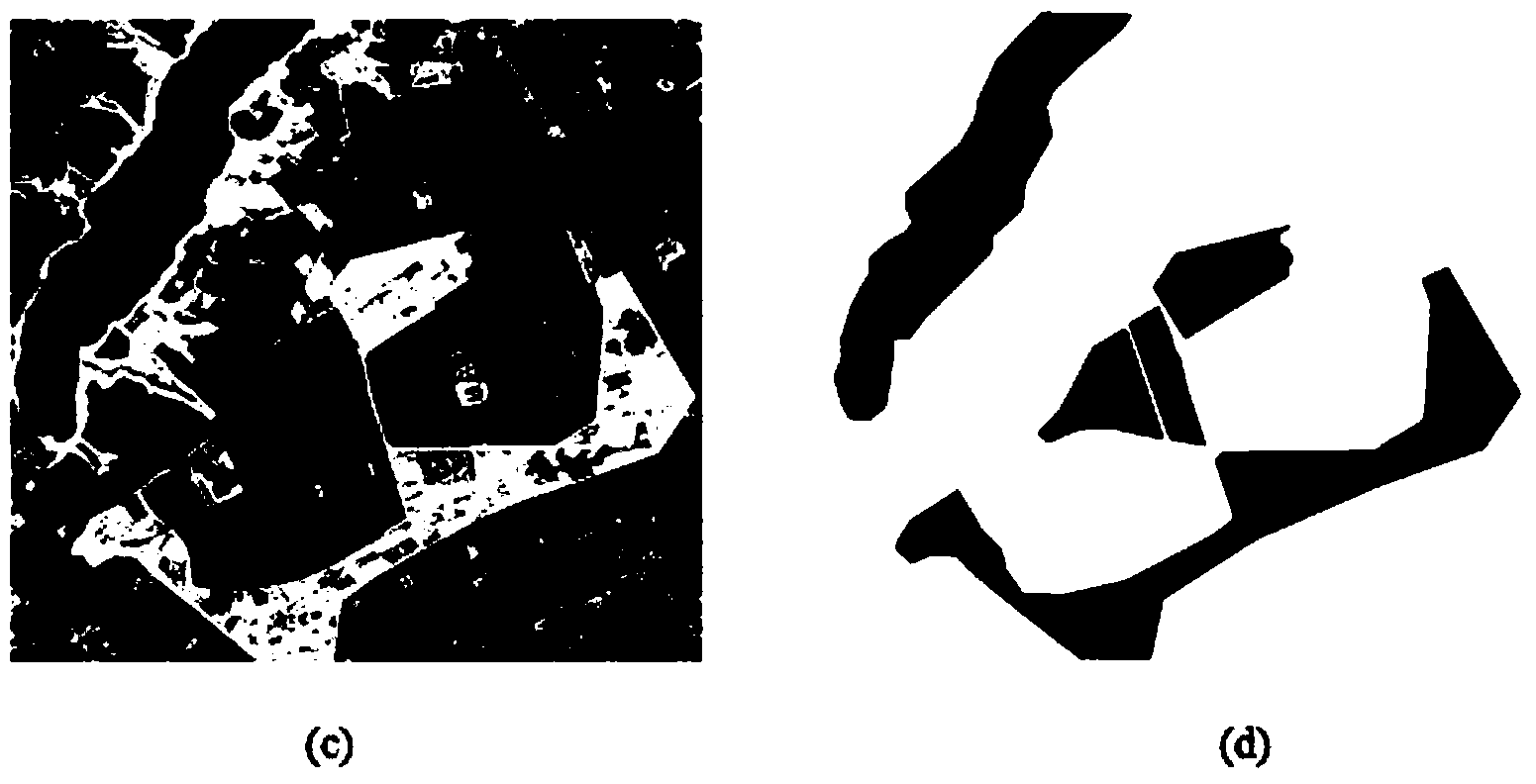
[0095] The second set of data comes from the L-band full-polarization data in the Foloum area of Denmark acquired by EMISAR. We use a subimage of it with a size of 943×1015 to do experiments, as image 3 (a). There are five types of land features in this area, namely rivers, forests (mainly con...
PUM
 Abstract
Description
Claims
Application Information