Device for displaying road navigation track

A technology for navigation paths and roads, which is applied to road network navigators and other directions, and can solve problems such as inability to search for the shortest navigation path of roads, short navigation paths, and inaccessibility

Active Publication Date: 2007-02-28
XIAMEN YAXON NETWORKS CO LTD
View PDF0 Cites 18 Cited by
  • Summary
  • Abstract
  • Description
  • Claims
  • Application Information

AI Technical Summary

Problems solved by technology

Because according to the generation process of the above-mentioned DijkStra algorithm, vertex S->vertex P->vertex A->vertex O must be the shortest path from the starting point S to the ending point O, that is, the previous point of the vertex O must be the vertex during the calculation process A, so that when the calculation is completed and the path is traced back, it is impossible to obtain a more realistic shortest path vertex S-

Method used


Image

  • Device for displaying road navigation track
  • Device for displaying road navigation track
  • Device for displaying road navigation track

Examples


Example Embodiment

[0042] One, embodiment one

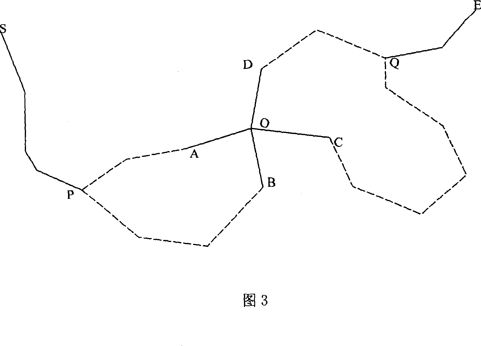
[0043] The structure of an embodiment of the device for providing a road navigation route according to the present invention, as shown in FIG. 3, consists of a main controller 10, a transceiver 20, a data memory 30 storing an electronic map, a searcher 40, a map editor 50 and The input module 60 is composed. The main controller 10 controls the transceiver 20, the data storage 30 storing the electronic map, the searcher 40, the map editor 50, and accepts the data for modifying the electronic map provided by the input module.

[0044] The transceiver 20 adopts a public GPRS network or CDMA network mobile transceiver to receive the current position and destination information of the vehicle provided by the vehicle-mounted terminal and forward it to the main controller 10, or send the navigation path data obtained by the main controller 10 to the vehicle-mounted terminal.

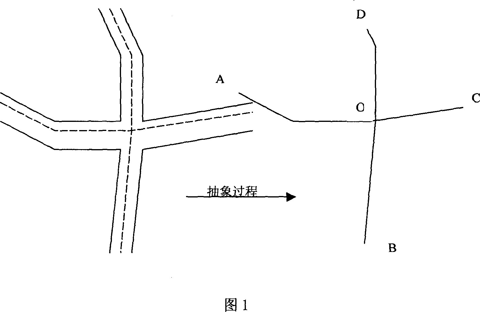
[0045] The abstract way of adopting the two-lane road model in the electronic map s...


PUM


Abstract

The invention relates to a device for providing road navigation road, especially a road traffic controller, wherein the electric map of its data memory contains the inlet top point from each cross road into said road and the road arc record relative to the inlet top point with steering limit character; the main controller controls the map edit modifier, based on the steering limit information at each port of cross road provided by the input module, to modify the road arc data of relative inlet top point of electric map; and the receiver/sender receives present position and target position information, to send the navigation path to the carrier terminal; the searcher extracts the electric map data and uses the steering limit character of each road arc to use the Di jkStra algorism to calculate out the shortest navigation path in top point serial type.

Description

Technical field [0001] The invention relates to a road traffic control device for transmitting navigation instructions to vehicles. technical background [0002] The currently reported navigation center device that provides road navigation paths for vehicles is equipped with a computer-based main controller, which is used to receive the current location and destination information of the vehicle provided by the vehicle terminal and send and receive the navigation path data to the vehicle terminal Finder, data storage with electronic map, searcher. The transceiver will receive the vehicle’s current location and destination information provided by the vehicle terminal and forward it to the main controller. Under the control of the main controller, the searcher extracts the electronic map data of the data memory and calculates the road node sequence form according to the vehicle’s current location and destination. After the navigation path data is submitted to the main controller; u...

Claims


Application Information

Patent Timeline
IPC IPC(8): G01C21/26G01C21/34
Inventor 时宜韦昌荣许宁陈典全陆云燕
Owner XIAMEN YAXON NETWORKS CO LTD
Why Eureka
Try Eureka