

Data mining to identify locations of potentially hazardous conditions for vehicle operation and use thereof
a technology of location and data mining, applied in the direction of navigation instruments, traffic control systems, instruments, etc., can solve the problems of difficult to obtain consistent information about traffic accidents on roads in a large geographic region, such as the entire united states or europe, and achieve the effect of increasing control authority and sensitivity
- Summary
- Abstract
- Description
- Claims
- Application Information
AI Technical Summary
Benefits of technology
Problems solved by technology
Method used
Image

Examples
Embodiment Construction
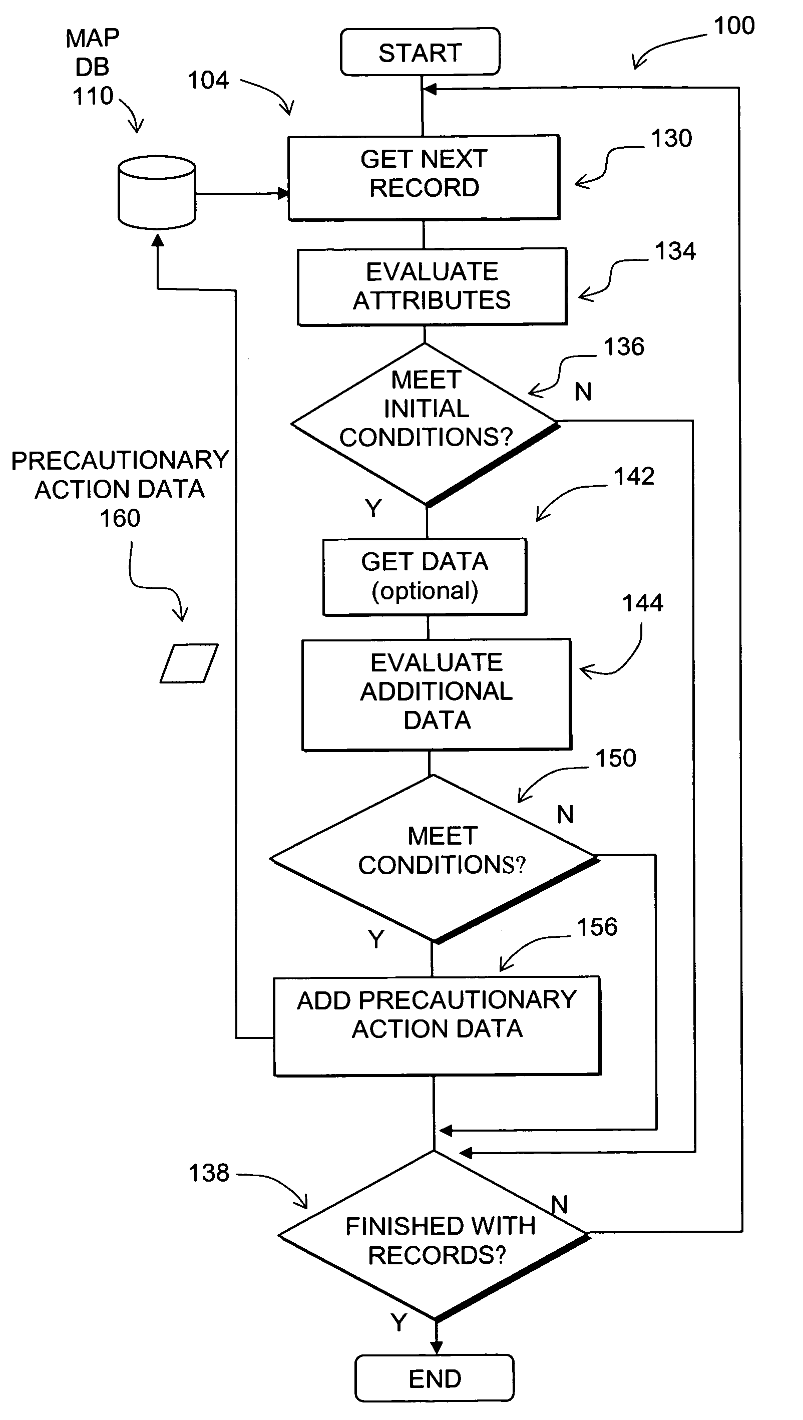
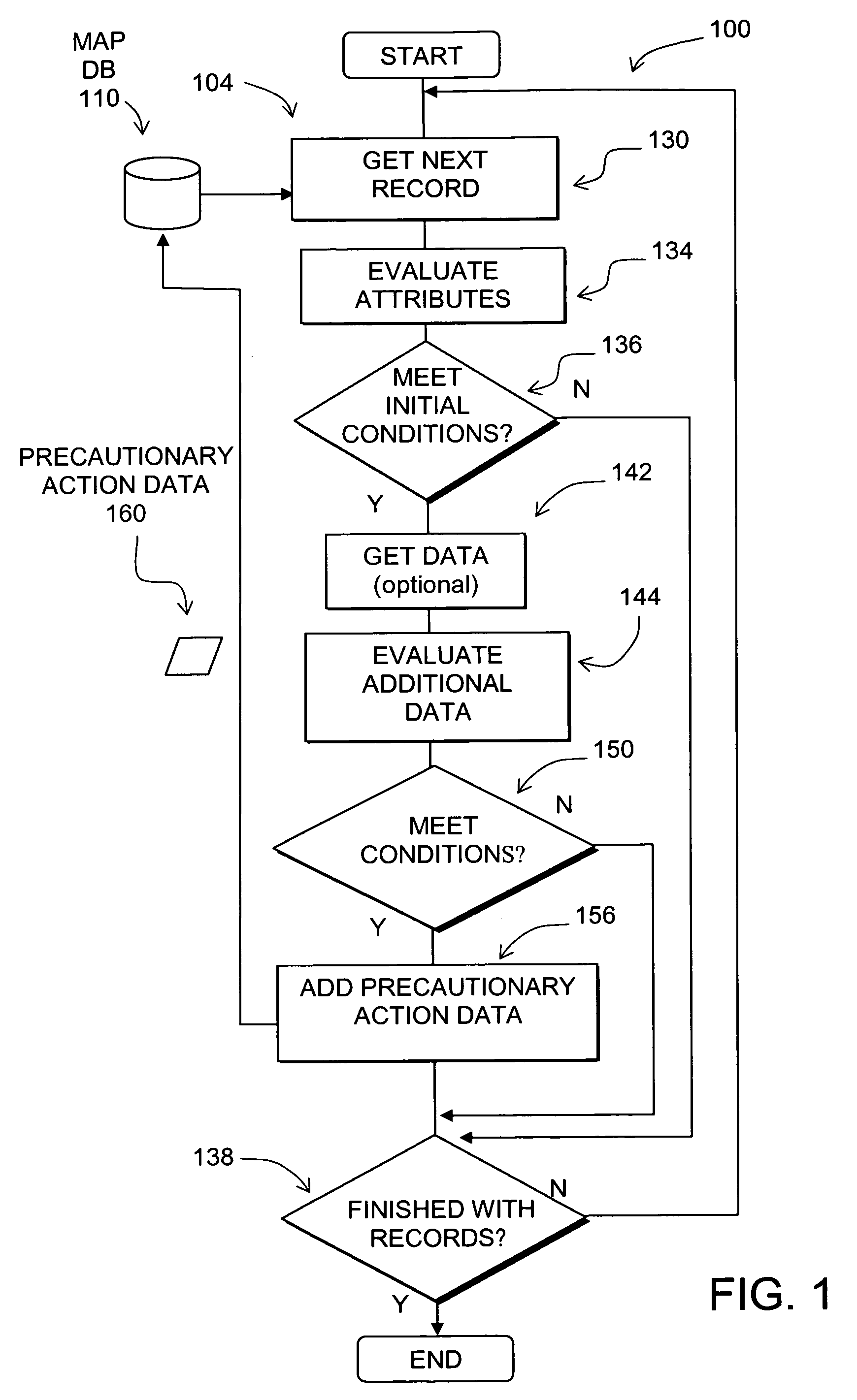
[0012]FIG. 1 is a flowchart of a process 100. The process 100 is performed by a software program or routine that is run on a suitable computing platform, such as a database server, PC or plurality of PCs coupled together for parallel computing applications.
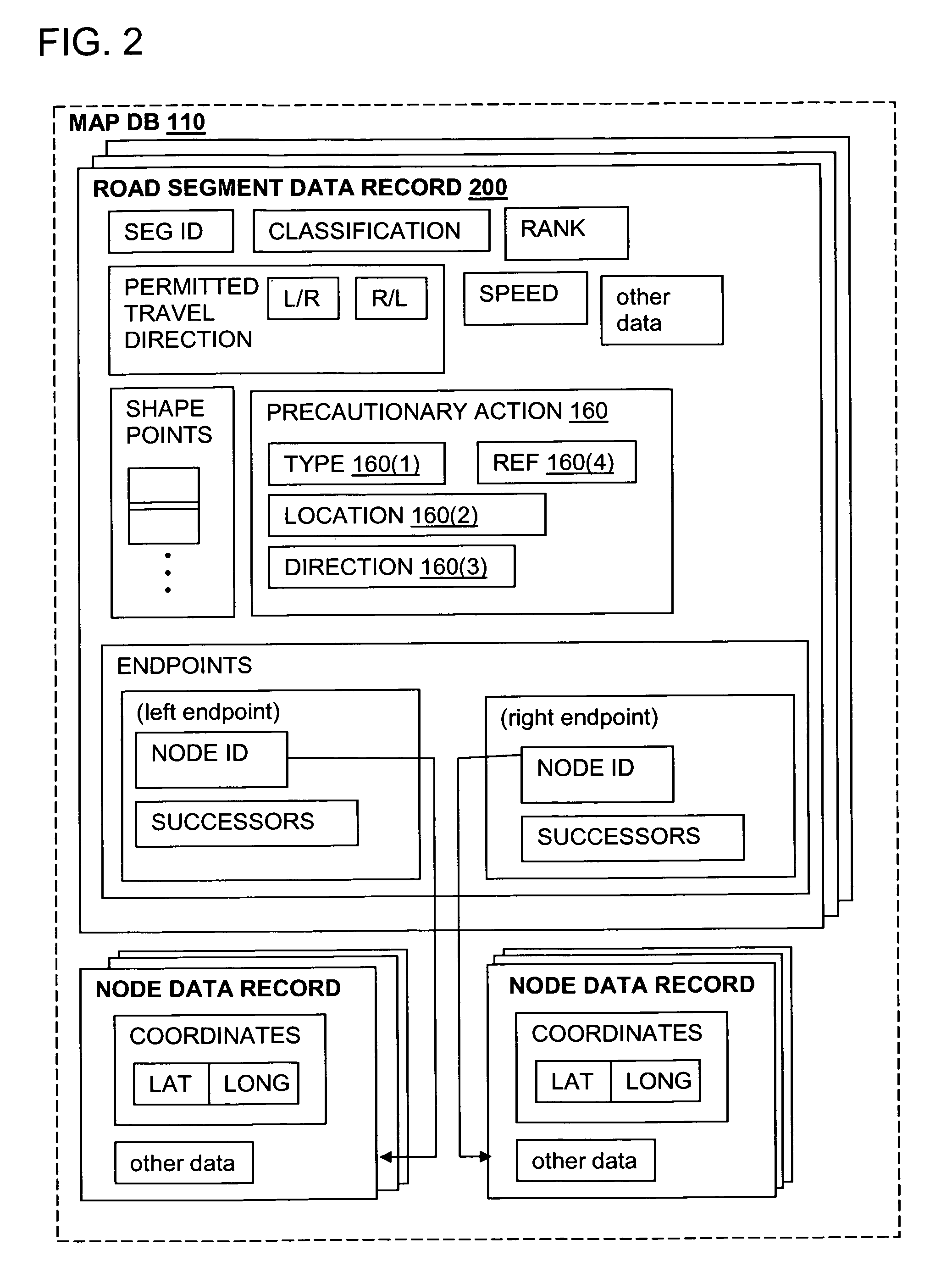
[0013]The process 100 uses a database 110 that contains data that represents the road network in a region. The region may be a country, such as the United States, Germany, France or Korea. Alternatively, the region may include several countries or an entire continent. According to another alternative, the region may include only a portion of a country, such as a state or several states or metropolitan areas.
[0014]The process 100 is performed by a map developer, such as NAVTEQ Corporation. Alternatively, the process 100 may be performed by another entity that has access to an editable version of a map database 110. For example, the process may be performed by a customer or licensee of NAVTEQ, such as a manufacturer of navigation sy...
PUM
 Abstract
Description
Claims
Application Information