
System and method for detecting features in aerial images using disparity mapping and segmentation techniques
a technology of disparity mapping and segmentation techniques, applied in image enhancement, instruments, image data processing, etc., can solve the problems of system inability to improve, system time-consuming and difficult to use, and a large amount of manual input by users, so as to achieve efficient over time
Patent Information
- Authority / Receiving Office
- US · United States
- Patent Type
- Patents(United States)
- Current Assignee / Owner
- Publication Date
- 2017-06-13
Smart Images
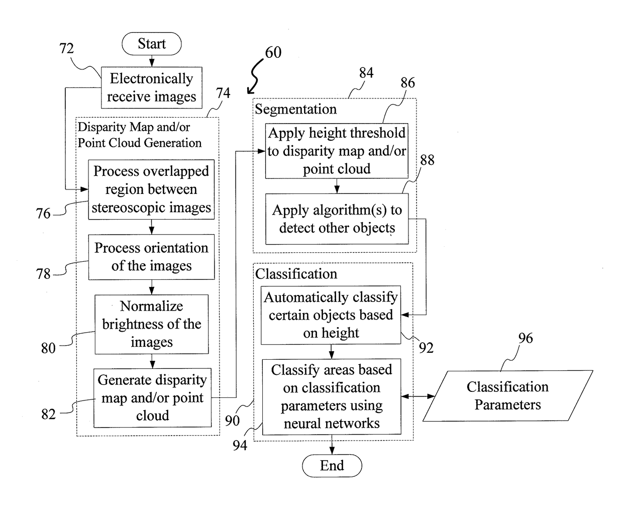
Figure 1 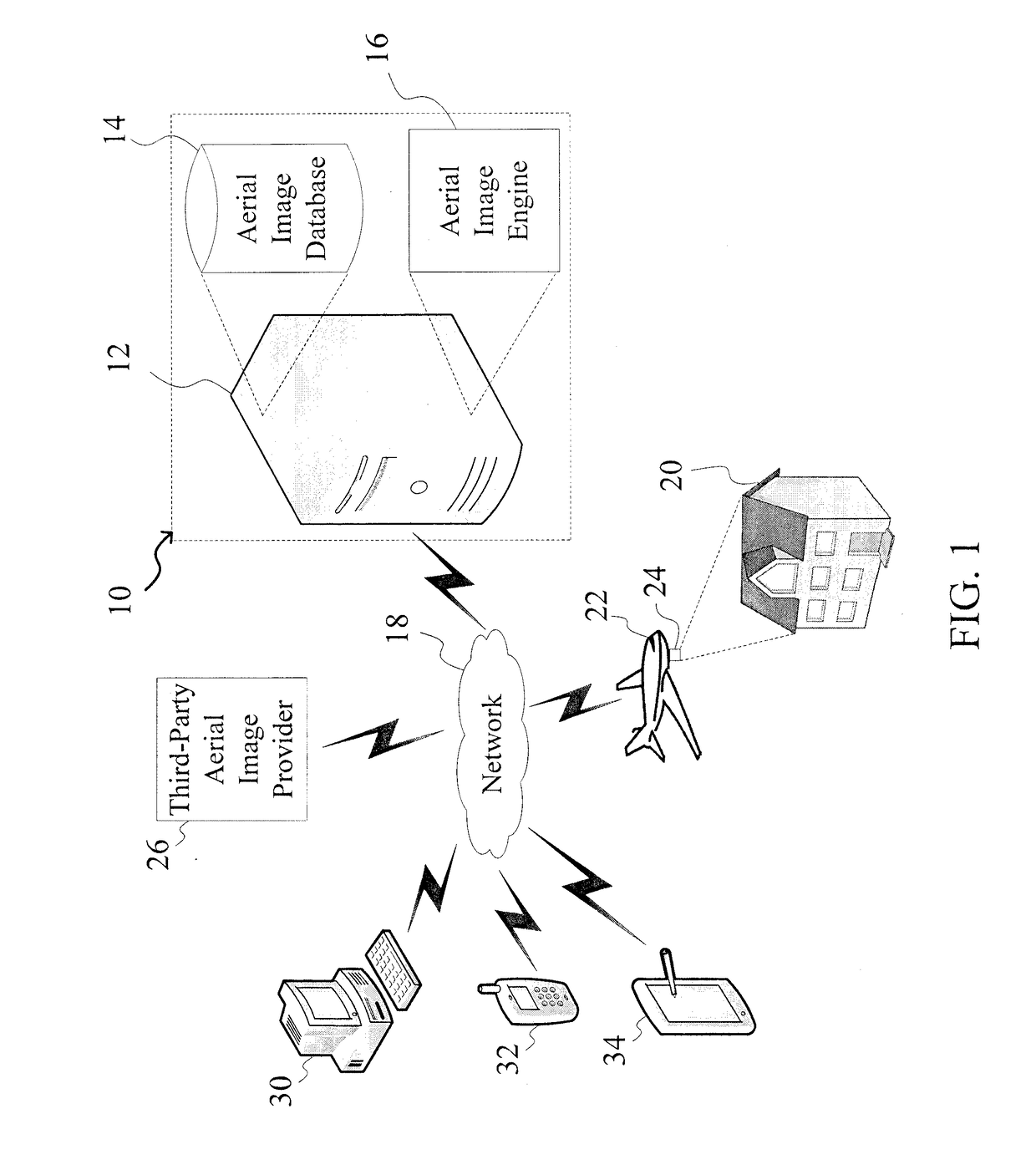
Figure 2 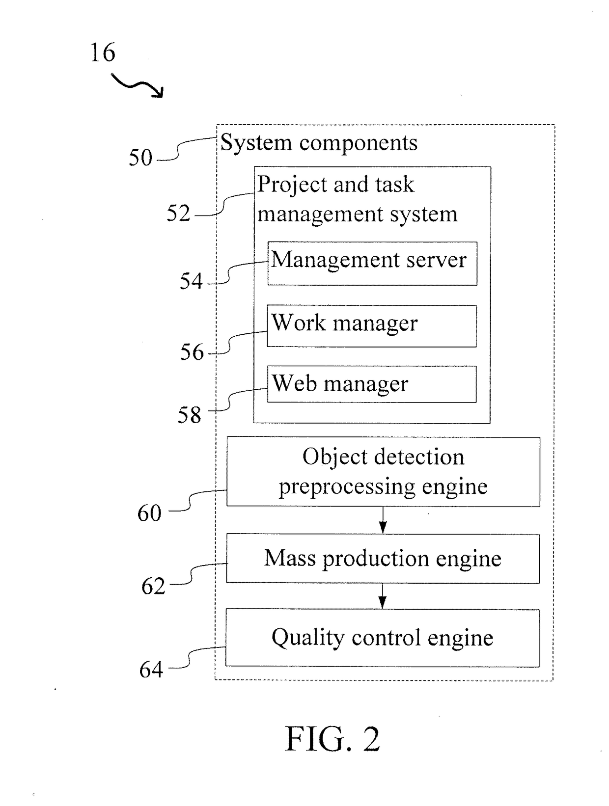
Figure 3
Abstract
Description
CROSS-REFERENCE TO RELATED APPLICATIONS
[0001] This application claims priority to U.S. Provisional Patent Application No. 61 / 861,610 filed on Aug. 2, 2013, the entire disclosure of which is expressly incorporated herein by referenceBACKGROUND
[0002] Field of the Disclosure
[0003] The present disclosure relates generally to the field of aerial image detection and classification. More specifically, the present disclosure relates to a system and method for detecting features in aerial images using disparity mapping and segmentation techniques.
[0004] Related Art
[0005] Accurate and rapid identification and estimation of objects in aerial images is increasingly important for a variety of applications. For example, roofing information is often used by construction professionals to specify materials and associated costs for both newly-constructed buildings, as well as for replacing and upgrading existing structures. Further, in the insurance industry, accurate information about construction materi...
Examples
Embodiment Construction
[0036]The present disclosure relates to a system and method for detecting features in aerial images using disparity mapping and segmentation techniques, as discussed in detail below in connection with FIGS. 1-28.
[0037]FIG. 1 is a diagram showing the system of the present disclosure for detecting features in aerial images, indicated generally at 10. The system 10 comprises a computer system 12 (e.g., a server) having an aerial image database 14 stored therein and a software aerial image engine (module) 16. The database 14 could be stored on the computer system 12, or located externally (e.g., in a separate database server in communication with the system 10). As will be discussed in greater detail below, the aerial image engine 16 allows users to detect features in aerial images and generate three-dimensional models therefrom.
[0038]The system 10 can communicate through a network 18 with one or more of a variety of image providers to obtain aerial images or photographs of a building s...