Three-dimensional fine imaging system and method based on drilling geological radar technology

An imaging system and geological radar technology, applied in radio wave measurement system, radio wave reflection/re-radiation, instruments, etc., can solve the problems that single-hole geological radar cannot determine the target body orientation, and there is no three-dimensional geological radar data

Active Publication Date: 2013-05-01
SHANDONG UNIV
View PDF4 Cites 25 Cited by
  • Summary
  • Abstract
  • Description
  • Claims
  • Application Information

AI Technical Summary

Problems solved by technology

The key problems to be solved in this invention are as follows: 1. the single-hole geological radar cannot determine the orientation of the target body, so the present invention needs to design a 360° three-dimensional observation method; The receiving antenna on the ground moves and scans according to certain rules, and it is necessary to develop an automatic delivery and transmission device for the ground radar antenna; A High-Precision 3D Imaging and Inversion Method

Method used


Image

  • Three-dimensional fine imaging system and method based on drilling geological radar technology
  • Three-dimensional fine imaging system and method based on drilling geological radar technology
  • Three-dimensional fine imaging system and method based on drilling geological radar technology

Examples


Embodiment Construction

[0076] The present invention will be further described below in conjunction with the accompanying drawings and embodiments.

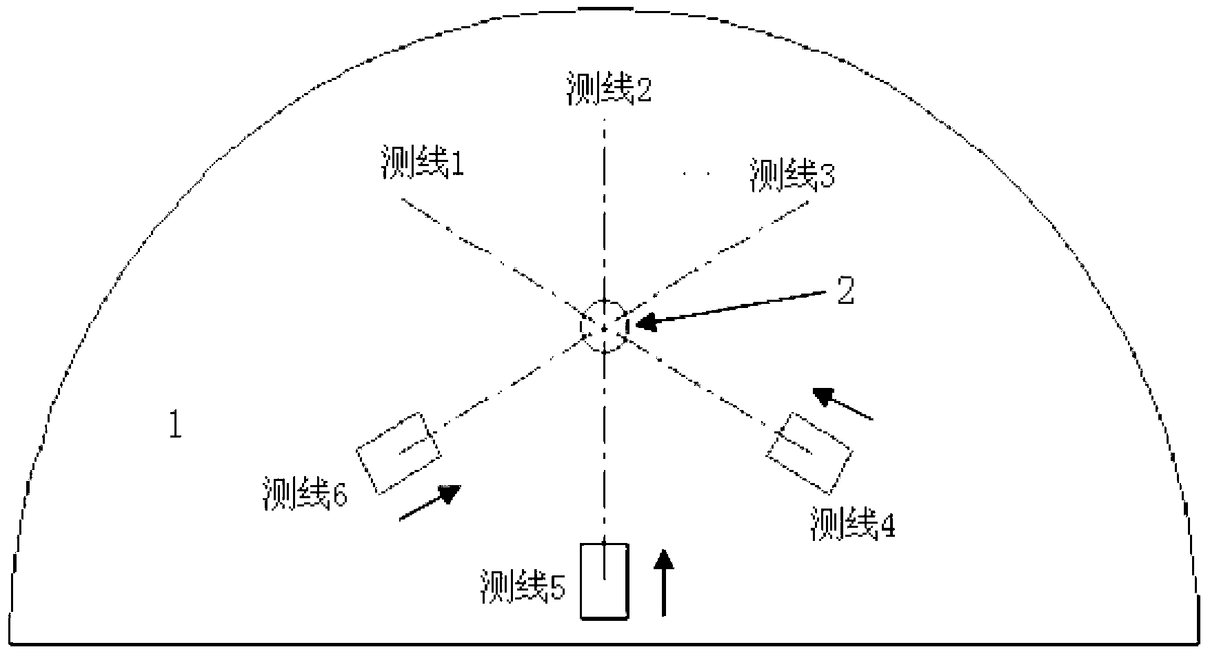
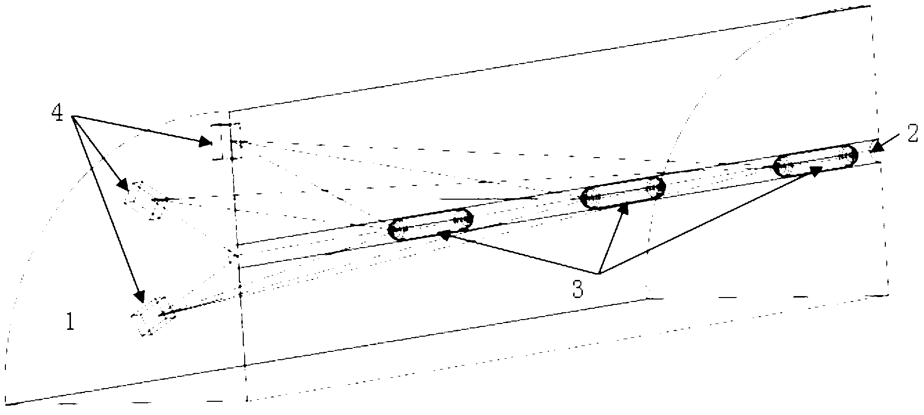
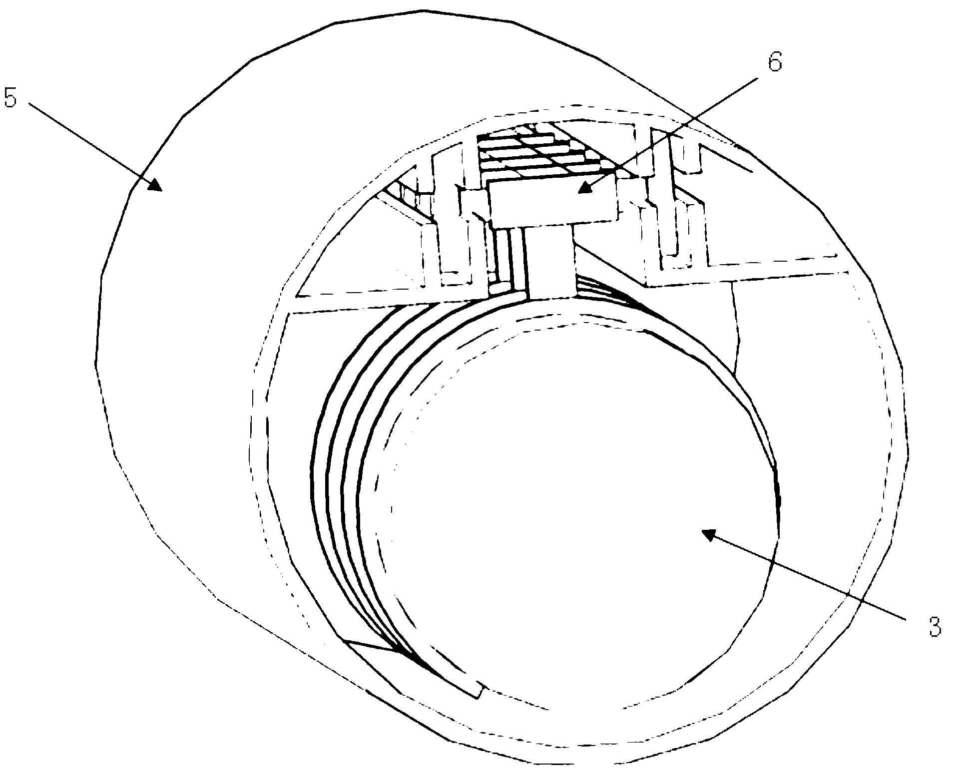
[0077] Such as figure 1 , figure 2 As shown, a three-dimensional refined imaging system based on borehole geological radar technology includes a radar transmitting antenna 3, a radar receiving antenna 4, a radar host 22, a radar antenna transmission device 21, a storage battery 19, a control host 18 and a computer 20; The radar transmitting antenna 3 is sent into the borehole 2 through the radar antenna delivery device 17, the radar transmitting antenna 3 and the radar receiving antenna 4 are connected to the radar host 22 through a cable, the radar host 22 is connected to the storage battery 19 through a power line, and the radar host 22 passes The communication cable is connected with the computer 20, the radar antenna transmission device 21 is connected with the control host 18 through the communication cable, the control host 18 is connected with ...


PUM


Abstract

The invention discloses a three-dimensional fine imaging system based on a drilling geological radar technology. The system comprises devices, such as a radar transmitting antenna, wherein the radar transmitting antenna is transmitted into a bore through a radar antenna transmitting device; a radar receiving antenna moves along a measuring line on a tunnel work area surface through a radar antenna driving device; the radar transmitting antenna and the radar receiving antenna are connected with a radar host machine; the radar host machine is respectively connected with a storage battery and a computer; the radar antenna transmitting device and the radar antenna driving device are connected with a control host machine; and the control host machine is connected with the storage battery through a power wire and controls the antenna to transmit and the driving device. The invention also provides a stereo three-dimensional observing method. Three-dimensional detection on surrounding media of the bore is realized by matching the method with a 'transmitting, receiving, circulating and detecting' way based on coverage observation for multiple times, and by a speed imaging method based on constrained reversion and a three-dimensional interpolation method, and the three-dimensional fine detection on the geological status in front of the tunnel work area surface is realized.

Description

technical field [0001] The invention relates to a three-dimensional refined imaging system and method, in particular to a three-dimensional refined imaging system and method based on borehole geological radar technology in tunnel construction. Background technique [0002] After entering the 21st century, a large number of major infrastructure projects such as railway and highway traffic projects, water conservancy and hydropower projects have been put on the construction agenda, which has greatly promoted the construction of tunnel projects. By the end of 2010, about 450 kilometers of tunnels have been built every year in my country's transportation, hydropower and other fields, and more than 10,000 kilometers of railway and road tunnels have been built. It is estimated that only my country's railway tunnel construction will reach "two ten thousand" (10000km / 10000 seats) in 2020. my country is already the country with the largest scale and difficulty in tunnel construction...

Claims


Application Information

Patent Timeline
Patent Type & Authority Applications(China)
IPC IPC(8): G01S13/89
Inventor 李术才刘斌徐磊孔凡年聂利超宋杰刘征宇孙怀凤王传武许新骥郝亭宇周浩张庆松李树忱
Owner SHANDONG UNIV
Why Eureka
Try Eureka