An evaluation method of earthquake disaster damage degree based on UAV aerial photography

A damage and disaster technology, applied in computer parts, instruments, character and pattern recognition, etc., can solve the problems of long editing and analysis cycle of remote sensing data, high cost, inconvenient to carry and use by rescue teams, etc., and achieve high evaluation reliability. effect with accuracy, low cost, and accurate description

Active Publication Date: 2017-11-28
BEIJING INST OF AEROSPACE CONTROL DEVICES
View PDF3 Cites 0 Cited by
  • Summary
  • Abstract
  • Description
  • Claims
  • Application Information

AI Technical Summary

Problems solved by technology

However, through the analysis of the above-mentioned patents, it is not difficult to see that the problem of using remote sensing data for disaster level assessment is that the acquisition, editing and analysis of remote sensing data takes a long time and the cost is high, and the release and acquisition of data can only be done through specific channels and authorities Provided by the department; and the acquisition of high-altitude aerial images requires the use of medium or large aircraft to perform flight missions, which is not convenient for rescue teams to carry and use

Method used


Image

  • An evaluation method of earthquake disaster damage degree based on UAV aerial photography
  • An evaluation method of earthquake disaster damage degree based on UAV aerial photography
  • An evaluation method of earthquake disaster damage degree based on UAV aerial photography

Examples


Embodiment Construction

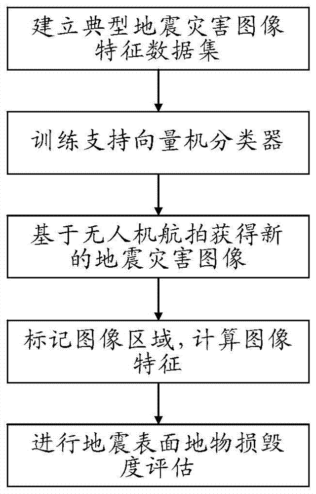
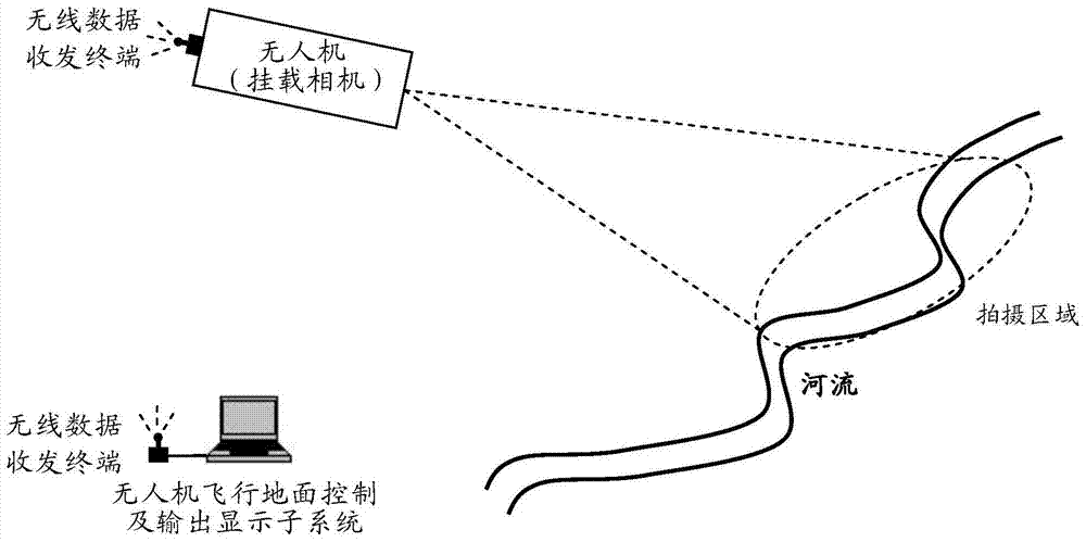
[0028] Such as figure 1 As shown, the evaluation system based on the method of the present invention includes a multi-rotor unmanned aerial vehicle subsystem, an unmanned aerial vehicle flight ground control and an output display subsystem, wherein:

[0029]The multi-rotor UAV subsystem consists of a multi-rotor UAV, a two-degree-of-freedom rotating motion camera, a GPS positioning module, and an air wireless data transceiver terminal; a two-degree-of-freedom rotating motion camera, a GPS positioning module and an airborne Wireless data transceiver terminal; multi-rotor drones are 4-rotor, 6-rotor or 8-rotor UAV aircraft, multi-rotor drones are powered by batteries, the continuous flight time is not less than 30 minutes, and the flying height is not lower than 15 meters; The two-degree-of-freedom rotating motion camera can realize the rotation of the angle range of pitch -5°~185° and yaw 0°~300°; the GPS positioning module is used to obtain the current spatial coordinate infor...


PUM


Abstract

A method for evaluating the damage degree of earthquake disasters based on aerial photography of UAVs. UAVs are used to hover over the earthquake-stricken areas and collect images. According to the manual interactive method, the area of ​​interest in the disaster area image is circled, and the gray-scale co-occurrence matrix texture feature, Tamura texture feature, Gabor wavelet texture feature, line and circle feature of the selected area are selectively calculated, and finally the support The vector machine classifier is used to evaluate the damage degree of earthquake disasters. This method is more suitable for early information collection and evaluation in the earthquake and secondary disaster areas caused by earthquakes.

Description

technical field [0001] The invention relates to a method for evaluating damage degree of earthquake disasters based on unmanned aerial vehicle photography. Background technique [0002] my country has a vast land area, undulating mountains, vertical and horizontal rivers, and relatively complex geological conditions. Due to climatic influences and differences in geological conditions, many areas are vulnerable to earthquakes and their secondary disasters all year round. For example, my country's Qinghai, Yunnan, western Sichuan, and southern Gansu are located in places where the Alps-Himalayan seismic belt passes. In recent years, earthquakes of magnitude 4.5 or above have occurred many times, causing large casualties and economic losses. Usually, when an earthquake disaster occurs, the most commonly used method is to use seismographs to collect the magnitude and crack index of different seismic sampling points to evaluate the disaster level. The advantage of this method is...

Claims


Application Information

Patent Timeline
Patent Type & Authority Patents(China)
IPC IPC(8): G06K9/46G06K9/62G06V20/13
CPCG06V20/13G06V10/54
Inventor 刘皓挺王巍王学锋于文鹏王军龙蓝天马建立何哲玺宋伟
Owner BEIJING INST OF AEROSPACE CONTROL DEVICES
Why Eureka
Try Eureka