Mountain line extraction method based on Gaussian scale space

A technology of Gaussian scale and extraction method, applied in image data processing, instrumentation, calculation and other directions, which can solve problems such as poor continuity, large deviation of mountain line, and inability to support practical applications.

Active Publication Date: 2015-09-09
西安道达天际信息技术有限公司
View PDF2 Cites 17 Cited by
  • Summary
  • Abstract
  • Description
  • Claims
  • Application Information

AI Technical Summary

Problems solved by technology

[0004] To sum up, there are quite a lot of research results on the automatic extraction of micro-topographic feature lines, but there are few methods for extracting macro-topographic feature mountain lines. The only few methods extract mountain lines with large deviations and poor continuity. Support for practical applications

Method used


Image

  • Mountain line extraction method based on Gaussian scale space
  • Mountain line extraction method based on Gaussian scale space
  • Mountain line extraction method based on Gaussian scale space

Examples


Embodiment Construction

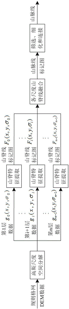
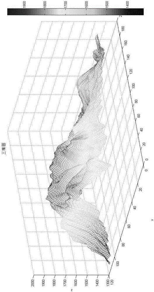
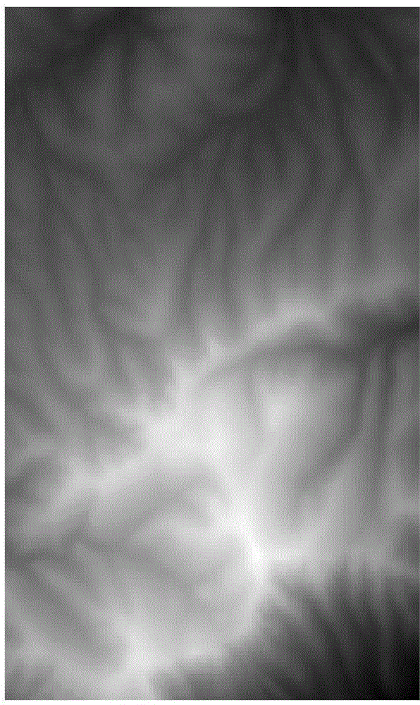
[0060] refer to figure 1 , taking 1:250,000 DEM data of a certain mountain area (the data grid accuracy is 50 meters, the elevation range is 1322-1980 meters, and the terrain relief is 498 meters, which belongs to the category of small undulations in the mountainous terrain. Its 3D perspective and gray Degree shaded images are as follows Figure 2(a) , 2(b) Shown) as an example, the specific embodiment of the present invention is as follows:

[0061] Step 1, use Gaussian kernel function to perform multi-scale decomposition and expression on regular grid DEM data

[0062] Step S10, select the number of decomposition layers n=5, the scale parameter proportional coefficient between two adjacent layers of DEM data Select the scale parameters expressed in the first layer according to the relief of the area According to σ i =k i σ 0 Get the scale parameter σ of each layer of Gaussian decomposition 0 ~σ 4 for ( 2 ,...


PUM


Abstract

The invention discloses a mountain line extraction method based on Gaussian scale space. The mountain line extraction method comprises the following steps: 1) carrying out multi-scale decomposition and expression on regular grid digital elevation model (DEM) data by a Gaussian kernel function; 2) extracting ridge lines from the decomposed each-scale data; 3) fusing the ridge lines of all scales, and marking primary-selection mountain feature points; 4) setting an elevation threshold value to further screen the mountain feature points; and 5) refining connection processing to obtain the mountain line. Firstly, filter groups of different parameters are used for carrying out multi-scale decomposition on the regular grid DEM data, the ridge lines under all scales are extracted from the DEM data, then, the ridge lines are fused to obtain the mountain line, so that the redundancy of ridge features can be effectively removed, and the main vein of a massif can be retained.

Description

technical field [0001] The invention belongs to the macro terrain feature extraction technology in the field of digital terrain analysis, and specifically relates to a method of decomposing DEM data with Gaussian scale space theory, extracting ridgelines at each scale, and then constructing the weights of ridgelines at each scale with Gaussian scale parameters. Fusion method for generating macroscopic mountain lines. Background technique [0002] Digital Terrain Analysis is a digital information processing technology for terrain attribute calculation and feature extraction on DEM data. As a major geomorphic framework, mountains are composed of several mountains with obvious trends, and often become the boundaries of biogeographical distribution and physical geographical regions. The mountain line is the main vein of mountainous terrain, distributed in high-altitude areas, coherent and prominent, and long in length, controlling the overall characteristics and situation of th...

Claims


Application Information

Patent Timeline
Patent Type & Authority Applications(China)
IPC IPC(8): G06T7/00
CPCG06T7/155G06T2207/30181
Inventor 孔月萍雷红涛刘大维翟亚婷万晨谢心谦张璋路婷婷聂文
Owner 西安道达天际信息技术有限公司
Why Eureka
Try Eureka