

County-level crop planting area remote sensing statistic sampling survey scheme design method
A scheme design and crop technology, applied in the field of surveying and mapping remote sensing, can solve the problems of large scale, inaccurate statistical data, overall inversion accuracy, sampling stability and sampling efficiency evaluation, etc., to achieve more rational evaluation, reduce workload, design system effect
- Summary
- Abstract
- Description
- Claims
- Application Information
AI Technical Summary
Problems solved by technology
Method used
Image

Examples
Embodiment Construction
[0045] In order to make the object, technical solution and advantages of the present invention clearer, the present invention will be further described in detail below in conjunction with the accompanying drawings and embodiments. It should be understood that the specific embodiments described here are only used to explain the present invention, not to limit the present invention.
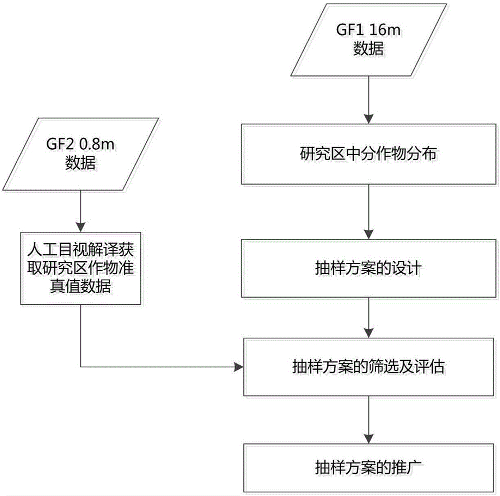
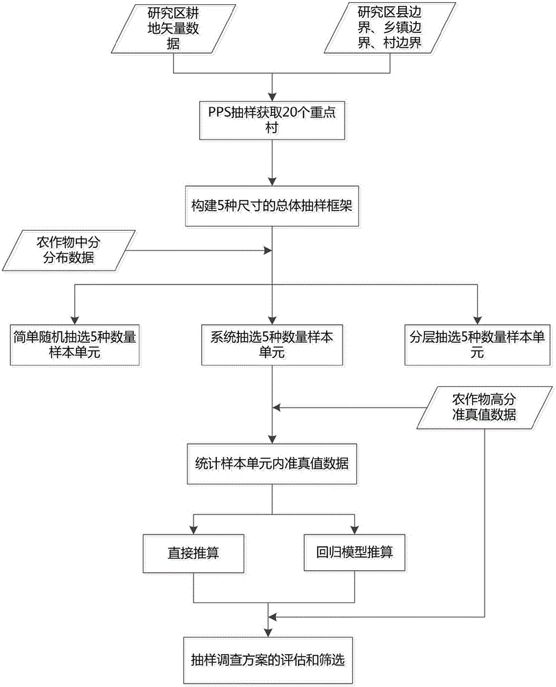
[0046] The invention relates to a method for designing a county-level crop planting area remote sensing statistical sampling survey plan, such as figure 1 As shown, the county-level crop planting area remote sensing statistical sampling survey program design method includes the following steps:
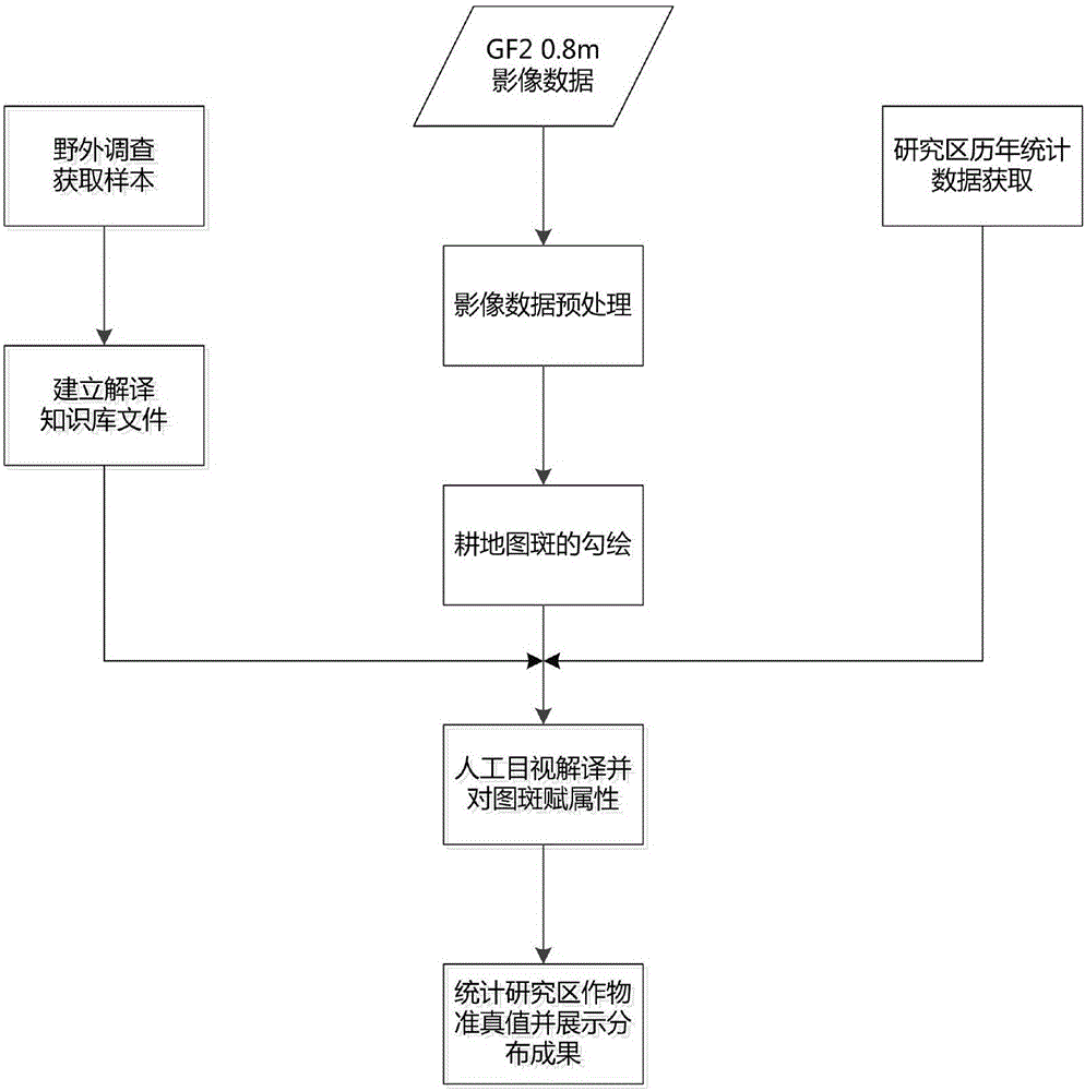
[0047] S1. Based on the 0.8-meter-resolution mid-range remote sensing image data obtained from the Resource Satellite Remote Sensing Application Center of the Gaofen-2 satellite as quasi-truth data, and manually interpret the target crops and assign values to the map spot attributes to obtain the targe...
PUM
 Abstract
Description
Claims
Application Information