Forest fire danger early warning method based on GIS and meteorological monitoring network

A technology of meteorological monitoring and fire risk, applied in the field of surveying and mapping science and technology, can solve the problems of extracting forest fire early warning related data, ignore the periodicity of remote sensing data, etc., and achieve the effect of good practical value

A technology of meteorological monitoring and fire risk, applied in the field of surveying and mapping science and technology, can solve the problems of extracting forest fire early warning related data, ignore the periodicity of remote sensing data, etc., and achieve the effect of good practical value

CN111126701APending Publication Date: 2020-05-08LANZHOU JIAOTONG UNIV

Image

  • Forest fire danger early warning method based on GIS and meteorological monitoring network
  • Forest fire danger early warning method based on GIS and meteorological monitoring network
  • Forest fire danger early warning method based on GIS and meteorological monitoring network

Examples


Embodiment Construction

[0024] In order to describe the technical content, structural features, objectives and effects of the present invention in detail, the following will be described in detail in conjunction with specific embodiments.

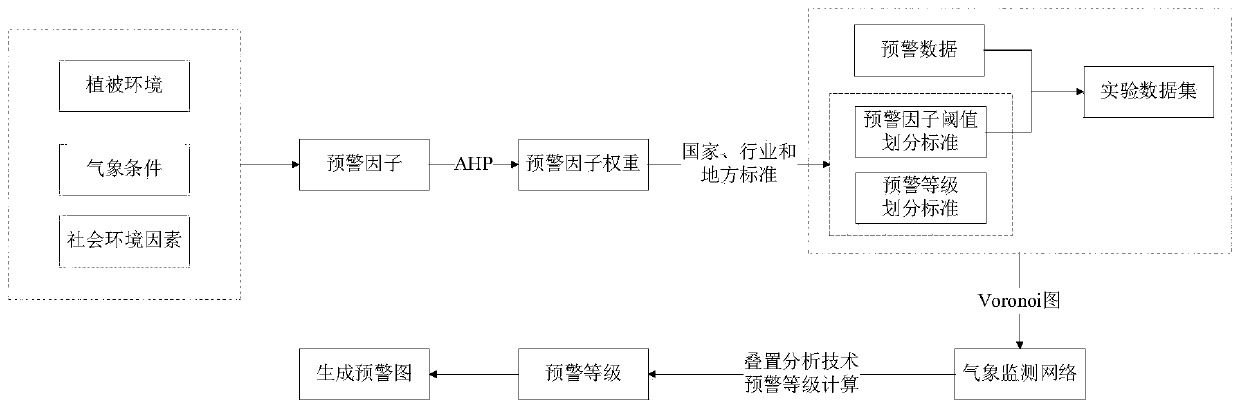
[0025] Step 1: Determine the early warning factors. Analyze the factors that lead to forest fires, and on the premise of ensuring the precision, accuracy and comprehensiveness of the early warning, specifically determine the early warning factors required for model construction from three aspects: vegetation environment, meteorological conditions and social environmental factors;

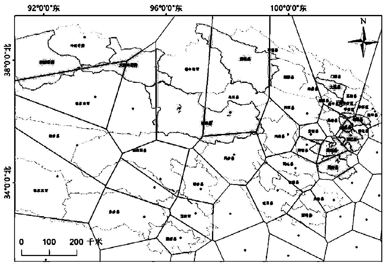
[0026] Step 2: Determine the weight of early warning factors. Using the AHP method, combined with the analysis of the early warning factors, the importance hierarchy model of the early warning indicators was established to determine the importance of the early warning factors selected in Step 1 in the real-time early warning process of forest fire danger, and to calculate the weight of ...


PUM


Abstract

The invention discloses a forest fire danger real-time early warning method based on a GIS and a meteorological monitoring network. The forest fire danger real-time early warning method mainly comprises two parts, namely forest fire danger real-time early warning model construction and fire danger early warning. The method includes the following steps that: (1) determining early warning factors required by a forest fire danger real-time early warning model in the method; (2) calculating the weight of the early warning factors by using an AHP method; (3) determining the division standards of early warning factor thresholds and early warning grades; (4) completing the construction of the real-time early warning model by using a GIS related technology; and (5) based on the model, collecting experimental data, and carrying out forest fire danger early warning. Experimental results show that (1) according to the early warning model, set real-time early warning indexes and set real-time meteorological monitoring data, early warning signals can be obtained one hour in advance, and early warning and timely response of county-level and forest farm-level forest fire dangers are rapidly achieved; and (2) by introducing a GIS visualization mode, spatial distribution information related to forest fire dangers in a research area can be quickly generated, and the change condition of an earlywarning level can be visually observed.

Description

technical field [0001] The invention belongs to the field of surveying and mapping science and technology, and relates to a method for real-time forest fire warning by using GIS related technology and a real-time meteorological monitoring network. Background technique [0002] In recent years, due to the abnormal changes in the global climate and the influence of human activities, forest fires have occurred frequently. The strong suddenness, great destructiveness and serious harm of forest fires will burn trees, endanger wild animals and plants, pollute the air, seriously threaten national economic development, global ecological balance and personal life and property safety, and lead to forest fire prevention. The trend is getting worse. Therefore, effective research on forest fire prevention has become an urgent need. In the work of forest fire prevention, real-time warning of forest fire danger is a key link. It is of great significance to forest fire prevention work, pr...

Claims


Application Information

Patent Timeline
08 May 2020
Publication
CN111126701A
IPC
G06Q10/04; G06Q50/26; G08B17/00; G06F16/29
CPC
G06Q10/04; G06Q50/26; G08B17/005; G06F16/29; Y02A90/10
Inventors
张黎明; 李玉