Method for digital restoration of urban spatial pattern

A spatial pattern and urban technology, applied in image data processing, image data processing, editing/combining graphics or text, etc., can solve the problems of lack of intuition and accuracy, and achieve the effect of improving efficiency and quality

Inactive Publication Date: 2010-11-10
南京市规划局 +1
View PDF3 Cites 17 Cited by
  • Summary
  • Abstract
  • Description
  • Claims
  • Application Information

AI Technical Summary

Problems solved by technology

[0005] In order to overcome the lack of intuition and accuracy in traditional urban spatial pattern restoration methods, and to address the problems existing in existing urban spatial pattern restoration methods, the present invention provides a digital restoration method for urban spatial pattern, which innovates the digital restoration of urban historical spatial pattern The research method syst

Method used


Image

  • Method for digital restoration of urban spatial pattern
  • Method for digital restoration of urban spatial pattern
  • Method for digital restoration of urban spatial pattern

Examples


Embodiment Construction

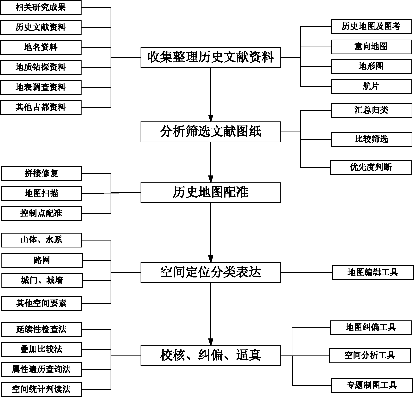
[0039] Below in conjunction with example the method of the present invention is described further.

[0040] The present invention is described by taking the restoration of the spatial pattern of the old city of Nanjing in the Republic of China as an example.

[0041] Step 1: Registration of historical old maps

[0042] According to the rules for analyzing and screening literature drawings in the technical scheme, the final selected picture materials are shown in Table 1.

[0043] Table 1 Image data analysis and screening

[0044]

[0045]

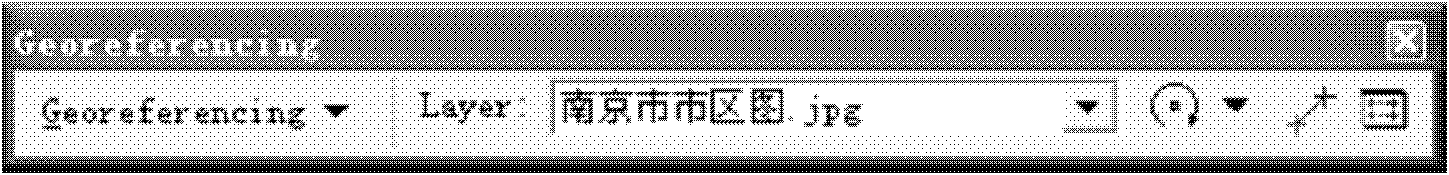
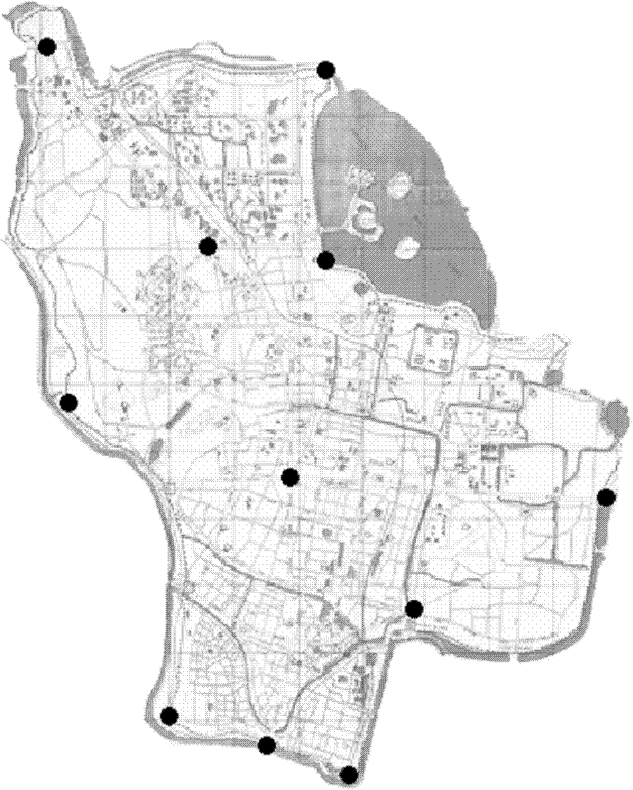
[0046] The images used for screening will be scanned, spliced ​​and processed, and the coordinates of each base map will be registered to the Nanjing 92 coordinate system. The current situation map uses IKNOS remote sensing images in 2005, and the scale is 1:10000. Registration tools such as figure 2 shown. Taking the map registration of "1946 Nanjing Urban Area Map (English Version)" as an example, the registration coordinates ...


PUM


Abstract

The invention discloses a method for digital restoration of an urban spatial pattern, which belongs to the field of the restoration of urban spaces. The method comprises the following steps: registration and scanning of a historically old map: registering and correcting through making full use of ArcGIS software and remote sensing data of a city to be restored, and registering the historically old map into the present remote sensing data; restoration of a historical urban space; correction of errors in restoration results of the historical urban space: correcting the errors in the restoration results with the spatial analysis method of the ArcGIS and the mathematical statistics, thereby realizing the digital restoration of the urban spatial pattern. With the adoption of the 3S technology, the invention changes the conventional method for spatial pattern restoration simply depending on paper drawings and verification of historical documents, effectively improves the drawing efficiency and quality of the historical urban map, forms 'a map' of urban spatial patterns in different historic periods based on the unified spatial scale, the unified spatial reference and the unified spatial classification, and guarantees the restoration, management, presentation and application of the urban spatial patterns.

Description

technical field [0001] This method involves the digital restoration method of urban spatial pattern, specifically refers to the method of restoring, correcting and visualizing urban spatial pattern by using geographic information system (GIS), remote sensing (RS), global positioning system (GPS) and other technologies. Background technique [0002] At present, the digital restoration of urban space using 3S technology is mostly aimed at a local area or key areas of a city or region. In 2003, Beijing Crystal Stone Company used digital technology to restore the old city gates of Beijing. In 2004, it restored Yuan Dadu and recorded the documentary "Forbidden City". In 2006, China Central Television and other media jointly recorded the large-scale epic film "Old Summer Palace", which digitally restored the whole picture of "Old Summer Palace"; Japan's Nara National Institute of Cultural Heritage conducted a comprehensive three-dimensional photography basis for the stone carvings...

Claims


Application Information

Patent Timeline
IPC IPC(8): G06T11/60G06T1/00
Inventor 周岚叶斌王芙蓉毛燕翎赵伟贺云翱刘正平孙玉婷迟有忠尹向军郑晓华何流徐明尧崔蓓诸敏秋
Owner 南京市规划局
Why Eureka
Try Eureka