Method for judging flight route deviation

A route and algorithm technology, applied in the direction of integrated navigator, etc., can solve problems such as difficult popularization, false alarm, large calculation error, etc., and achieve the effect of accurate algorithm, fast judgment speed, stable and reliable performance

Active Publication Date: 2012-06-20
NO 54 INST OF CHINA ELECTRONICS SCI & TECH GRP
View PDF5 Cites 12 Cited by
  • Summary
  • Abstract
  • Description
  • Claims
  • Application Information

AI Technical Summary

Problems solved by technology

The first method involves a large calculation error when the route crosses the Gaussian zone, and it is easy to cause false alarms, and the altitude deviation needs to be calculated separately. The second method is suitable for special situations when performing emergency tasks, and it is difficult to popularize and apply

Method used


Image

  • Method for judging flight route deviation
  • Method for judging flight route deviation
  • Method for judging flight route deviation

Examples


Embodiment Construction

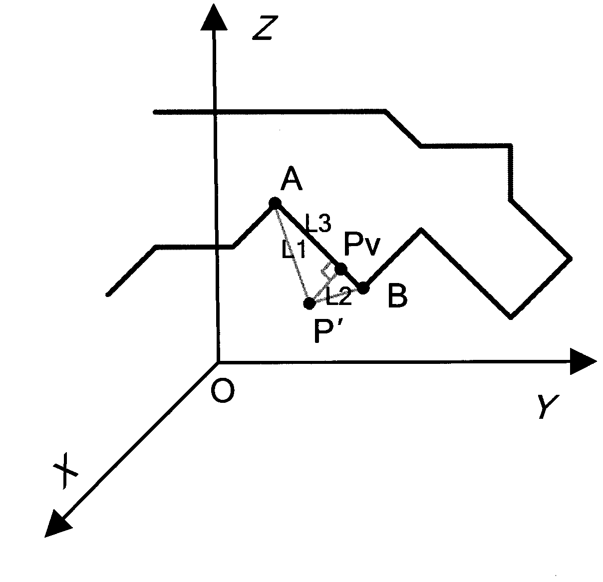
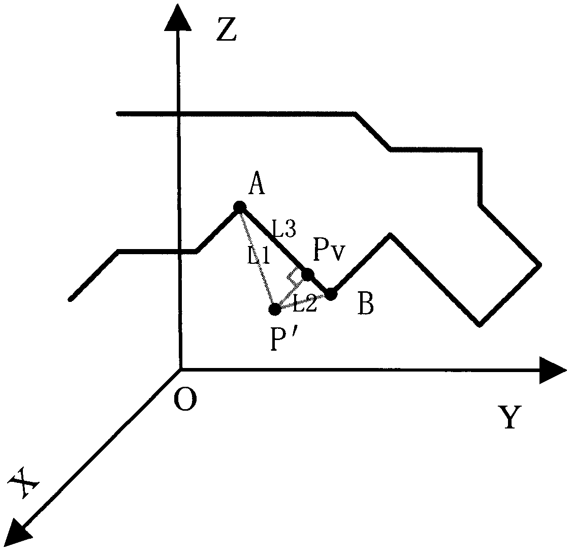
[0029] Below, combine figure 1 with figure 2 The present invention will be further explained.

[0030] A method to determine the flight path deviation. The principle of the method is to convert the geodetic coordinates of the current position of the aircraft and the geodetic coordinates of the path position into rectangular coordinates in space, and use a three-dimensional geometric algorithm to calculate the shortest distance between the current position and the route section by section Coordinates, and inversely convert the coordinates at the shortest distance to geodetic coordinates, and then calculate the horizontal distance and height difference between two geodetic coordinate points to determine whether it is within the allowable deviation range of the route.

[0031] The present invention includes the steps:

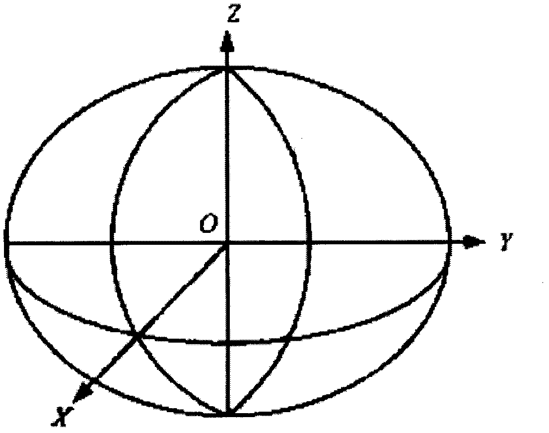
[0032] (1) Convert the current position point P of the aircraft in the geodetic coordinate system to the position point P'in the space rectangular coordinate system. ...


PUM


Abstract

The invention discloses a method for judging flight route deviation and relates to an application technique for judging air route deviation in the route planning field. The method is characterized in that, according a transformation relation between terrestrial coordinates and space rectangular coordinates, the terrestrial coordinates of the current position point of an aircraft and the terrestrial coordinates of the route position point of the aircraft are transformed into the space rectangular coordinates, the coordinates of a position of a route which is closest to the current position point are calculated section by section by adopting a three-dimensional solid geometrical algorithm, the coordinates of the position which is closest to the current position point are inversely transformed into the terrestrial coordinates, and then whether the deviation is within an allowable route deviation range or not is judged by calculating the horizontal distance and the altitude difference between two terrestrial coordinate points. The method for judging the flight route deviation has the characteristics of precise algorithm, rapid judging speed, small error, stable and reliable performance and the like, and is particularly suitable for application fields of air route deviation alarm, flight navigation and monitoring, airspace management and the like.

Description

Technical field [0001] The invention relates to a method for determining flight route deviation in the field of route planning, and is particularly suitable for application fields such as air route deviation alarm, flight navigation and monitoring, and airspace management. Background technique [0002] With the development of technology, the number of air vehicles has increased rapidly, and airspace management and flight monitoring have become more and more important, requiring all aircraft to fly along planned routes. Therefore, route deviation warning is an important consideration. The location point and route coordinates are generally geodetic coordinates, and the units between the coordinates (longitude and latitude are in degrees, and height is in meters) are not uniform, and cannot be directly used for calculation. At present, the method for determining the flight path deviation in the air mostly adopts a method similar to the ground yaw determination. The air path is proj...

Claims


Application Information

Patent Timeline
Patent Type & Authority Applications(China)
IPC IPC(8): G01C21/24
Inventor 刘让国彭会湘李峰韦二龙
Owner NO 54 INST OF CHINA ELECTRONICS SCI & TECH GRP
Why Eureka
Try Eureka