
Rendering method for computer three-dimensional terrain grid based on boundary maintenance
A three-dimensional terrain and computer technology, applied in computing, image data processing, 3D modeling, etc., can solve problems such as affecting visual effects and inability to accurately repair, reduce the amount of data, quickly draw large-scale terrain scenes, and facilitate batch operations. Effect
- Summary
- Abstract
- Description
- Claims
- Application Information
AI Technical Summary
Problems solved by technology
Method used
Image

Examples
Embodiment Construction
[0024] In order to make the object, technical solution and advantages of the present invention clearer, the present invention will be described in further detail below in conjunction with specific embodiments and with reference to the accompanying drawings.
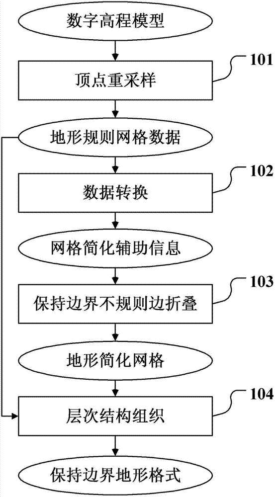
[0025] Such as figure 1 as shown, figure 1 It is a flowchart of a computer three-dimensional terrain grid drawing method according to an embodiment of the present invention, and the main steps include:
[0026] Step 101, resampling the digital elevation model to generate terrain regular grid data;
[0027] Step 102, converting terrain regular grid data into grid simplification auxiliary information;
[0028] Step 103, using the grid simplification auxiliary information to perform irregular edge folding and simplification on the terrain regular grid data while maintaining boundaries;
[0029] Step 104: Organize the simplification result of irregular edge folding and terrain regular grid data into a terrain format with b...
PUM
 Abstract
Description
Claims
Application Information