
City spatial quality evaluation method based on big data
A quality evaluation and big data technology, applied in the fields of electrical digital data processing, special data processing applications, instruments, etc., can solve problems such as the inability to distinguish the quality characteristics of urban space and the inability to truly achieve objective neutrality.
- Summary
- Abstract
- Description
- Claims
- Application Information
AI Technical Summary
Problems solved by technology
Method used
Image


Examples
Embodiment
[0071] This embodiment takes Shenzhen City as an example to provide a method for evaluating urban space quality based on big data. The following describes a method for evaluating urban space quality based on big data according to an embodiment of the present invention with reference to the accompanying drawings.
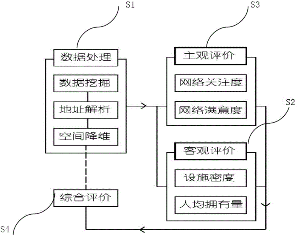
[0072] figure 1 It is a method for evaluating urban space quality based on big data in an embodiment of the present invention, and the specific implementation process is described as follows:
[0073] S1 data processing: After data mining is completed, the address analysis of the data is carried out through the Baidu open platform, and on this basis, it is transformed into GIS platform data, and the spatial dimensionality reduction is processed through the lkmxlkm raster, and transformed into spatial data that can be analyzed by conventional software;
[0074] S2 objective evaluation;
[0075] S3 subjective evaluation;
[0076] S4 comprehensive evaluation.
[0077...
PUM
 Abstract
Description
Claims
Application Information