Cloud determination method and system for remote sensing satellite images

A remote sensing satellite and image technology, applied in the field of image processing, can solve problems such as identification, achieve high recognition rate and ensure accuracy

Inactive Publication Date: 2016-03-23
SPACE STAR TECH CO LTD
View PDF9 Cites 20 Cited by
  • Summary
  • Abstract
  • Description
  • Claims
  • Application Information

AI Technical Summary

Problems solved by technology

[0004] In view of this, the present invention provides a method and system for cloud judgment of remote sensing satellite images to solve the technical problem of identifying cloud masks in received remote sensing satellite image data in the prior art

Method used


Image

  • Cloud determination method and system for remote sensing satellite images
  • Cloud determination method and system for remote sensing satellite images
  • Cloud determination method and system for remote sensing satellite images

Examples


Embodiment Construction

[0056]The following will clearly and completely describe the technical solutions in the embodiments of the present invention with reference to the accompanying drawings in the embodiments of the present invention. Obviously, the described embodiments are only some, not all, embodiments of the present invention. Based on the embodiments of the present invention, all other embodiments obtained by persons of ordinary skill in the art without making creative efforts belong to the protection scope of the present invention.

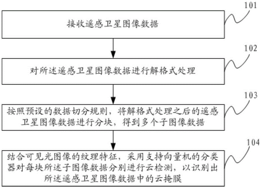
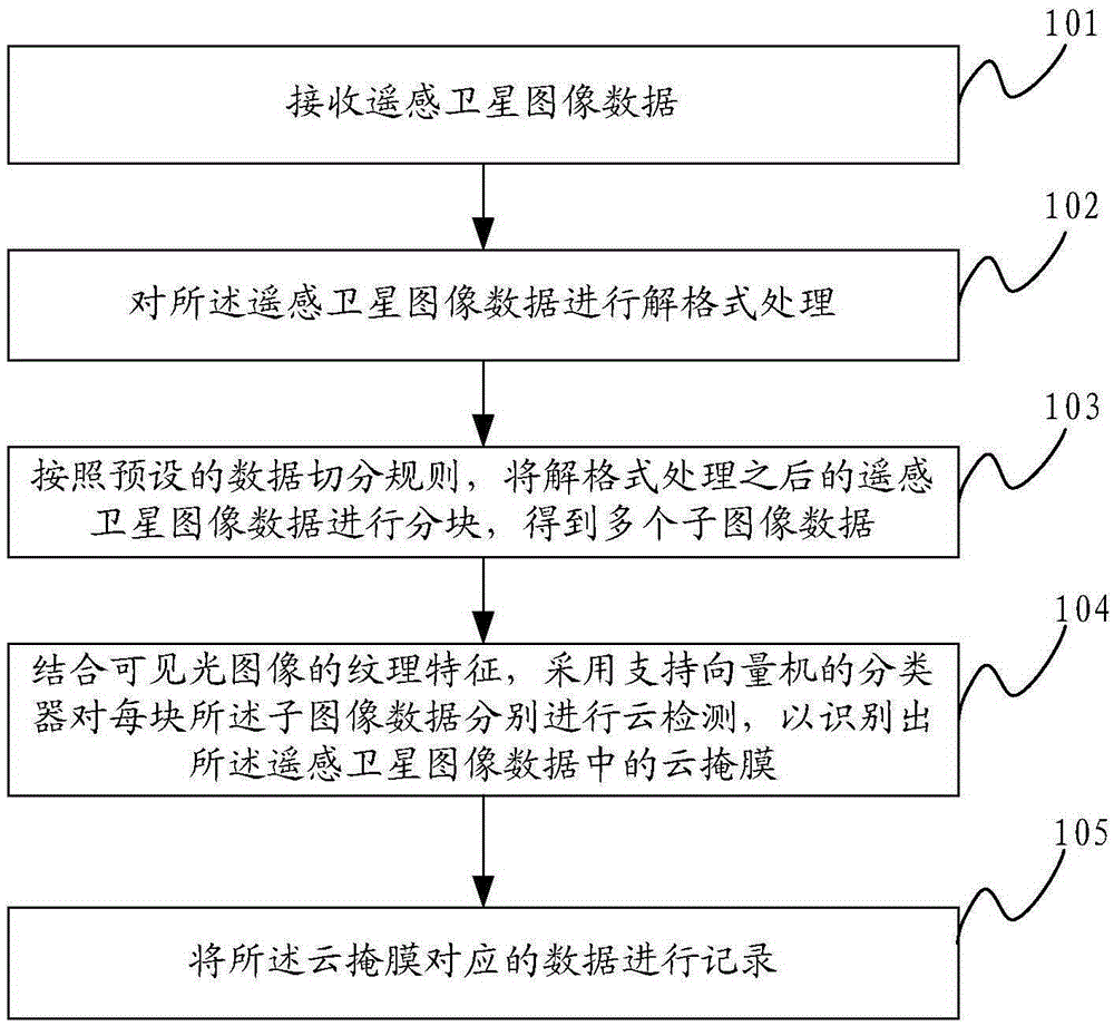
[0057] refer to figure 1 , is a flow chart of a method for cloud judgment of remote sensing satellite images provided in Embodiment 1 of the present invention, wherein the method may include the following steps:

[0058] Step 101: Receive remote sensing satellite image data.

[0059] Wherein, the remote sensing satellite image data is decompressed high-speed remote sensing satellite code stream data, and in this embodiment, a high-speed receiving board can be ...


PUM


Abstract

The invention discloses a cloud determination method and a system for remote sensing satellite images. The method includes: receiving remote sensing satellite image data; performing format-removing processing of the remote sensing satellite image data; according to a preset data sharding rule, partitioning the remote sensing satellite image data after format-removing processing, and obtaining a plurality of sub-image data; and with the combination of texture features of visible light images, conducting cloud detection of each sub-image data by employing a classifier of a support vector machine in order to recognize a cloud mask in the remote sensing satellite image data. According to the method and the system, compared with cloud mask recognition of multi-spectrum images in the remote sensing satellite images in the prior art, cloud mask recognition is realized by employing the classifier of the support vector machine with the combination of the remote sensing satellite images and the texture features of the visible light images, the accuracy of the scheme can be effectively guaranteed via a general and engineering design, the cloud mask and other target substances such as snow and sand are effectively distinguished and classified, and the recognition rate can be high.

Description

technical field [0001] The invention relates to the technical field of image processing, in particular to a cloud judgment method and system for remote sensing satellite images. Background technique [0002] In remote sensing satellite image data, due to the limitation of climate and other conditions, there is a large amount of data covered by clouds. These data themselves have no intelligence value, but they occupy the storage resources of the ground data processing system, which is difficult for later interpretation work, Information production, etc. bring interference. [0003] Therefore, in order to solve this interference, it is necessary to identify the cloud masks in the received remote sensing satellite image data, and then remove the invalid data covered by clouds corresponding to these cloud masks in subsequent operations. Contents of the invention [0004] In view of this, the present invention provides a method and system for cloud judgment of remote sensing s...

Claims


Application Information

Patent Timeline
Patent Type & Authority Applications(China)
IPC IPC(8): G06K9/62
CPCG06F18/2411
Inventor 刘莉董学志姜河汪红强袁广辉丁火平曾莎莎周志翔
Owner SPACE STAR TECH CO LTD
Why Eureka
Try Eureka