Three-dimensional terrain simplified algorithm based on high precision DEM data

A technology of 3D terrain and simplified algorithms, applied in image data processing, computing, 3D modeling, etc., can solve problems such as large memory space, occupation, and low efficiency of triangulation algorithm execution

Inactive Publication Date: 2016-08-10
SUZHOU POWER SUPPLY COMPANY OF STATE GRID ANHUI PROVINCE ELECTRIC POWER +1
View PDF4 Cites 12 Cited by
  • Summary
  • Abstract
  • Description
  • Claims
  • Application Information

AI Technical Summary

Problems solved by technology

[0003] The tree structure can conveniently block the terrain, greatly reduce the terrain rendering time, and accelerate the simplification of the terrain, but it takes up a lot of memory space, and the irregular triangle (T

Method used


Image

  • Three-dimensional terrain simplified algorithm based on high precision DEM data
  • Three-dimensional terrain simplified algorithm based on high precision DEM data
  • Three-dimensional terrain simplified algorithm based on high precision DEM data

Examples


Embodiment Construction

[0025] The present invention will be further described below.

[0026] This 3D terrain simplification algorithm based on high-precision DEM data includes the following steps:

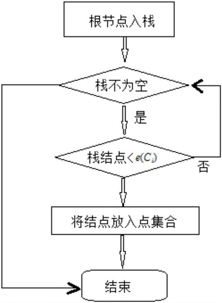
[0027] (1) On the basis of high-precision DEM data, establish a DEM model based on a quadtree structure, and define points, edges, triangular surface linked lists, as well as the center point boundary of the block and the error measurement value of the block. The design process is as follows:

[0028]

[0029] The purpose of the above design is to conveniently perform clipping and error transition calculation on the terrain other than the visual scene in the hierarchical detail model of the terrain, so as to speed up the drawing speed.

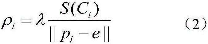
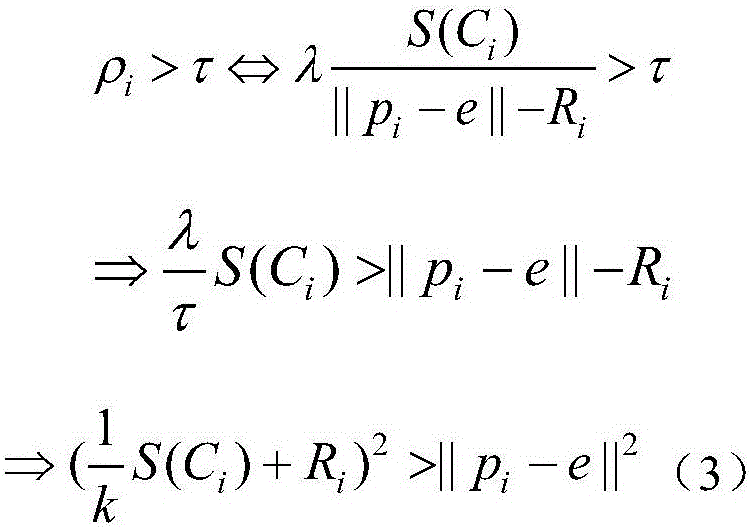
[0030] (2) According to the design of step (1), calculate the viewpoint-independent error value of the irregular triangulation, carry out the calculation of projection error according to the viewpoint-independent error of the irregular triangulation obtained, to impr...


PUM


Abstract

The invention discloses a three-dimensional terrain simplification algorithm based on high-precision DEM data, comprising the following steps: 1) quadtree data structure design, 2) calculating the viewpoint-independent error of the irregular triangular network, 3) quadtree node Subdivision, 4) Terrain simplifies error judgment. Compared with the common DEM, this algorithm has a special design for the quadtree data structure. After calculating the viewpoint-independent error of the irregular triangulation, the error value is further subdivided, and further error judgments are made, and the establishment of a large-scale, large-scale real-time, interactive virtual terrain While the environment is simplified, the complexity of the nodes is simplified by calculating the importance measure of each node, thereby improving the efficiency of terrain rendering, and the terrain details of the obtained effect map are detailed and real.

Description

technical field [0001] The invention relates to an algorithm, in particular to a three-dimensional terrain simplification algorithm based on high-precision DEM data, and belongs to the technical field of image processing. Background technique [0002] In order to generate high-simulation, large-scale, and high-precision 3D terrain scenes of transmission lines more efficiently, terrain digital elevation data (DEM) is often used. When using these massive terrain data to build terrain models, it usually contains hundreds of millions of triangles. One way to solve the large amount of data in the triangular mesh model is to simplify the network data. The regular grid structure has been widely used because of its simple data structure. The common DEM uses a regular grid. The tree structure is a data structure often used in regular network terrain rendering. Quadtrees are often used to simplify terrain. . [0003] The tree structure can conveniently block the terrain, greatly red...

Claims


Application Information

Patent Timeline
IPC IPC(8): G06T17/00G06T17/05
CPCG06T17/005G06T17/05
Inventor 刘广州于启万许启金别长报吴翔叶辉廖志斌吴伟
Owner SUZHOU POWER SUPPLY COMPANY OF STATE GRID ANHUI PROVINCE ELECTRIC POWER
Why Eureka
Try Eureka