A route planning method for inspection of bridge side rails

A technology for bridges and routes, applied in the field of route planning for bridge sidebar inspections, can solve the problems of low degree of automation, poor data stability, low security, etc., and achieve improved automation, high stability and security, and high data quality. Effect

Active Publication Date: 2022-02-11
ZHUZHOU TIMES ELECTRONICS TECH CO LTD
View PDF25 Cites 0 Cited by
  • Summary
  • Abstract
  • Description
  • Claims
  • Application Information

AI Technical Summary

Problems solved by technology

[0019] In view of this, the purpose of the present invention is to provide a bridge sidebar inspection route planning method to solve the problem of low automation, heavy workload, and data acquisition in the existing inspection methods that mainly rely on manual operation of drones to collect bridge surface data. Technical problems of poor stability and low security

Method used


Image

  • A route planning method for inspection of bridge side rails
  • A route planning method for inspection of bridge side rails
  • A route planning method for inspection of bridge side rails

Examples


Embodiment 1

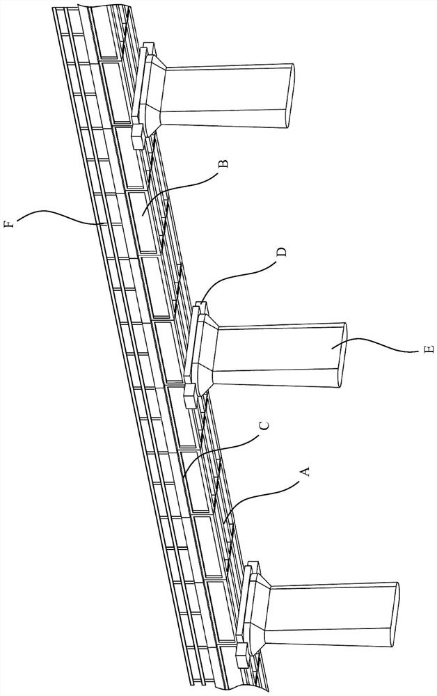
[0068] Bridge side rail inspection includes sidewalk side rail inspection, because there is no occlusion at the side rail, GNSS (Global Navigation Satellite System, short for Global Navigation Satellite System) signal is good, so it can be directly in the 3D model, according to the 3D coordinates of the bridge edge, combined with The UAV inspection distance is calculated from the optimal position of the bridge sidebar, and the route coordinates of the entire sidebar are obtained. The altitude of the operation flight is consistent with the height of the bridge deck, and the pan-tilt camera 12 is placed on or front and shoots inward.

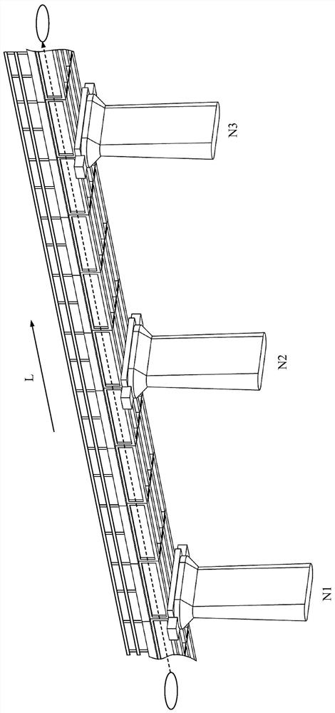
[0069] as attached image 3 To attach Figure 5 As shown, an embodiment of the bridge sidebar inspection route planning method of the present invention specifically includes the following steps:

[0070] Operate the UAV 10 to inspect the side rail of the bridge along the line length direction L (the inspection direction is the bridge pier body N1...

Embodiment 2

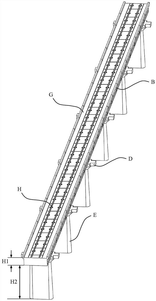
[0086] as attached Figure 8 Shown, a kind of embodiment of the bridge inspection route planning method based on the method of the present invention, specifically comprises the following steps:

[0087] S100) setting up the reference station 4;

[0088] S200) prepare the unmanned aerial vehicle 10, and set the no-fly area through the ground station 20;

[0089] S300) Manually operate the UAV 10 to perform the first inspection operation on the area of ​​the bridge that needs to be inspected, including the bottom surface, side rails, base, pier body and side rails, and plan corresponding inspection routes for each part of the bridge;

[0090] S400) After the inspection route planning for each part of the bridge to be detected is completed, load the corresponding inspection route to the flight control module 16, so as to control the UAV 10 to perform automatic inspection operations.

[0091] Step S100) further includes the following process:

[0092] S101) erecting the tripod ...

Embodiment 3

[0104] as attached Figure 9 As shown, an embodiment of the bridge inspection system of the present invention specifically includes: an unmanned aerial vehicle system 1 and a ground terminal system 2 . The unmanned aerial vehicle system 1 further includes an unmanned aerial vehicle 10, and an airborne data processing unit 11, a pan-tilt camera 12, a flight control module 16, an obstacle avoidance module 110 and a positioning module 111 mounted on the unmanned aerial vehicle 10, and the ground terminal system 2 further comprises a ground station 20. The UAV 10 performs the first inspection operation on the bridge to be detected under manual operation, and collects bridge surface data through the pan-tilt camera 12, and according to the positioning signal obtained by the positioning module 111 (such as: using GNSS signals, Global Navigation Satellite System, The abbreviation of global navigation satellite system, such as GPS, Glonass, Galileo, Beidou satellite navigation system...


PUM


Abstract

The invention discloses a route planning method for inspection of side rails of bridges. An unmanned aerial vehicle is operated to inspect the side rails on one side of the bridge, and images of the side rails of the bridge are collected by a pan-tilt camera. While inspecting the one-sided sidebar of the bridge, the flight path of the UAV is fused with the information of the gimbal camera, including attitude angle, shooting angle, frame rate, focal length and exposure time, to generate a single-sided sidebar inspection of the bridge. Check the route. Operate the drone to inspect the sidebar on the other side of the bridge, collect images of the sidebar of the bridge through the PTZ camera, and generate the inspection route of the other sidebar. At the end of the inspection route on both sides of the bridge, manually fly a route across the bottom of the bridge, and then merge the three routes into a complete bridge sidebar inspection route. The invention can solve the technical problems that the existing patrol inspection method mainly relies on manual operation of unmanned aerial vehicles to collect bridge surface data, low degree of automation, heavy workload, poor stability of acquired data, and low safety.

Description

technical field [0001] The invention relates to the technical field of engineering detection, in particular to a method for planning bridge sidebar patrol inspection routes using unmanned aerial vehicles to realize bridge inspections of railways and highways. Background technique [0002] By the end of 2017, the national railway operating mileage reached 127,000 kilometers, including 25,000 kilometers of high-speed rail. Calculated based on the proportion of bridges accounting for 52% of the line, there are about 10,000 kilometers of high-speed rail bridges in my country. For example, the accumulative length of the Beijing-Tianjin intercity bridge accounts for 86.6% of the total length of the main line, the Beijing-Shanghai high-speed railway accounts for 80.5%, the Guangzhou-Zhuhai intercity bridge accounts for 94.0%, the Wuhan-Guangzhou Railway Express accounted for 48.5%, and the Harbin-Dalian Railway Express accounted for 74.3%. As a routine operation type in the enginee...

Claims


Application Information

Patent Timeline
Patent Type & Authority Patents(China)
IPC IPC(8): G05D1/10G01N21/95
Inventor 颜琼李华伟王文昆罗梓河王贤朱义明
Owner ZHUZHOU TIMES ELECTRONICS TECH CO LTD
Why Eureka
Try Eureka