Method for planning bridge pier inspection route

A bridge and pier body technology, applied in the field of bridge pier inspection route planning, can solve the problems of poor data stability, low degree of automation, low security, etc., achieve high stability and safety, improve automation degree, and data quality high effect

Active Publication Date: 2019-06-18
ZHUZHOU TIMES ELECTRONICS TECH CO LTD
View PDF25 Cites 6 Cited by
  • Summary
  • Abstract
  • Description
  • Claims
  • Application Information

AI Technical Summary

Problems solved by technology

[0019] In view of this, the object of the present invention is to provide a bridge pier inspection route planning method to solve the problem that the existing inspection methods mainly rely on manual operation of drones to collect bridge surface data, which has low automation, heavy workload, and difficult data acquisition. Technical problems of poor stability and low security

Method used


Image

  • Method for planning bridge pier inspection route
  • Method for planning bridge pier inspection route
  • Method for planning bridge pier inspection route

Examples


Embodiment 1

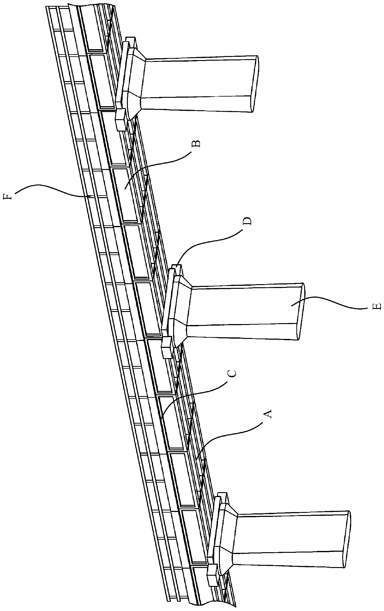
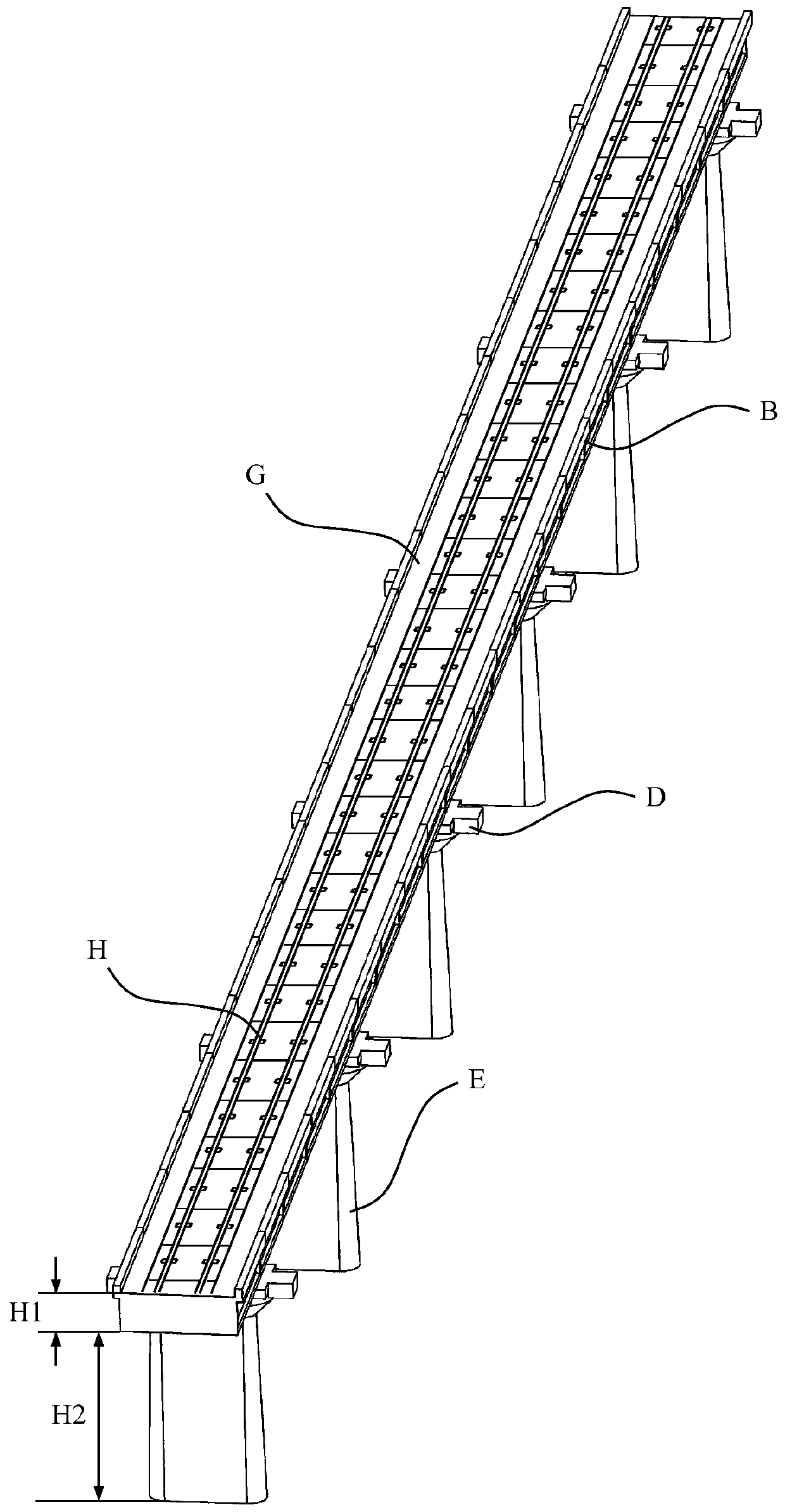
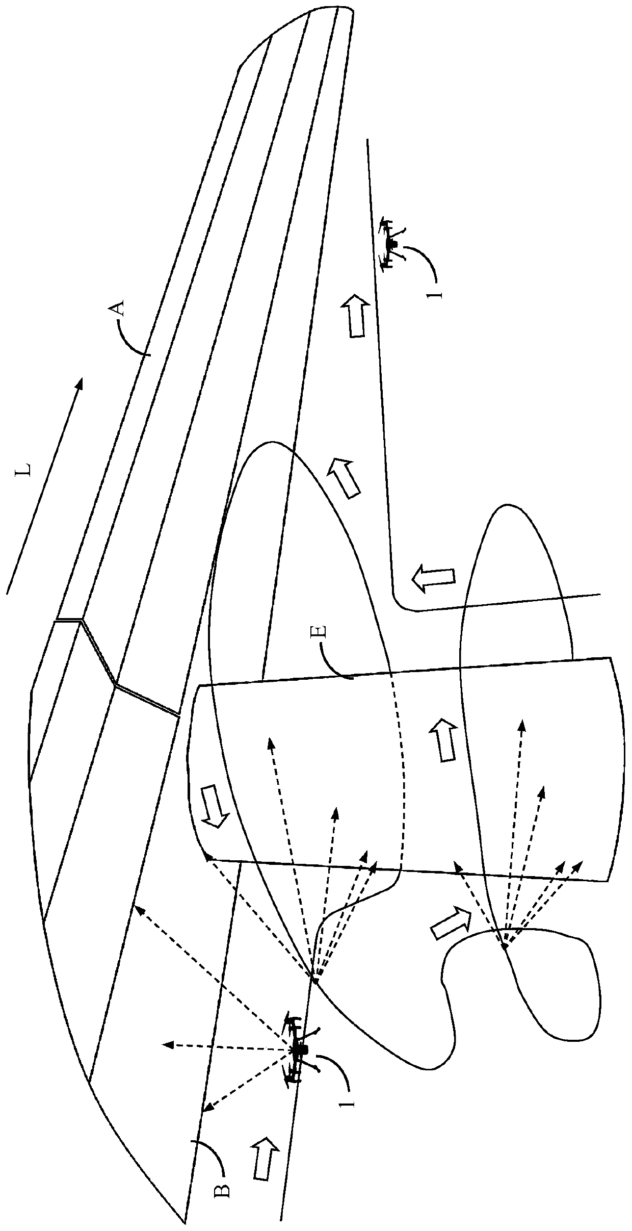
[0068] as attached image 3 As shown, an embodiment of the method for planning the inspection route of the bridge pier body of the present invention specifically includes the following steps:

[0069] Operate the unmanned aerial vehicle 10 to perform inspections at least twice around the pier body from top to bottom or from bottom to top under the bottom of the bridge, and collect images on the surface of the entire pier body through the pan-tilt camera 12. The flight route is fused with the information of the pan / tilt camera 12 including attitude angle, shooting angle, frame rate, focal length and exposure time to generate an inspection route. During the inspection process of the pier body, navigation is carried out through the inertial measurement module 17 , the vision module 18 and the laser radar 19 . After completing the inspection of a single pier body, the UAV 10 flies along the length direction L of the bridge line to the next pier body to continue the inspection of ...

Embodiment 2

[0084] as attached Figure 7 Shown, a kind of embodiment of the bridge inspection route planning method based on the method of the present invention, specifically comprises the following steps:

[0085] S100) setting up the reference station 4;

[0086] S200) prepare the unmanned aerial vehicle 10, and set the no-fly area through the ground station 20;

[0087] S300) Manually operate the unmanned aerial vehicle 10 to perform the first inspection operation on the area of ​​the bridge that needs to be inspected, including the bottom surface, outer edge surface, base, pier body and side rails, and plan corresponding inspection routes for each part of the bridge;

[0088] S400) After the inspection route planning for each part of the bridge to be detected is completed, load the corresponding inspection route to the flight control module 16, so as to control the UAV 10 to perform automatic inspection operations.

[0089] Step S100) further includes the following process:

[0090...

Embodiment 3

[0102] as attached Figure 8 As shown, an embodiment of the bridge inspection system of the present invention specifically includes: an unmanned aerial vehicle system 1 and a ground terminal system 2 . The unmanned aerial vehicle system 1 further includes an unmanned aerial vehicle 10, and an airborne data processing unit 11, a pan-tilt camera 12, a flight control module 16, an obstacle avoidance module 110 and a positioning module 111 mounted on the unmanned aerial vehicle 10, and the ground terminal system 2 further comprises a ground station 20. The UAV 10 performs the first inspection operation on the bridge to be detected under manual operation, and collects bridge surface data through the pan-tilt camera 12, and according to the positioning signal obtained by the positioning module 111 (such as: using GNSS signals, Global Navigation Satellite System, The abbreviation of global navigation satellite system, such as GPS, Glonass, Galileo, Beidou satellite navigation system...


PUM


Abstract

The invention discloses a method for planning a bridge pier inspection route. An unmanned aerial vehicle is controlled to inspect the pier at least two circles below the bottom of the bridge from topto bottom or from bottom to top. A cloud deck camera carries out image collection on the surface of the whole pier; the flight route of the unmanned aerial vehicle is integrated with information, including the attitude angle, shooting angle, frame rate, focal length and exposure time of the cloud deck camera to generate an inspection route. During the pier inspection process, an inertial measurement module, a vision module and a laser radar are used for navigation. After completion of inspection of the whole pier, the unmanned aerial vehicle flies to a next pier continuously for inspection. Therefore, technical problems of low automation degree, large workload, poor data stability, and low safety because of mainly reliance on manual operation of the unmanned aerial vehicle for bridge surface data collection are solved.

Description

technical field [0001] The invention relates to the technical field of engineering detection, in particular to a bridge pier patrol inspection route planning method for realizing bridge inspection of railways, highways and the like by using an unmanned aerial vehicle. Background technique [0002] By the end of 2017, the national railway operating mileage reached 127,000 kilometers, including 25,000 kilometers of high-speed rail. Calculated based on the proportion of bridges accounting for 52% of the line, there are about 10,000 kilometers of high-speed rail bridges in my country. For example, the accumulative length of the Beijing-Tianjin intercity bridge accounts for 86.6% of the total length of the main line, the Beijing-Shanghai high-speed railway accounts for 80.5%, the Guangzhou-Zhuhai intercity bridge accounts for 94.0%, the Wuhan-Guangzhou Railway Express accounted for 48.5%, and the Harbin-Dalian Railway Express accounted for 74.3%. As a routine operation type in th...

Claims


Application Information

Patent Timeline
Patent Type & Authority Applications(China)
IPC IPC(8): G05D1/10
Inventor 颜琼李华伟王文昆罗梓河王贤朱义明廖时才
Owner ZHUZHOU TIMES ELECTRONICS TECH CO LTD
Why Eureka
Try Eureka