Meteorological service performance evaluation method based on geographical information system (GIS)

A geographic information system and meteorological service technology, applied in the field of meteorological service benefit evaluation

Inactive Publication Date: 2010-10-06
NANJING UNIV OF INFORMATION SCI & TECH
View PDF1 Cites 28 Cited by
  • Summary
  • Abstract
  • Description
  • Claims
  • Application Information

AI Technical Summary

Problems solved by technology

[0004] At present, there is no geographic information system method of this kind of met

Method used


Image

  • Meteorological service performance evaluation method based on geographical information system (GIS)
  • Meteorological service performance evaluation method based on geographical information system (GIS)
  • Meteorological service performance evaluation method based on geographical information system (GIS)

Examples


Embodiment Construction

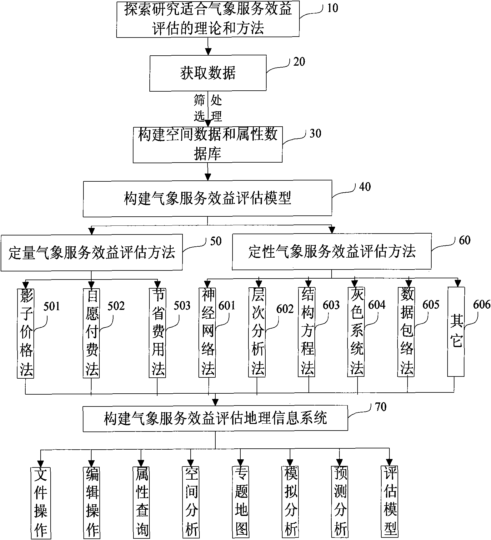
[0088] The method for evaluating the benefits of meteorological services based on geographic information systems in the present invention will be further described in detail in conjunction with the accompanying drawings and specific examples.

[0089] Such as figure 1 Shown, the present invention comprises the steps:

[0090] Step 20 acquires spatial data and attribute data. Use corresponding GIS software to digitize raster data or irregular map data to make a digital map with practical application value. Attribute data include hydrological data, social survey data, and flood disaster loss data required for meteorological service benefit assessment;

[0091] Step 30 uses geographic information system technology and database technology to establish corresponding spatial databases and attribute databases according to the filtered and statistically processed hydrological data, social survey data, and flood disaster loss data;

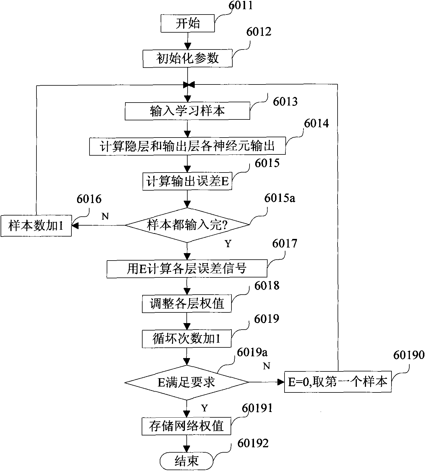
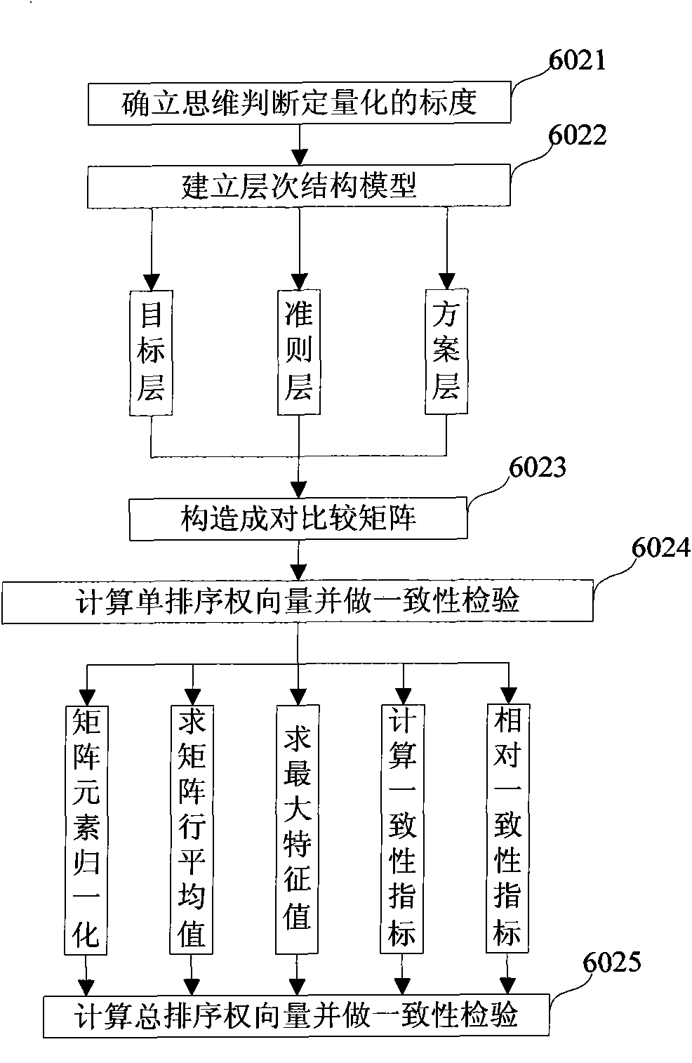
[0092] Step 40 constructs a weather service benef...


PUM


Abstract

The invention discloses a meteorological service performance evaluation method based on a geographical information system (GIS), which is used for carrying out meteorological service performance analysis and evaluation by comprehensively utilizing a neural network method, an analytic hierarchy process, a structural equation method, a gray system method and a statistical analysis technique through using corresponding social statistics and survey data. The method is used for carrying out uniform control and management on hydrologic information, humanity information and meteorological information in a researched region by using a cartographic database and remote sensing data as basis geospatial data through using population data, casualty loss data and geographical hydrologic thematic data based on a GIS technology and a database technology by adopting a design mode of centralized management and maintenance. The invention realizes graphic and feature integrated maintenance management, comprehensive query, space analysis, thematic map, simulation analysis and meteorological service evaluation functions, improves the informatization level and the aid decision making capability of the meteorological service evaluation, and provides aid decision basis for the geographical hydrologic management and the meteorological service performance evaluation.

Description

technical field [0001] The invention is a meteorological service benefit evaluation method based on a geographic information system, which mainly includes the functions of attribute query, thematic map, spatial analysis, simulation analysis, forecast analysis and meteorological service benefit evaluation. Relevant knowledge includes geographic information system, meteorological technology, computer technology, computer graphics, database technology, statistics, etc. Background technique [0002] In September 1994, the World Meteorological Organization (WMO) convened the second special meeting on the benefit assessment of meteorological and hydrological services in the 1990s. The meeting considered that the benefit assessment of meteorological services is an important and valuable work, and it is also a difficult task. larger subject. Experts from the United States, the former Soviet Union, the United Kingdom and other countries have analyzed and evaluated the benefits of me...

Claims


Application Information

Patent Timeline
IPC IPC(8): G06F17/30G06N3/08
CPCY02A90/10
Inventor 毕硕本董学士梁静涛王启富何晓庆
Owner NANJING UNIV OF INFORMATION SCI & TECH
Why Eureka
Try Eureka