Method of importing CAD (computer-aided design) graph and attribute data into GIS (Geographic information system)

A technology of attribute data and graphics, applied in the direction of electrical digital data processing, special data processing applications, instruments, etc., can solve problems such as complex operation steps, poor use effect, attribute data association, etc., to achieve simple steps, convenient implementation, and effective use Good results

Inactive Publication Date: 2012-06-20
AERIAL PHOTOGRAMMETRY & REMOTE SENSING CO LTD
View PDF3 Cites 25 Cited by
  • Summary
  • Abstract
  • Description
  • Claims
  • Application Information

AI Technical Summary

Problems solved by technology

[0004] The technical problem to be solved by the present invention is to provide a method for importing CAD graphics and attribute data into the GIS system in view of the deficiencies in the above-mentioned prior art. Effectively solve the probl

Method used


Image

  • Method of importing CAD (computer-aided design) graph and attribute data into GIS (Geographic information system)
  • Method of importing CAD (computer-aided design) graph and attribute data into GIS (Geographic information system)
  • Method of importing CAD (computer-aided design) graph and attribute data into GIS (Geographic information system)

Examples


Embodiment Construction

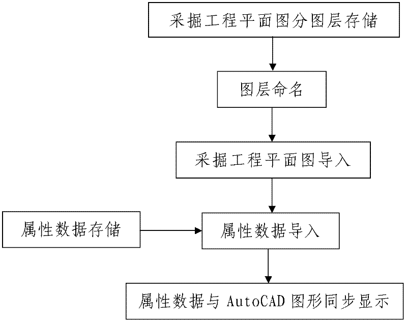
[0046] Such as figure 1 A method for importing CAD graphics and attribute data into a GIS system, comprising the following steps:

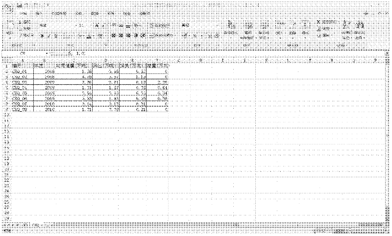
[0047] Step 1. Import of excavation engineering plan: Use data processing equipment to organize and import the excavation engineering plan, and the arrangement and import process are as follows:

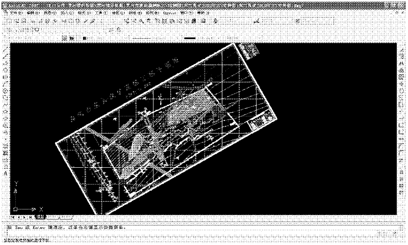
[0048] 101. Layer-by-layer storage: Open the excavation engineering plan through AutoCAD software, and split the excavation engineering plan into a plurality of mutually independent graphic objects, and then store the split graphic objects in multiple different graphic objects. Among the layers, and a plurality of the layers are respectively one-to-one corresponding to a plurality of the graphic objects; the excavation engineering plan is the excavation engineering plan of the managed coal mine drawn by AutoCAD software.

[0049] In this embodiment, the managed coal mine is Dongxing Coal Mine in Heihe City, and the excavation engineering plan is the exc...


PUM


Abstract

The invention discloses a method of importing a CAD (computer-aided design) graph and attribute data into a GIS (Geographic information system). The method comprises the following steps: I, importing a mining engineering planar graph: 101, storing in different layers, 102, naming the layers, and 103, importing the mining engineering planar graph to the GIS system; II, importing attribute data: before importing the attribute data, storing the attribute data of the mining engineering planar graph in a data sheet form and generating an attribute data sheet, wherein the attribute data through the following importing processes: 201, recognizing the attribute data, and 202, importing the attribute data to the GIS system; and III, synchronously displaying the attribute data and the Auto CAD graph. The method provided by the invention is rational in design, simple in importing step, good in use effect and high in practical value, and can be used for effectively solving the problems that the existing mining engineering planar graph cannot correlate with the attribute data in the graph after being imported to the GIS system, the operation step is complex, third-party software is utilized, and the use effect is bad.

Description

technical field [0001] The invention belongs to the technical field of coal mine excavation engineering plan processing drawn by AutoCAD software, and in particular relates to a method for importing CAD graphics and attribute data into a GIS system. Background technique [0002] The mining supervision and management system built by the land and resources management department needs to measure and map the mining conditions of mining enterprises such as roadways and goafs, so as to realize the supervision of the mining conditions of mining enterprises. Mining judgment, quantitative analysis, etc. However, at present, the professional mine surveying team of the land and resources management department or a third-party professional mine surveying team generally use theodolite, total station, level, rangefinder, topographic mapping instrument, gyro theodolite, suspension compass, geological compass, Laser pointing instrument, GPS, gradient gauge, measuring rope, various steel ru...

Claims


Application Information

Patent Timeline
IPC IPC(8): G06F17/30G06F17/50
Inventor 段建华
Owner AERIAL PHOTOGRAMMETRY & REMOTE SENSING CO LTD
Why Eureka
Try Eureka