
Common method and system for three-dimensional simulation of sundial
A three-dimensional simulation, sundial technology, applied in special data processing applications, image data processing, instruments, etc., can solve the problems of high labor, material resources and time, difficult to understand, unable to meet the personalized requirements of users, etc. Technical solutions and advantages Clear and clear effects
- Summary
- Abstract
- Description
- Claims
- Application Information
AI Technical Summary
Problems solved by technology
Method used
Image

Examples
Embodiment Construction
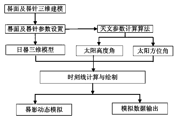
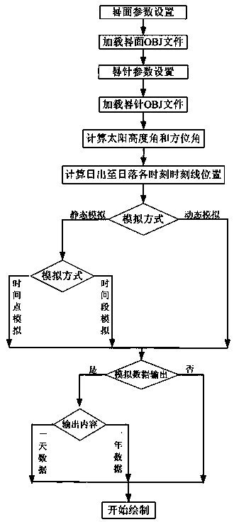
[0035] Such as figure 2 As shown, the present invention provides a general sundial three-dimensional simulation method, comprising the following steps:
[0036] S10: Establish a three-dimensional model of the sundial surface and the sundial pin;
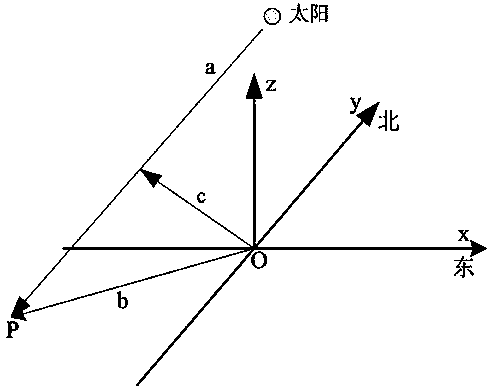
[0037] S11: Set the spatial geographic location, inclination and orientation of the center point of the sundial surface, set the inclination and orientation of the sundial pin, and establish a three-dimensional model of the sundial;
[0038] S12: According to the geographical longitude and latitude of the center point of the sundial surface, use the sun's astronomical parameter calculation algorithm to calculate the solar altitude angle and solar azimuth angle at different times at the location;
[0039] S13: According to the geometric parameters of the sundial surface and the sundial pin in step S11, combined with the formation principle of the sundial sundial shadow, calculate the position of the shadow formed by the sundial pin ...
PUM
 Abstract
Description
Claims
Application Information