Inertial navigation positioning method and system based on differential GPS

A technology of GPS positioning and positioning method, which is applied in the field of inertial navigation positioning method and system based on differential GPS, which can solve the problems of system stability and reliability limitation, inertial navigation origin and direction deviation, unrecoverable and other problems, and achieve positioning accuracy and High reliability, eliminate the impact of positioning, and reduce the difficulty of initialization

Active Publication Date: 2017-07-11
HUNAN NOVASKY ELECTRONICS TECH
View PDF6 Cites 7 Cited by
  • Summary
  • Abstract
  • Description
  • Claims
  • Application Information

AI Technical Summary

Problems solved by technology

In order to more intuitively grasp the position of the moving target carrying the inertial navigation, the origin and direction selected during the initialization of the inertial navigation must match the actual environment as much as possible, otherwise it will increase the difficulty of tracking, making it impossible to arbitrarily select the origin of the inertial navigation initialization The position and direction increase the difficulty of initialization and reduce the flexibility of the system;
[0005] (2) It is difficult to keep the positioning coordinates consistent
In multi-inertial navigation applications, the origin and direction must be the same when multiple inertial navigation units are initialized to maintain the consistency of the positioning coordinates of each inertial navigation unit. However, no matter how the inertial navigation units are placed, it is impossible to avoid There are deviations in the origin and direction, and it takes a long time to prepare for the initial alignment. In addition, it is easy to cause serious consequences that cannot be recovered due to unexpected situations, such as system reset. Initialization, the above problems will lead to inconsistencies between the positioning coordinates of each inertial navigation, making it impossible to accurately grasp the positions of multiple moving targets;
[0006] Some practitioners have proposed a collaborative positioning technology that combines inertial navigation with satellite positioning system, electronic compass and barometer. Too many, and there are certain errors in their respective outputs. For example, the positioning accuracy of the commonly used GPS technology has meter-level errors, which cannot meet the high requirements of precise positioning for dyna

Method used


Image

  • Inertial navigation positioning method and system based on differential GPS
  • Inertial navigation positioning method and system based on differential GPS
  • Inertial navigation positioning method and system based on differential GPS

Examples


Example Embodiment

[0033] The following further describes the present invention with reference to the accompanying drawings of the specification and specific preferred embodiments, but the protection scope of the present invention is not limited thereby.
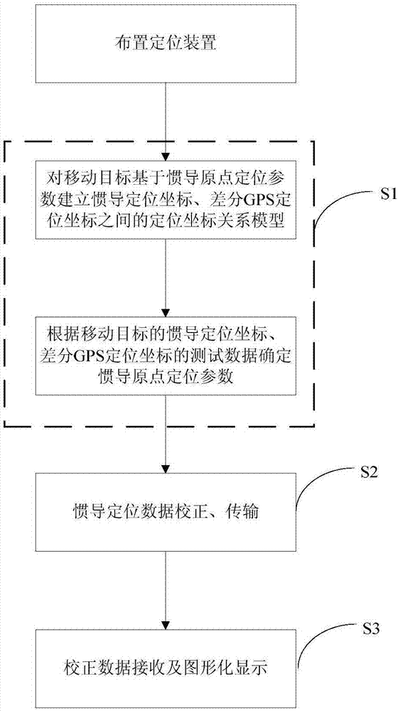
[0034] Such as figure 1 As shown, the inertial navigation positioning method based on differential GPS in this embodiment includes the following steps:

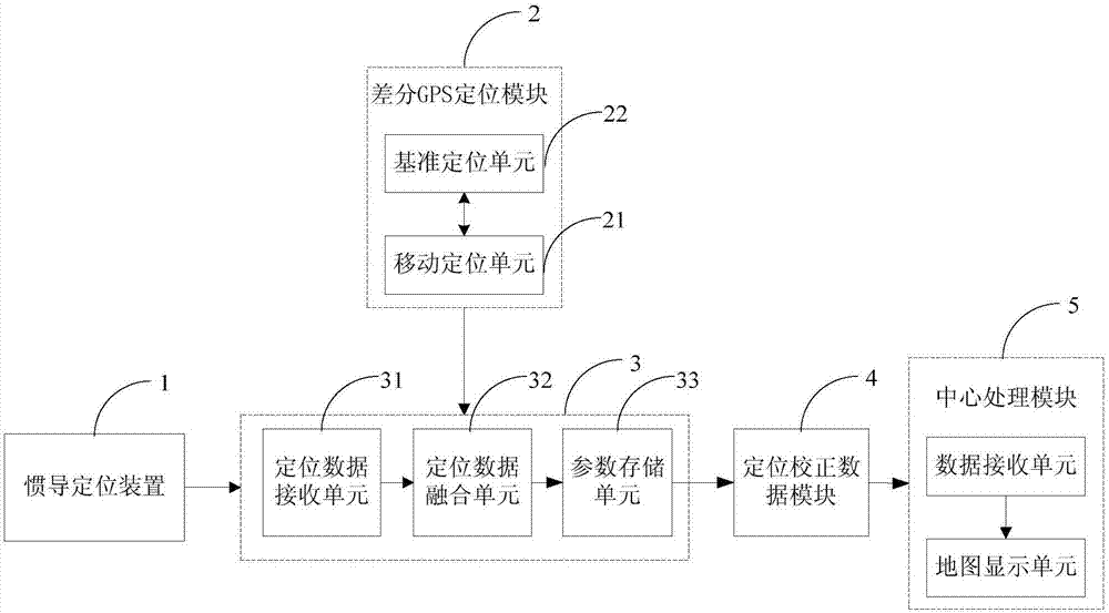
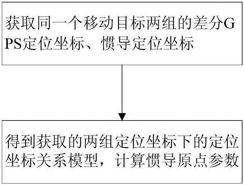
[0035] S1. Determination of origin positioning parameters: establish a positioning coordinate relationship model between inertial navigation positioning coordinates and differential GPS positioning coordinates for mobile targets based on inertial navigation origin positioning parameters, and test according to the inertial navigation positioning coordinates and differential GPS positioning coordinates of the moving target The data determines the inertial navigation origin positioning parameters; the inertial navigation positioning coordinates are the positioning coordinates obtained based on the in...


PUM


Abstract

The invention discloses an inertial navigation positioning method and system based on differential GPS. The method comprises S1, building a positioning coordinate relation model of inertial navigation positioning coordinates and differential GPS positioning coordinates of a moving target based on inertial navigation origin orientation parameters, and determining inertial navigation origin orientation parameters according to test data of the inertial navigation positioning coordinates and differential GPS positioning coordinates of the moving target, and S2, in the real-time positioning, acquiring current inertial navigation positioning coordinates of the moving target in real time, calculating corresponding differential GPS positioning coordinate outputs according to the inertial navigation origin orientation parameters, and correcting correct inertial navigation positioning coordinates. The system includes an inertial navigation positioning device, a differential GPS positioning device, an origin parameter determination module and a positioning data correction module. The inertial navigation positioning method and system can select the position and direction of the original point at random in inertial navigation initialization. In use of multiple inertial navigation devices, the inertial navigation device initialization conformity is avoided. The method and system have the advantages of simple implementation, high positioning accuracy and high reliability.

Description

technical field [0001] The invention relates to the technical field of dynamic moving target positioning, in particular to a differential GPS-based inertial navigation positioning method and system suitable for dynamic moving targets. Background technique [0002] Target positioning is to measure the position information of the measurement target. There are more and more targets that need to be accurately positioned in various fields, so higher-level requirements are put forward for the problem of target positioning, especially for the precise positioning of dynamic moving targets. . The inertial navigation system (INS) is a navigation parameter calculation system based on gyroscopes and accelerometers as sensitive devices. The system establishes a navigation coordinate system based on the output of the gyroscope, and then calculates the velocity and position of the carrier in the navigation coordinate system based on the output of the accelerometer. , for dead reckoning na...

Claims


Application Information

Patent Timeline
IPC IPC(8): G01C21/16
CPCG01C21/165
Inventor 康琴简博宇周俊
Owner HUNAN NOVASKY ELECTRONICS TECH
Why Eureka
Try Eureka