

A geolocation method for ground panorama images
A panoramic image and geographic positioning technology, applied in the field of remote sensing information system, can solve the problems of unsuitable urban areas, limited precision, low precision, etc.
- Summary
- Abstract
- Description
- Claims
- Application Information
AI Technical Summary
Problems solved by technology
Method used
Image

Examples
Embodiment Construction
[0041]Below in conjunction with accompanying drawing and specific embodiment the present invention is described in further detail:
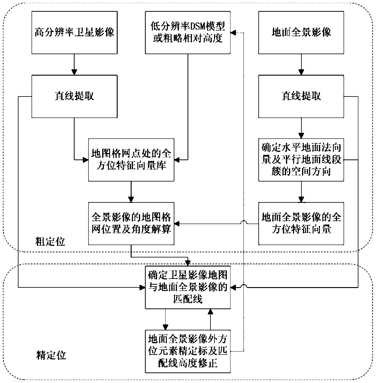
[0042] The present invention proposes a geographic location method for ground panorama images. The method is divided into two stages: coarse location and fine location. The matching line is used as the control line when the height information is distorted, and the constrained minimization problem is constructed to solve the precise outer orientation elements. Compared with the existing registration methods, this method is suitable for situations with huge differences in field of view and scale between the sky and the earth, and greatly reduces the dependence on elevation accuracy, and can realize automatic precision without control points for single-frame panoramic images. position. Such as figure 1 Shown is a kind of geolocation method work flow diagram of the ground panorama image of the present invention, the present invention is divided int...
PUM
 Abstract
Description
Claims
Application Information