Correlation imaging method based on multi-component gradient data combination and depth weighting

A technology of data union and correlation imaging, applied in the field of geophysical data interpretation, can solve the problem of low vertical resolution of correlation imaging, achieve the effect of improving resolution, high computing efficiency, and avoiding multiple iterative operations

Active Publication Date: 2019-11-26
NORTHEASTERN UNIV
View PDF4 Cites 4 Cited by
  • Summary
  • Abstract
  • Description
  • Claims
  • Application Information

AI Technical Summary

Problems solved by technology

However, in the prior art mentioned above, the longitudinal resolution of correlation imaging in gravity exploration is still low

Method used


Image

  • Correlation imaging method based on multi-component gradient data combination and depth weighting
  • Correlation imaging method based on multi-component gradient data combination and depth weighting
  • Correlation imaging method based on multi-component gradient data combination and depth weighting

Examples


Embodiment Construction

[0049] The present invention will be further described below in conjunction with the accompanying drawings and specific embodiments.

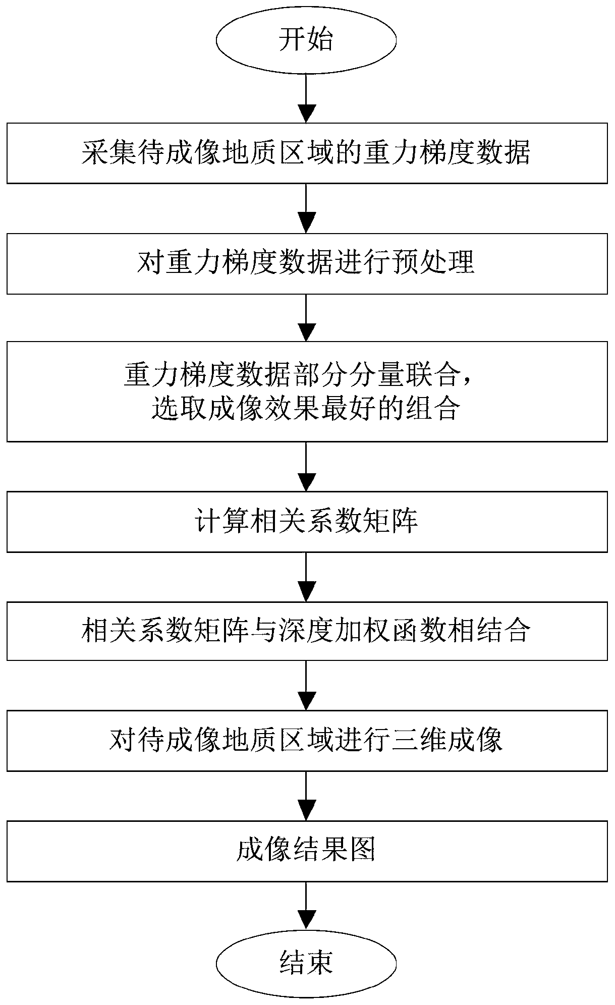
[0050] Such as figure 1 As shown, the correlation imaging method based on multi-component gradient data union and depth weighting of the present invention comprises the following steps:

[0051] Step 1: Data collection: use a gravimeter to collect the gravity gradient data of the geological region to be imaged; the gravity gradient data has 6 components {V xx ,V xy ,V xz ,V yy ,V yz ,V zz}.

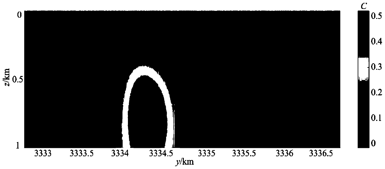
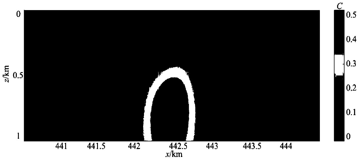
[0052] In this example, the geological area to be imaged is the Vinton Salt Dome in the United States, which is located in the southwestern intersection of Texas and Louisiana. It is mainly composed of a large salt rock and the cap rock above it. The cap rock is mainly Composed of plaster and limestone.

[0053] In this embodiment, the gravity gradient data of the geological region to be imaged is the data provided by BellGeospace Corporation of th...


PUM


Abstract

The invention relates to the geophysical data interpretation technology field and provides a correlation imaging method based on multi-component gradient data combination and depth weighting. The method comprises the following steps of firstly, using a gravity meter to collect gravity gradient data of a geological area to be imaged; and, preprocessing the gravity gradient data; then, combining a part of components of the preprocessed gravity gradient data, and selecting a multi-component gradient data combination with the best imaging effect to calculate a correlation coefficient matrix; obtaining a top surface burial depth and a bottom surface burial depth of the geological area to be imaged according to prior geological data of the geological area to be imaged, carrying out partitioningprocessing on an underground space of the geological area to be imaged, introducing a depth weighting function, and calculating a weighted correlation coefficient matrix; and finally, carrying out three-dimensional imaging on the geological area to be imaged by using the weighted correlation coefficient matrix. In the invention, a resolution of an imaging result in a depth direction can be improved, upper and lower boundaries of a geologic body can be determined more accurately, and calculation efficiency is high.

Description

technical field [0001] The invention relates to the technical field of geophysical data interpretation, in particular to a correlation imaging method based on multi-component gradient data union and depth weighting. Background technique [0002] As my country's resource mining advances to the deep part of the earth, there are still many defects in the traditional and existing geophysical methods and technologies, which cannot meet the requirements. In particular, if the gravity and magnetic methods want to play their due role in the new round of resource exploration, The breakthrough of its method technology is imperative. In geophysical exploration, the data is often massive. How to interpret the exploration results faster and more accurately is the future development trend of geophysics. [0003] The gravity and magnetic 3D inversions can be roughly divided into two types according to different inversion methods. One is linear and nonlinear inversions based on the inversio...

Claims


Application Information

Patent Timeline
Patent Type & Authority Applications(China)
IPC IPC(8): G01V7/00G01V7/06
CPCG01V7/00G01V7/06
Inventor 侯振隆郑玉君
Owner NORTHEASTERN UNIV
Why Eureka
Try Eureka