Method of managing latitude and longitude of base station

A management method and technology of longitude and latitude, applied in the direction of electrical components, selection devices, wireless communication, etc., can solve the problems of inputting wrong data, heavy manual operation workload, etc., to achieve the effect of ensuring flexibility, reducing workload, and eliminating input errors

Inactive Publication Date: 2008-03-12
ZTE CORP
View PDF0 Cites 4 Cited by
  • Summary
  • Abstract
  • Description
  • Claims
  • Application Information

AI Technical Summary

Problems solved by technology

[0003] In the existing mobile communication system, the latitude and longitude information of the base station is generally entered manually and stored in the database of the OMC (Operation Mainten...

Method used


Image

  • Method of managing latitude and longitude of base station
  • Method of managing latitude and longitude of base station
  • Method of managing latitude and longitude of base station

Examples


Embodiment Construction

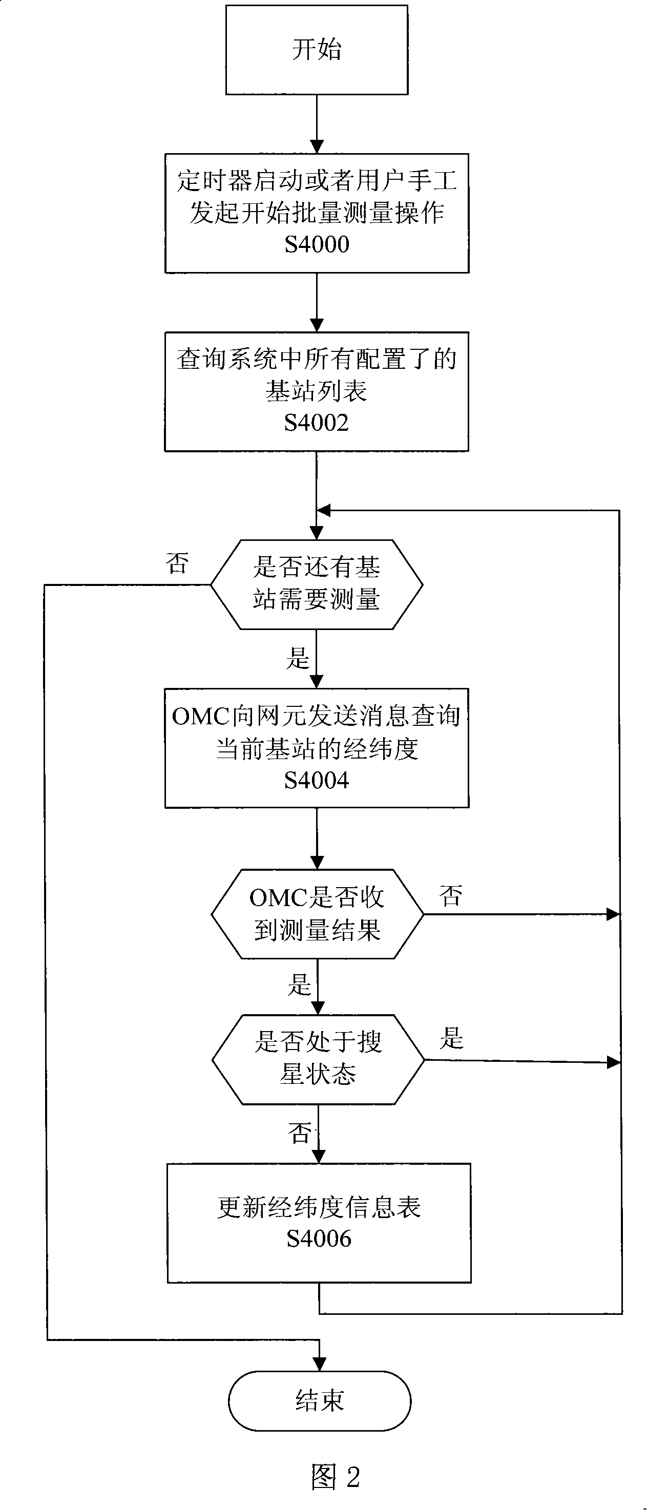
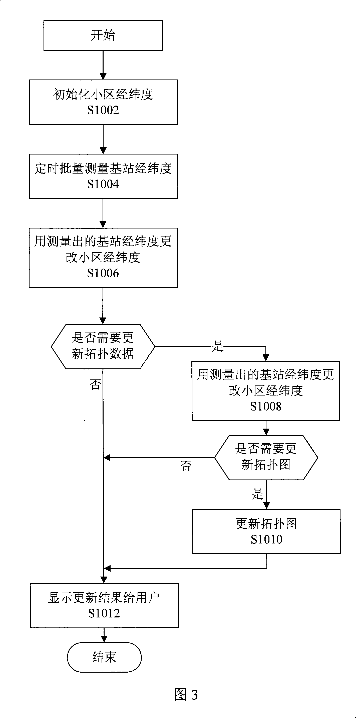
[0022] The present invention will be described in further detail below in conjunction with the accompanying drawings.

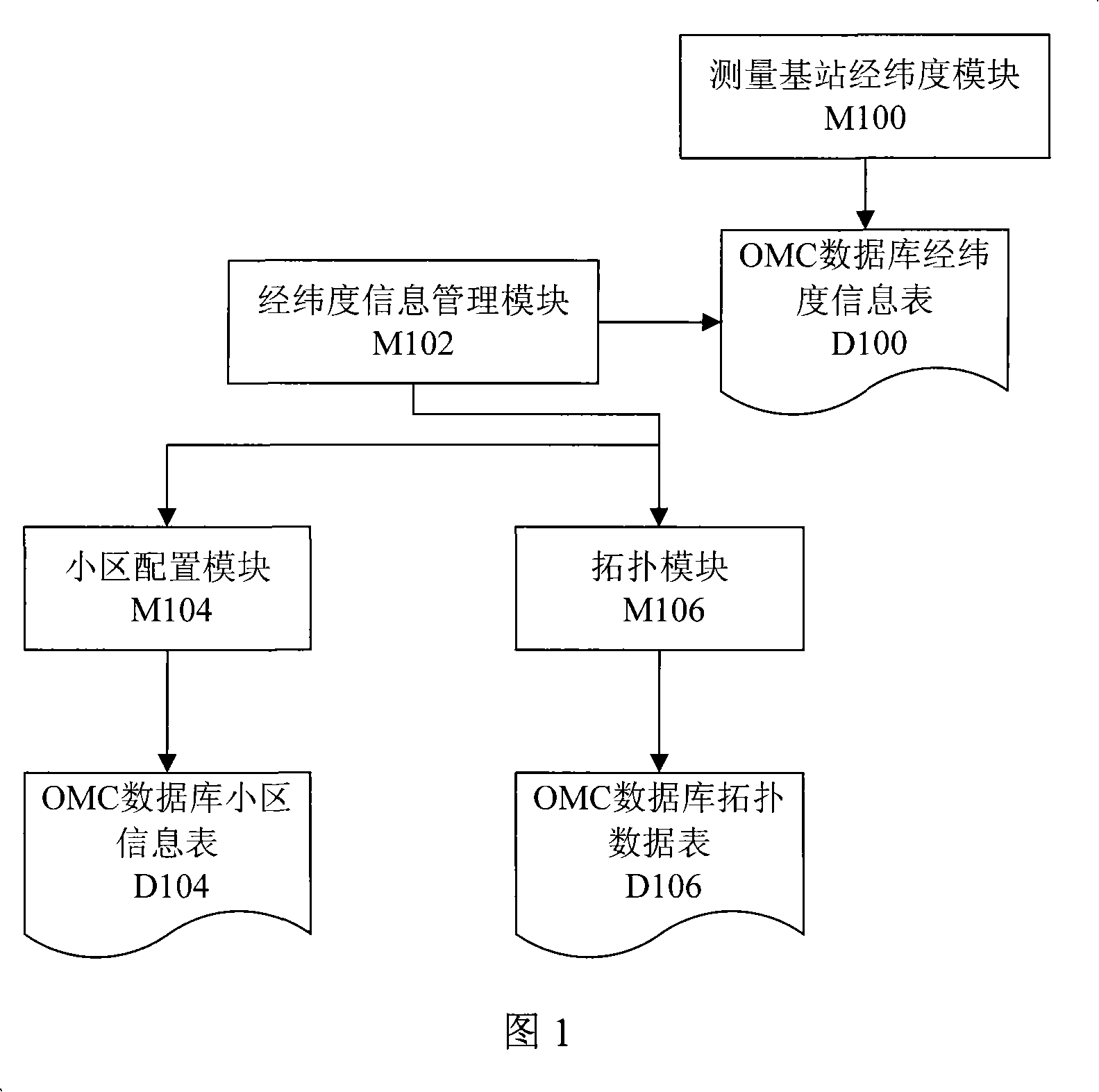
[0023] As shown in Figure 1, the base station latitude and longitude management system that realizes this method includes the following modules:

[0024] M100: Measuring base station latitude and longitude module.

[0025] D100: The latitude and longitude information table of the OMC database, used to store the latitude and longitude information of the base station measured by M100.

[0026] M102: Longitude and latitude information management module, composed of M104 and M106.

[0027] M104: Cell configuration module, used to complete the cell parameter configuration function.

[0028] D104: OMC database cell information table, including cell latitude and longitude information.

[0029] M106: Topology module, including topological map management functions, which can be used to update the latitude and longitude information of the base station in the D106 to...


PUM


Abstract

The present invention discloses the management method of the latitude and the longitude of a base station. The method comprises the following processing processes: A, an operation maintenance center sends request to the base station, and informs the base station to report self latitude and longitude; B, the operation maintenance center gets the latitude and the longitude information reported by the base station and allocates the information to a latitude and longitude information management module. The present invention reports the latitude and the longitude through the base station, the operation maintenance center allocates to the latitude and longitude information management module, thus the latitude and the longitude information can be effectively input and managed, the manual workload is reduced, and the manual input error is avoided.

Description

technical field [0001] The invention relates to the technical field of wireless communication, in particular to a method for managing the longitude and latitude of a base station. Background technique [0002] In mobile communication systems such as CDMA (Code Division Multiple Access) and GSM (Global System of Mobile communication, Global System for Mobile Communications), the latitude and longitude of the base station is an important parameter, which is related to the basic structure of the entire network and the regional coverage. , PN (pseudo-random noise code) planning, adjacent cell parameter configuration, distance-based registration technology and other CDMA system parameter settings will have a direct impact. In addition, in topology management in wireless system network management, precise base station location information also needs to be displayed in maps such as GIS (Geographic Information System, geographic information system). [0003] In the existing mobile ...

Claims


Application Information

Patent Timeline
IPC IPC(8): H04Q7/34H04Q7/30H04W24/02H04W24/04H04W88/08
Inventor 张红
Owner ZTE CORP
Why Eureka
Try Eureka