Cell base station longitude and latitude data correction method based on KNN (K Nearest Neighbor)

A data correction, longitude and latitude technology, applied in the field of signal simulation, can solve the problems affecting the longitude and limitation of mobile phone user location positioning, and cannot be applied to scenarios such as the separation of BBU module and RRU module, to achieve automatic processing of the whole process and improve positioning accuracy. , the effect of improving the accuracy

Active Publication Date: 2019-03-29
FUJIAN NEWLAND SOFTWARE ENGINEERING CO LTD
View PDF6 Cites 4 Cited by
  • Summary
  • Abstract
  • Description
  • Claims
  • Application Information

AI Technical Summary

Problems solved by technology

[0007] 1. The first method needs to send instructions to collect the GPS information of the base station through the OMC platform of the operation and maintenance center. This method is limited to the base station that can automatically collect GPS information through the platform
[0008] 2. The second method needs to first obtain all adjacent cells of the base station cell to be verified, and use simple calculations to judge the abnormal latitude and longitude according to the spatial relationship between adjacent cells, and cannot identify the spatial relationship between the error latitude and longitude of the base station to be verified and the surrounding cells no obvious abnormality
[0009] 3. The existing method cannot be applied to the scenario where the BBU module and the RRU module are installed separately
Since the longitude and latitude of the BBU are recorded in the public reference of the base station community, the BBU module is usually installed indoors, and the OMC platform of the maintenance center also obtains the longitude and latitude of the BBU. Therefore, the existing method cannot provide the longitude and latitude of the RRU module, and the location of the mobile phone user Positioning depends on the longitude and latitude of the RRU module. As the installation of RRU remote radio frequency modules becomes more and more flexible, more and more RRU modules are installed separately from the BBU module, which affects the longitude of mobile phone user location positioning.

Method used


Image

  • Cell base station longitude and latitude data correction method based on KNN (K Nearest Neighbor)

Examples


Embodiment Construction

[0053] The present invention will be described in detail below in conjunction with specific embodiments shown in the accompanying drawings. However, these embodiments do not limit the present invention, and any structural, method, or functional changes made by those skilled in the art according to these embodiments are included in the protection scope of the present invention.

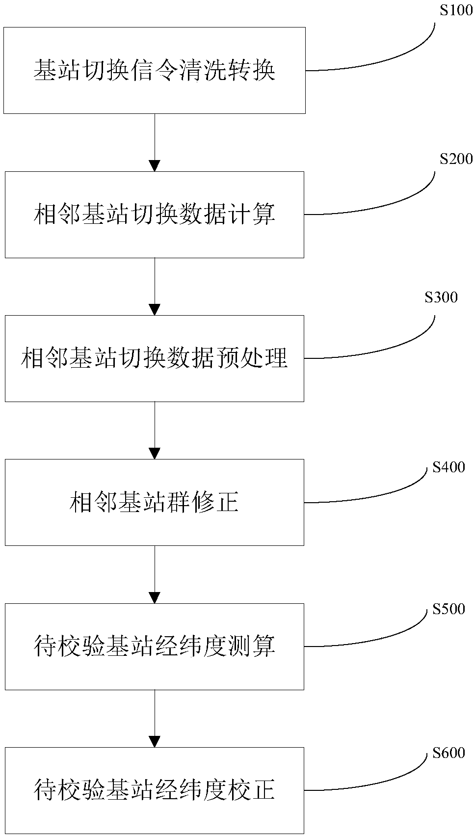
[0054] refer to figure 1 As shown, an embodiment of the present invention discloses a KNN-based cell base station latitude and longitude data correction method, including:

[0055] S100: Cleaning and conversion of base station handover signaling, cleaning, conversion, and serialization of mobile phone signaling data, and constructing mobile phone user base station handover sequences; obtaining 2 / 3 / 4G mobile phone signaling data of the entire network of operators, and filtering signaling missing user identifiers , sorted by user, time, and sequence, eliminating consecutive redundant base station signal...


PUM


Abstract

The invention discloses a cell base station longitude and latitude data correction method based on a KNN (K Nearest Neighbor), which comprises the steps of: carrying out base station switching signaling cleaning conversion, carrying out cleaning, conversion and serialization on mobile phone signaling data, and constructing a mobile phone user base station switching sequence; calculating neighbor base station switching data; preprocessing the neighbor base station switching data; correcting a neighbor base station group; measuring and calculating a longitude and a latitude of a to-be-verified base station; and correcting the longitude and the latitude of the to-be-verified base station. By the method, automatic verification on a longitude and a latitude of a to-be-verified base station cellis implemented; meanwhile, by the method, the measured and calculated values of the longitude and the latitude of the to-be-verified base station cell can be output so as to facilitate carrying out manual correction on the base station cell with an longitude and latitude abnormality by network optimization personnel. The method adopts a big data processing technology; by regularly executing a background task, the base station cell with the longitude and latitude abnormality is regularly output; and the method provides a front-end base station cell application management function and is convenient for operation and maintenance personnel to carry out abnormal longitude and latitude base station query and abnormal longitude and latitude correction.

Description

technical field [0001] The invention relates to the field of signal simulation technology, in particular to a KNN-based method and system for correcting longitude and latitude data of cell base stations by using large data of location signaling of mobile phone users of operators to realize automatic verification of longitude and latitude of base stations. Background technique [0002] In the process of collecting and maintaining the latitude and longitude of the base station, due to collection methods and manual management problems, the latitude and longitude of many base stations on the background network management platform of the operator do not match the actual location of the site. There are two main methods for checking the latitude and longitude data of existing base stations: [0003] Method 1 Realize the verification of the public reference latitude and longitude data of the base station community through the real latitude and longitude of the base station. This me...

Claims


Application Information

Patent Timeline
Patent Type & Authority Applications(China)
IPC IPC(8): H04W64/00
CPCH04W64/003
Inventor 张江华吕绪祥孙婧雯林克朱爱军
Owner FUJIAN NEWLAND SOFTWARE ENGINEERING CO LTD
Why Eureka
Try Eureka