A method for customizing and displaying a real three-dimensional map navigation route

A technology of three-dimensional maps and navigation routes, which is applied in navigation, surveying and navigation, road network navigators, etc., can solve problems such as complicated processes, and achieve the effect of reducing the smoothness of playback and facilitating downloading while broadcasting

Active Publication Date: 2022-07-08
TERRA DIGITAL CREATING SCI & TECH (BEIJING) CO LTD
View PDF28 Cites 0 Cited by
  • Summary
  • Abstract
  • Description
  • Claims
  • Application Information

AI Technical Summary

Problems solved by technology

In this way, the process that requires multiple choices to obtain the route that has already been determined in the heart becomes complicated and unnecessary.

Method used


Image

  • A method for customizing and displaying a real three-dimensional map navigation route

Examples


Embodiment Construction

[0019] Attached below figure 1 The specific embodiments of the present invention will be further described in detail.

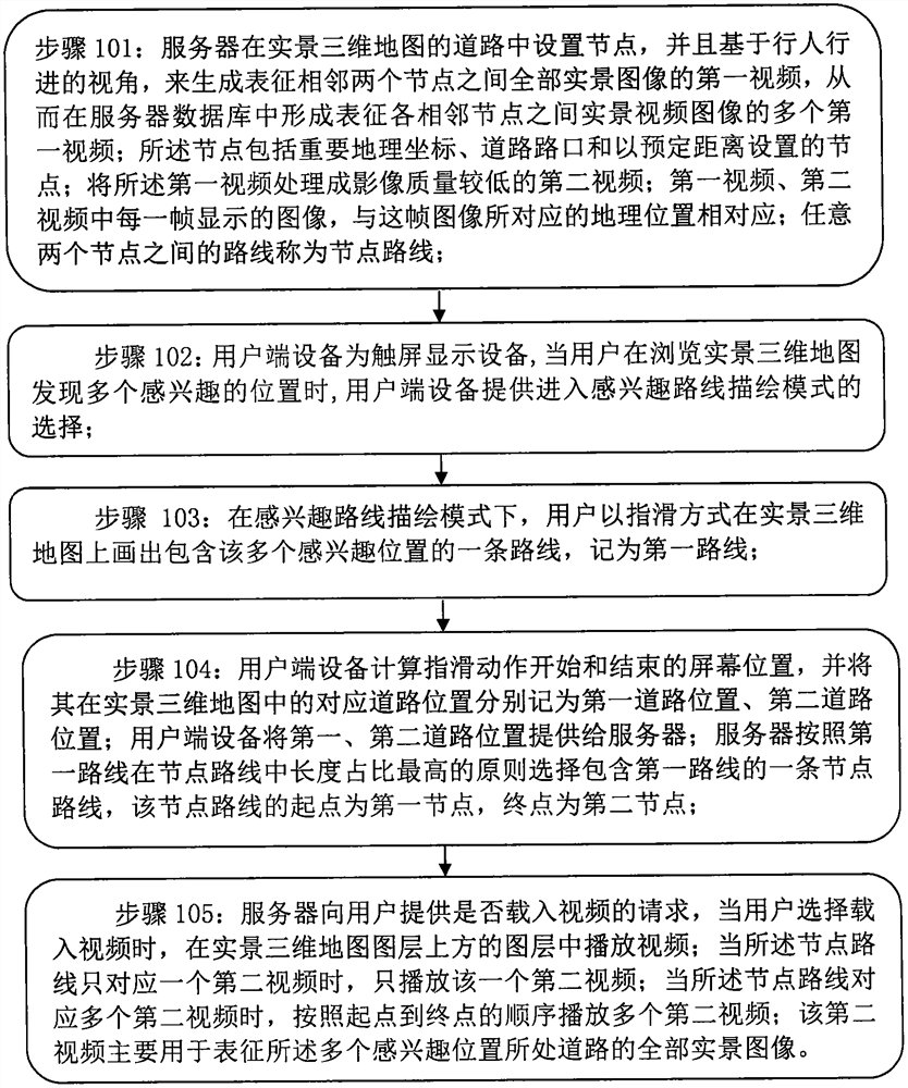
[0020] figure 1 A method for customizing and displaying a real-world three-dimensional map navigation route according to the present invention is shown, and the method includes the following steps:

[0021] Step 101: The server sets nodes in the road of the real-world three-dimensional map, and generates a first video representing all real-world images between two adjacent nodes based on the pedestrian's traveling perspective, thereby forming a representation of each adjacent node in the server database. multiple first videos of real video images between; the nodes include important geographic coordinates, road intersections and nodes set at a predetermined distance; the first video is processed into a second video with lower image quality; the first video , The image displayed in each frame of the second video corresponds to the geographic location corresp...


PUM


Abstract

A method for customizing and displaying a real-world three-dimensional map navigation route, comprising the following steps: a server sets nodes in a road of a real-world three-dimensional map, and generates a first video representing a real-world image between two adjacent nodes based on a pedestrian's traveling perspective , process the first video into a second video with lower image quality; when the user finds multiple locations of interest while browsing the live 3D map, enter the interesting route drawing mode to draw on the live 3D map by finger-swiping obtaining a first route including the multiple locations of interest; further obtaining a node route including the first route; and playing one or more second videos corresponding to the node route based on the pedestrian's traveling perspective. The method has the advantage of fully displaying the information of the entire travel route to the user based on the pedestrian's travel perspective, and also has an "interesting route drawing mode", which can intuitively and conveniently obtain the desired route.

Description

technical field [0001] The invention relates to the field of real-scene three-dimensional maps, in particular to a method for customizing and displaying a real-scene three-dimensional map navigation route. Background technique [0002] The real 3D map uses satellite or laser technology to directly scan the height and width of the building, and finally forms a 3D map data file. The real 3D map is realized based on the technology of physical shooting and data abstraction collection. [0003] When using the real 3D map, the inventor found that although the real 3D map is highly realistic and highly visible, it usually does not provide a browsing method based on the user's traveling perspective, nor can the entire map be viewed based on the user's traveling perspective. All images of travel route information are presented to the user. [0004] Moreover, when the user browses the 3D map of the real scene, since the distribution characteristics of the surrounding scenery can be o...

Claims


Application Information

Patent Timeline
Patent Type & Authority Patents(China)
IPC IPC(8): G01C21/36
CPCG01C21/3673G01C21/3647
Inventor 刘俊伟
Owner TERRA DIGITAL CREATING SCI & TECH (BEIJING) CO LTD
Why Eureka
Try Eureka