
Implementation method of fast visualization of large-capacity vector map for embedded devices
An embedded device, vector map technology, applied in special data processing applications, instruments, electrical digital data processing, etc., can solve the problems of memory expansion, time-consuming, etc., and achieve the effect of speeding up, speeding up, and improving ability
- Summary
- Abstract
- Description
- Claims
- Application Information
AI Technical Summary
Problems solved by technology
Method used
Image

Examples
Embodiment Construction
[0039]The present invention will be further described below in conjunction with the accompanying drawings.
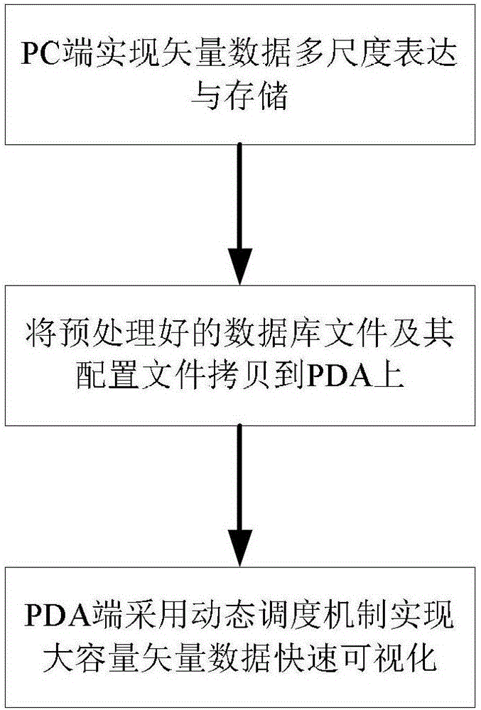
[0040] Such as figure 1 As shown, a method for realizing fast visualization of large-capacity vector maps for embedded devices, the steps include:
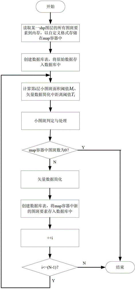
[0041] (1) The PC end preprocesses the vector map: the PC end uses a series of comprehensive operations such as selection, merging, and simplification to perform multi-scale expression on the vector map; store the multi-scale expression results in the embedded sqlite database, and finally generate a Multi-scale spatial database file XX.db and an associated configuration file XX.zlw;
[0042] Described pretreatment process comprises:
[0043] (1.1) The PC side needs to obtain relevant parameters first: ①The denominator of the original scale of the vector map is S; ②The minimum visible target diameter D in the screen coordinate system; ③The geographical range of the vector map is Left, Right, Top, and Bottom; ④The mobile te...
PUM
 Abstract
Description
Claims
Application Information