Method for measuring simulated seabed terrain based on active stereo vision technology and measuring equipment

A technology of stereo vision and terrain measurement, applied in the directions of measurement devices, camera devices, surveying and navigation, etc., can solve the problems of small number of terrain feature points, low accuracy of terrain data, and difficulty in capturing and simulating seabed terrain, etc., to increase the number of , Solve the corresponding problem, easy to distinguish the effect

Inactive Publication Date: 2014-02-19
INST OF MECHANICS - CHINESE ACAD OF SCI
View PDF5 Cites 31 Cited by
  • Summary
  • Abstract
  • Description
  • Claims
  • Application Information

AI Technical Summary

Problems solved by technology

Asynchronous measurements can make it difficult to capture the rapidly changing topography of the entire simulated seabed in some special cases, such as the moment of scour initiation
[0004] In addition, the image acquisition based on passive vision usually has a small number of terrain feature points, and the computer is not easy to distinguish, and the accuracy of the acquired terrain data is not high.

Method used


Image

  • Method for measuring simulated seabed terrain based on active stereo vision technology and measuring equipment
  • Method for measuring simulated seabed terrain based on active stereo vision technology and measuring equipment
  • Method for measuring simulated seabed terrain based on active stereo vision technology and measuring equipment

Examples


Embodiment Construction

[0019] Embodiments of the present invention will be described in detail below in conjunction with the accompanying drawings. It should be noted that, in the case of no conflict, the embodiments in the present application and the features in the embodiments can be combined arbitrarily with each other.

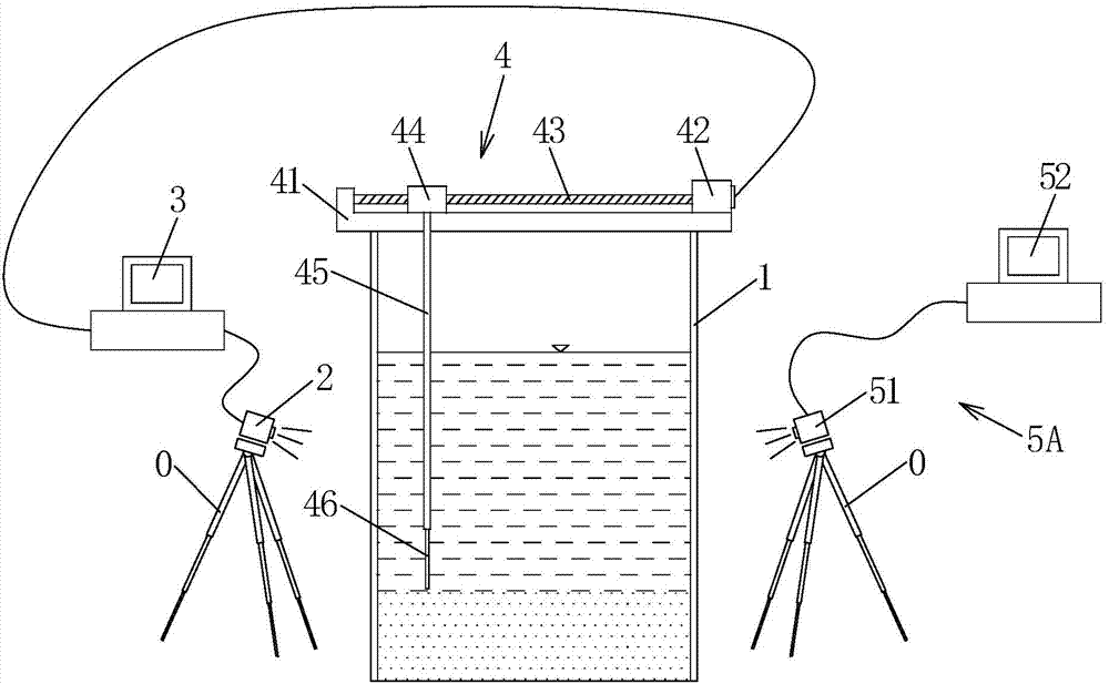
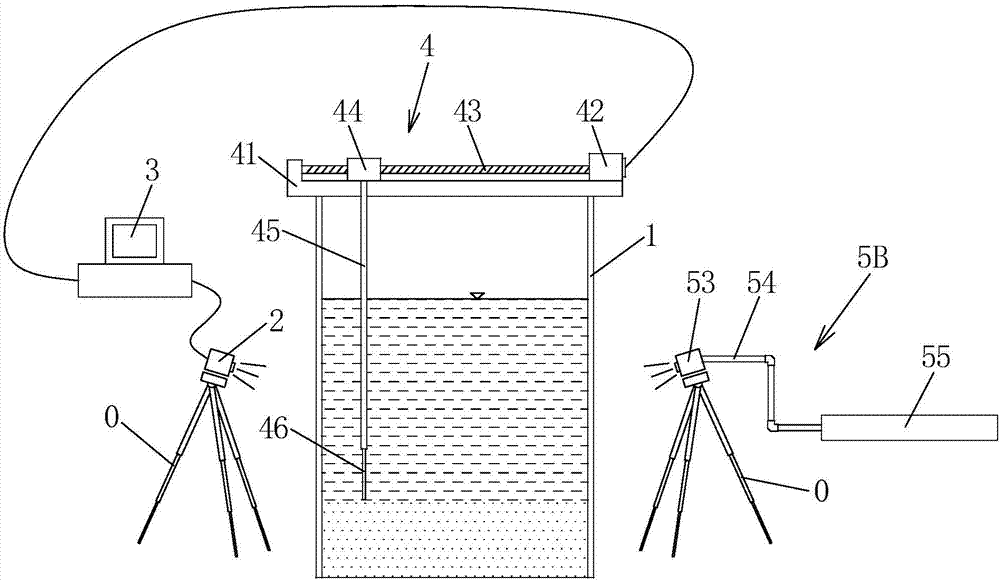
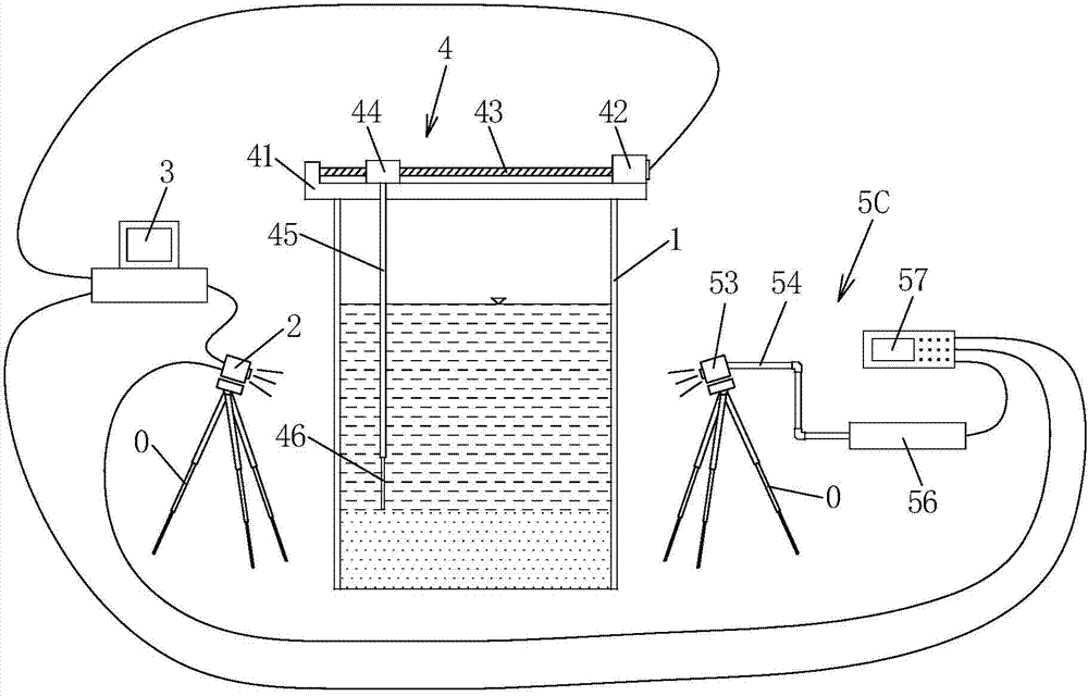
[0020] refer to Figure 1~3 , the simulated seabed topography measurement method based on the active stereo vision technology of the present embodiment comprises the following steps: (1) at least one set of opposite glass side walls of the experimental tank 1 having glass on the opposite side walls respectively Arrange the binocular camera 2 and the active structured light system 5A / 5B / 5C so that the binocular camera 2 and the active structured light system 5A / 5B / 5C are facing each other, so that the binocular camera 2 is facing the glass on the side wall of the glass, and the camera lens is A certain depression angle is aimed at the measured topography of the simulated seabed i...


PUM


Abstract

The invention discloses a method for measuring simulated seabed terrain based on an active stereo vision technology and measuring equipment. By the stereo vision technology, a binocular camera is arranged on the outside of an experimental trough, and seabed terrain changes are measured contactlessly through glass sidewalls of the experimental trough. Partial flow field will not be disturbed, and synchronous acquisition of the whole simulated seabed terrain can be realized. According to the invention, the active vision technology is used in underwater measurement. That is to say, by the utilization of auxiliary structured light irradiating underwater terrain through the glass sidewalls of the experimental trough, dense structured textures or dot arrays are formed on the terrain such that the camera can distinguish more easily. Meanwhile, quantity of terrain characteristic points is also increased. With the combination of the high-resolution camera, high-precision terrain data can be obtained. By the adoption of the method provided by the invention, noncontact, synchronous and high-precision measurement of the simulated seabed terrain can be realized, and corresponding problems existing in the prior art are solved.

Description

technical field [0001] The invention relates to a laboratory simulation seabed topography measurement method and a measurement device. Background technique [0002] In marine engineering, due to the long-term erosion and erosion of the seabed by ocean currents and waves and the passage of sand waves on the seabed, the foundations of offshore platforms, offshore wind power equipment, and submarine oil pipelines located in the seabed are exposed or even suspended, resulting in the overall structure destabilization, leading to serious disasters. The evolution of seabed topography is a dynamic process. Accurate and real-time measurement of seabed topography is an important basis for studying the mechanism and law of sand wave movement and local scour. [0003] Laboratory simulation is an important means to study the influence of seabed topography evolution on marine engineering structures. Laboratory simulations of seabed topographic changes include large-scale sand wave migra...

Claims


Application Information

Patent Timeline
Patent Type & Authority Applications(China)
IPC IPC(8): G01C11/02G01C13/00
CPCG01C7/02G01C11/02
Inventor 臧志鹏高福平姜海洋
Owner INST OF MECHANICS - CHINESE ACAD OF SCI
Why Eureka
Try Eureka