

Basin erosion sediment production predicting method coupling with different spatial and temporal scale models
A watershed and scale technology, applied in the direction of measuring devices, weather resistance/light resistance/corrosion resistance, instruments, etc., can solve the problems that cannot fully reflect the physical process and mechanism of sediment production in the watershed, so as to avoid the fixed topographic parameters and increase the physical mechanism Effect
- Summary
- Abstract
- Description
- Claims
- Application Information
AI Technical Summary
Problems solved by technology
Method used
Image

Examples
Embodiment Construction
[0055] In order to make the purpose, technical solutions and advantages of the present invention clearer, the technical solutions in the embodiments of the present invention will be clearly described below in conjunction with the accompanying drawings in the embodiments of the present invention. Obviously, the described embodiments are part of the present invention Examples, not all examples. Based on the embodiments of the present invention, all other embodiments obtained by persons of ordinary skill in the art without making creative efforts belong to the protection scope of the present invention.
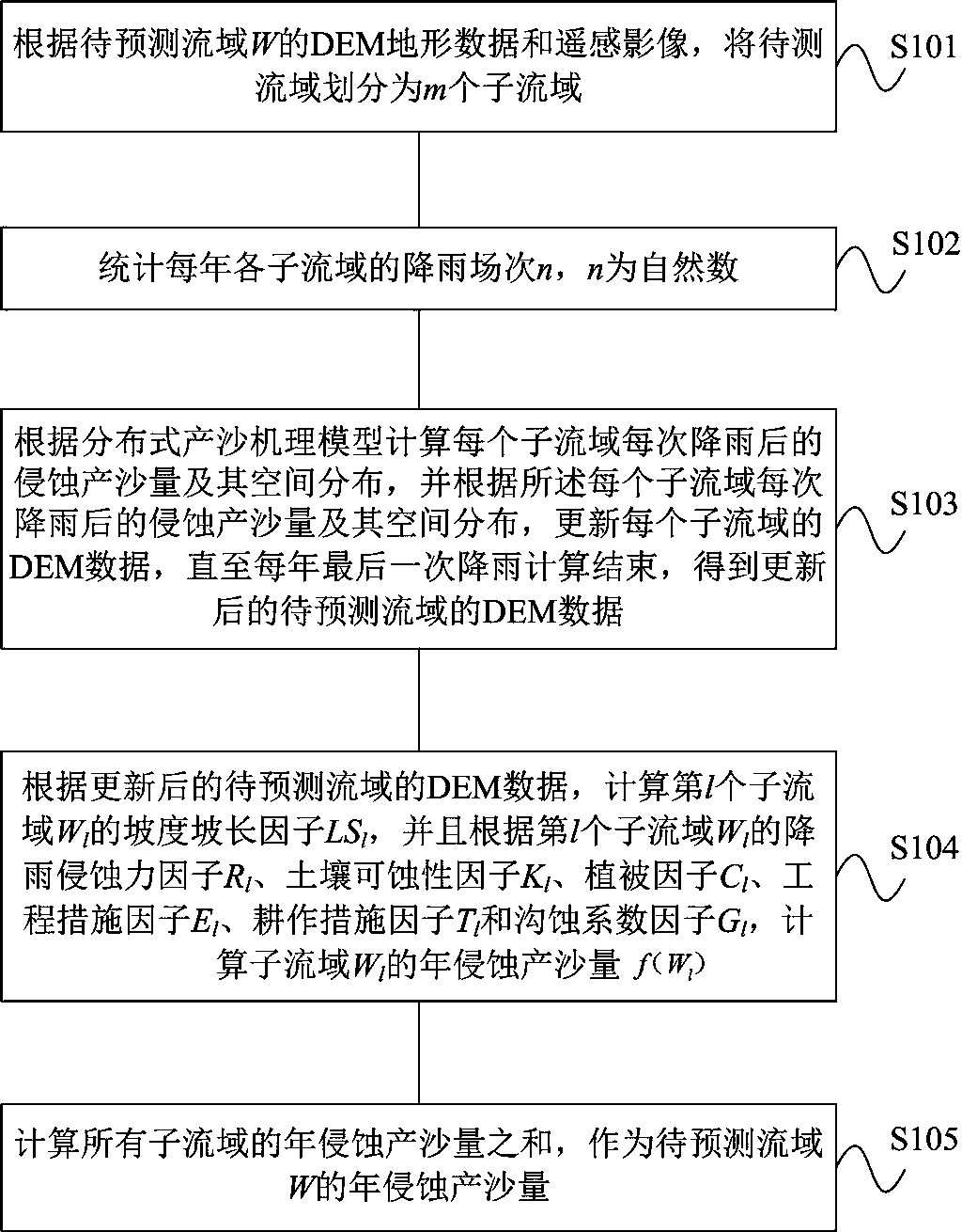
[0056] figure 1 It is a schematic flowchart of a method for predicting erosion and sediment yield in a watershed coupled with models of different temporal and spatial scales provided by an embodiment of the present invention. Such as figure 1 As shown, the method includes the following steps:
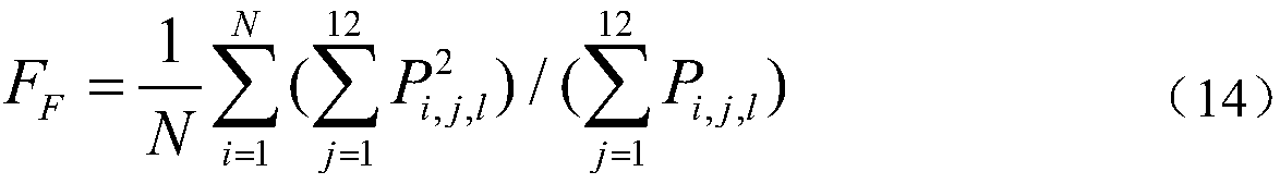
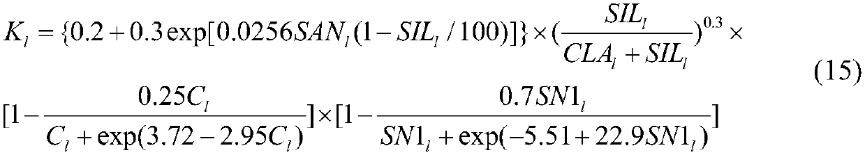
[0057] S101. According to the DEM terrain data and remote sensing images of the wat...
PUM
 Abstract
Description
Claims
Application Information