

Method and device for updating digital map in space place and electronic equipment
A digital map and image acquisition equipment technology, applied in database update, data processing application, structured data retrieval, etc., can solve the problems of high cost, time-consuming and laborious, direct removal, etc., to reduce the impact of business status and low cost Effect
- Summary
- Abstract
- Description
- Claims
- Application Information
AI Technical Summary
Problems solved by technology
Method used
Image


Examples
Embodiment 1
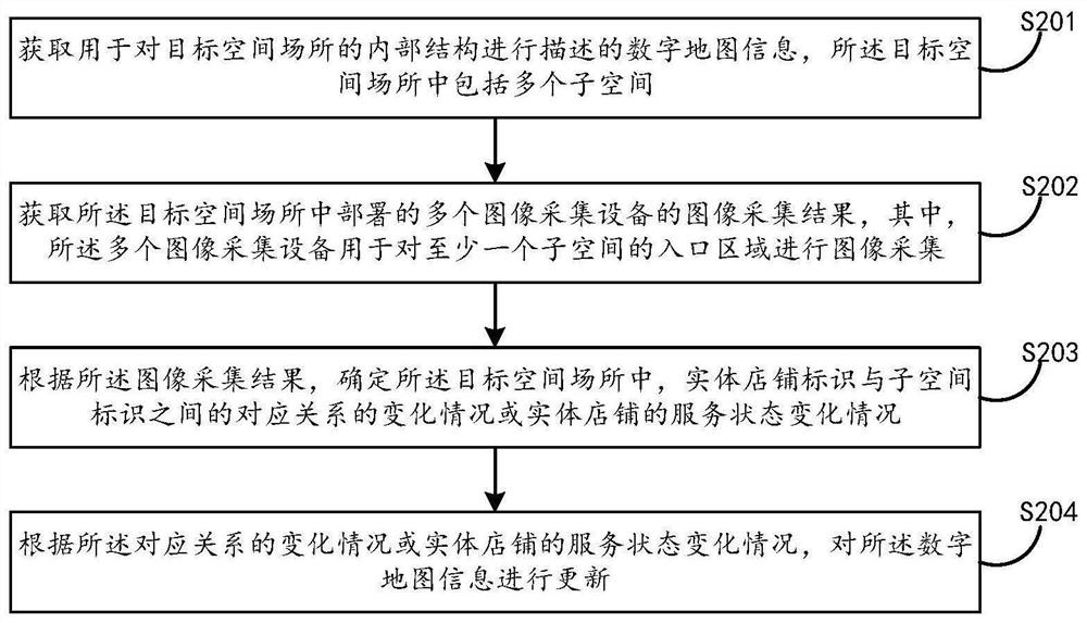
[0082] First of all, this embodiment 1 provides a digital map update method from the perspective of the server, see figure 2 , the method can include:
[0083] S201: Obtain digital map information used to describe the internal structure of the target space, where the target space includes multiple subspaces, and the digital map information includes: the physical store identifier, subspace identifier, and location coordinates Correspondence between.
[0084] In actual implementation, for a specific space such as a shopping mall, when generating a digital map for the first time, it can be generated by SLAM and other technologies. Digital maps of spaces. In the embodiment of the present application, since the specific subspace is provided for use by a specific physical store, the specific digital map may include the correspondence between the physical store identifier, the subspace identifier, and the location coordinates.
[0085] Wherein, the subspace identifier may be an i...
Embodiment 2
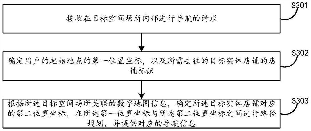
[0111] The second embodiment provides a navigation method inside a space from the perspective of a specific consumer user client, see image 3 , the method can include:
[0112] S301: Receive a request for navigating inside the target space;
[0113] S302: Determine the first location coordinates of the user's starting location, and the store logo of the target physical store to be visited;
[0114] S303: According to the digital map information associated with the target space and place, determine the second location coordinates corresponding to the target physical store, perform path planning between the first location coordinates and the second location coordinates, and provide corresponding navigation information;
[0115] Wherein, the digital map information can be updated according to the change of the corresponding relationship between the physical store identification and the subspace identification information or the service state change of the physical store, and t...
PUM
 Abstract
Description
Claims
Application Information