

Method and system for serving three dimension web map service using augmented reality
An augmented reality and network map technology, applied in image generation, image data processing, 3D modeling, etc., can solve problems such as high load and difficulty in storing objects
- Summary
- Abstract
- Description
- Claims
- Application Information
AI Technical Summary
Problems solved by technology
Method used
Image

Examples
Embodiment Construction
[0025] Hereinafter, a method and system for a three-dimensional (3D) web map service using augmented reality will be described with reference to the accompanying drawings.
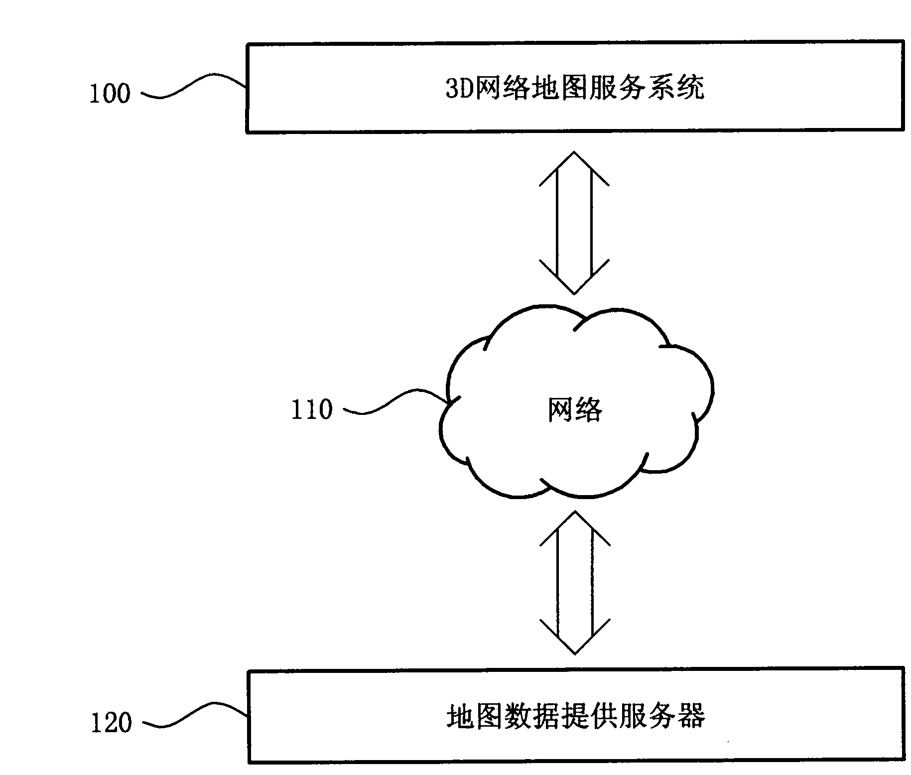
[0026] figure 1 It shows the intercommunication relationship between the three-dimensional (3D) network map service system using augmented reality and the map data providing server according to the present invention.
[0027] refer to figure 1 The 3D network map service system 100 downloads a mapping information file in which 2D marker information and 3D modeling data are mapped in advance.
[0028] In addition, the 3D network map service system 100 receives map data including 2D marker information from the Internet map data providing server 120 through the network 110 .
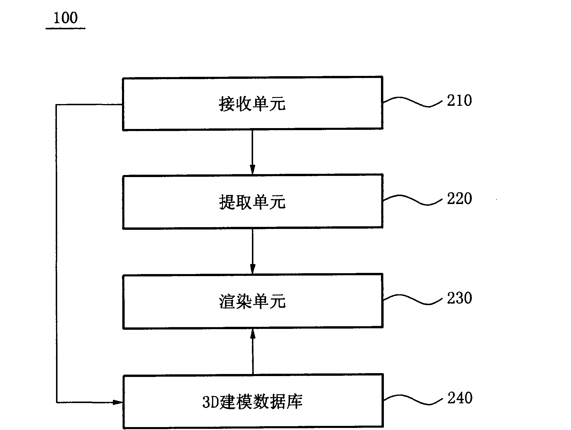
[0029] The 3D network map service system 100 uses the received data to render the map to the frame buffer, detects 2D marker information from the map data, and searches the map information file to extract the ID of the 3D modeling da...
PUM
 Abstract
Description
Claims
Application Information