
A method for determining the occlusion area of the sensor's field of view based on the stl grid model
A technology for determining the method and occlusion area, applied in the directions of instruments, image analysis, image enhancement, etc., can solve the problems of difficulty in carrying out the occlusion analysis of the field of view of the solar sensor, heavy workload, low efficiency, etc., to optimize the mutual positional relationship, The effect of reducing launch weight and launch cost
- Summary
- Abstract
- Description
- Claims
- Application Information
AI Technical Summary
Problems solved by technology
Method used
Image

Examples
Embodiment Construction
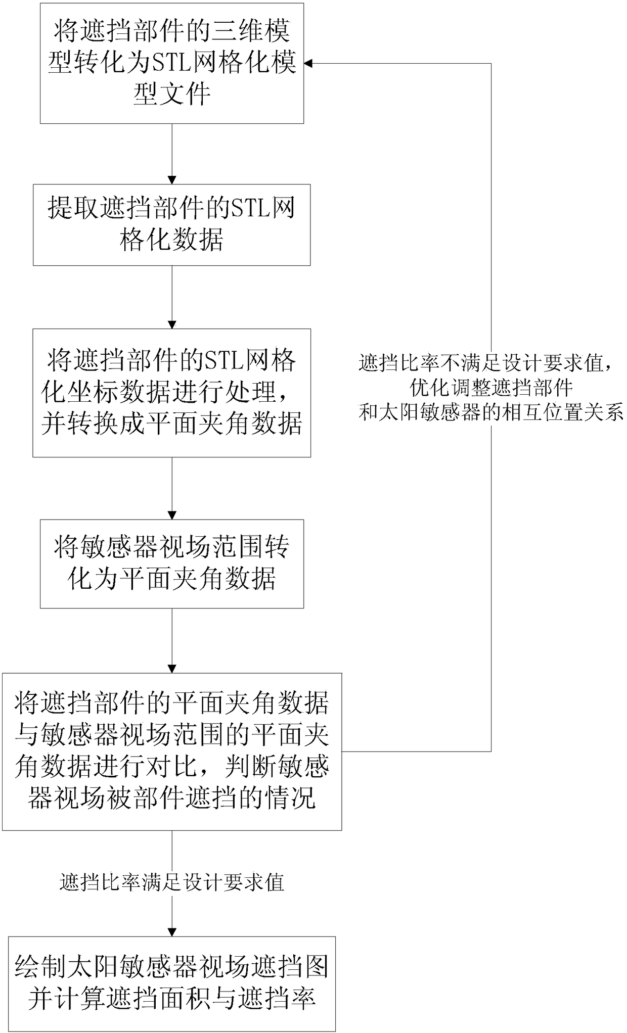
[0032] The implementation process of the present invention will be described in detail below in conjunction with the accompanying drawings. The implementation of the present invention is as figure 1 As shown, the specific steps are as follows:
[0033] (1) Convert the three-dimensional model of the parts that may block the field of view of the sensor (hereinafter referred to as the blocking part) into an STL grid model file;
[0034] Based on the satellite mechanical coordinate system (the origin of the coordinate system is located at the center of mass of the satellite, the positive direction of the x-axis points to the east plate of the satellite, the positive direction of the y-axis points to the south plate of the satellite, and the positive direction of the z-axis is determined according to the right-hand rule), the three-dimensional The model is transformed into an STL meshed model file, which discretizes the surface of the 3D model into a triangular mesh, including the...
PUM
 Abstract
Description
Claims
Application Information